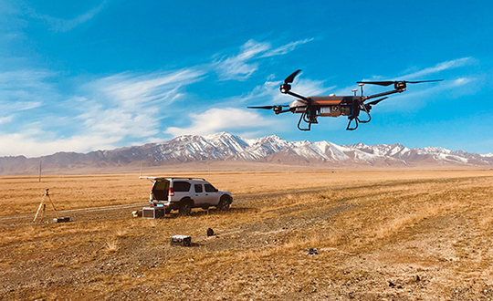
In September 2019, the Xinjiang Institute of Ecology and Geography conducted a nine-day project on the Heishan Mining Zone in Toksun County, Xinjiang Province, China.
The CHCNAV BB4 UAV was combined with the AlphaUni 900 lidar solution to capture data and produce a topographic map of the mining area at a scale of 1:500. The point-cloud data was collected for subsequent 3D modeling to facilitate asset management and inventory work.
In another project, CHCNAV provided training and equipment for a China Railway No. 10 Engineering Bureau project. For this project, CHCNAV’s BB4 UAV was combined with the AlphaUni 1300 lidar system and deployed to study the topography of the tunnel mouth in Liangshan, Sichuan province.
The BB4 is a high-end unmanned aerial system resulting from an alliance between the two companies in their respective segments. Its scientific design and highly integrated production technology come from CHCNAV — a global manufacturer specialized in efficient geospatial measurement technologies — and its fully automated flight control system from DJI, pioneer in the manufacture of commercial UAVs.
The AlphaUni 900 and AlphaUni 1300 are high-end multi-platform lidar systems, designed and improved by CHCNAV through many years of exploration and data-capture experience. Both are fully integrated systems with high-precision, long-range laser scanners that provide unique waveform lidar technology from Riegl and a high-accuracy inertial navigation system.
The AlphaUni systems can take on demanding surveying missions in the air and on the ground that require the highest quality of data.
