Publicerad den Lämna en kommentar

u-blox: Disruption leads to wide adoption

An interview with Markus Uster, head of product center positioning at u-blox about recent GNSS receiver innovations.


Uster

Uster

What was the most significant technical innovation in your GNSS receivers in the past five years?

The u-blox F9, launched in 2018, is our robust and versatile high-precision positioning technology platform. It was the first receiver to enable multi-band high-precision positioning solutions for mass-market industrial and automotive applications — and remains the benchmark for the industry today.

The platform combines multi-constellation (continuous reception of four satellite constellations) GNSS technology with dead reckoning and high-precision algorithms. It is also compatible with a variety of GNSS correction data services to achieve positioning accuracy down to the centimeter level.

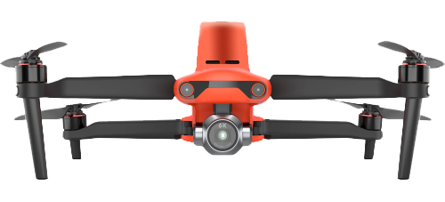
The u-blox F9 platform is leading the next generation of high-precision navigation with its augmented reality, unmanned vehicles and various machine automation applications. It has since been integrated into a selection of modules catering to a wide range of applications.

What has it enabled users to do that they could not do before?

The u-blox F9 is a widely adopted multi-band GNSS platform for automotive and industrial applications. (Photo: u-blox)

The u-blox F9 is a widely adopted multi-band GNSS platform for automotive and industrial applications. (Photo: u-blox)

In a nutshell, the u-blox F9 brought high-precision positioning to the mass market. The demand for scalable high-precision technology is growing rapidly, as evident in the automotive world with next-generation advanced driver-assistance systems (ADAS) and in robotics with applications such as UAVs and robotic lawnmowers. However, due to the complexity, size, power and cost restrictions of existing high-precision solutions, until now it has been difficult to meet the demands of these markets.

u-blox developed the u-blox F9 platform by building on the success of our NEO-M8P high-precision GNSS module series and drawing on our extensive experience in GNSS positioning technologies, including dead reckoning, multi-band, real-time kinematic (RTK) and GNSS correction services. The platform delivers the next level of scalable GNSS high-precision technology and shows how u-blox is consistently addressing challenges and driving the GNSS technology evolution.

What is a good example of this?

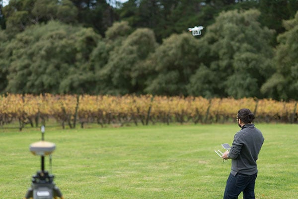
Integration of the u-blox F9 platform into various applications has proven quite successful in a diverse range of use cases. In the industrial realm, u-blox F9 technology enables mass adoption of commercial unmanned vehicle applications. One example is precision agriculture, where high-precision positioning cost-effectively enables vehicle guidance solutions to improve pass-to-pass accuracy resulting in improved crop yield and reduced consumption of pesticides, fertilizer and seeds. The u-blox F9 modules also paved the way for autonomous driving, including lane-level navigation for heads-up displays and vehicular infotainment systems, a prerequisite for highly automated and fully autonomous vehicles.

Publicerad den Lämna en kommentar

Celestia UK wins ESA contract to improve GNSS signals

Celestia UK has won a €800,000 European Space Agency (ESA) contract to develop an innovative positioning, navigation and timing(PNT) solution based on LEO satellite constellations for 5G networks and applications.

The contract was granted under ESA’s Navigation, Innovation and Support Programme (NAVISP).

Malachy Devlin, CEO, Celestia UK

Malachy Devlin, CEO, Celestia UK

Celestia’s LEO-SYN+ project is intended to boost the reliability and performance of GNSS. It will use low-Earth-orbit (LEO) satellite signals of opportunity to provide a resilient position and time reference for 5G networks and improve the robustness of GNSS signals.

It includes development of a PNT receiver compatible with multi-GNSS constellations and LEO signals of opportunity, as well as testing of the solution in 5G networks. A prototype receiver will validate the product design and the technology development, paving the way for additional applications of the technology to other critical infrastructures after the initial ESA NAVSIP roll-out.

To deliver the ambitious project, Celestia UK is partnering with Heriot-Watt University, which brings extensive knowledge in satellite communications and digital signal processing, and The Scotland 5G Centre, the national center for accelerating deployment and adoption of 5G and realizing its economic and societal potential for Scotland.

“It is a great benefit for the business to have won an ESA NAVSIP contract,” said Malachy Devlin, CEO of Celestia UK. “We are looking forward to collaborating with ESA and our partners to unlock the potential to improve the resilience of 5G networks with our PNT solution.”

Ian Sharp, head of Business Development, The Scotland 5G Centre, added,“The Scotland 5G Centre is providing businesses access to 5G services through a national network of innovation hubs, under its 5GConnect Programme. It is well known that 5G will support higher data throughput and interactive services through reduced latency. However, 5G will also provide new possibilities for positioning, navigation and timing (PNT).  Use of advanced antennas and positioning over satellite will be critical for outdoor applications where precise navigation is essential to meet safety requirements for the likes of drone navigation and autonomous vehicles.  We are delighted to be working alongside Celestia UK, supporting the innovative LEO-SYN+ project, which will utilise our cutting edge 5G network.”

Publicerad den Lämna en kommentar

APNT/Space team aims to advance navigation capabilities

APNT/Space modernization gives U.S. Army a clearer view of multi-domain battlefield

U.S. Army soldiers experiment with new assured PNTT/space equipment during the 2021 PNT Assessment Exercise at White Sands Missile Range, New Mexico. (Photo: U.S. Army/Austin Thomas, Army Futures Command)

U.S. Army soldiers experiment with new assured PNTT/space equipment during the 2021 PNT Assessment Exercise at White Sands Missile Range, New Mexico. (Photo: U.S. Army/Austin Thomas, Army Futures Command)

News from U.S. Army Futures Command

The Assured Positioning, Navigation and Timing/Space Cross-Functional Team — APNT/Space CFT — takes a multi-dimensional approach to understanding and preparing for future warfare.

The team — based at Redstone Arsenal, Alabama — is dedicated to advancing the Army’s tactical and navigational capabilities and ensuring tomorrow’s soldiers  have the modern situational tools they need to maneuver with the utmost accuracy, safety and skill.

The CFT is making significant progress toward this goal by leveraging iterative developments, remaining open to new technologies and committing to continuously evolving PNT equipment and systems to meet changing threats and needs.

“Our cross-functional team will continue to assess and strengthen the future of our operational environments, emerging threats and technologies to ensure our Army is prepared for 2030 and beyond. We will continue to support the requirement development and delivery of trusted solutions to the soldier,” said Michael C. Monteleone III, director of the APNT/Space CFT, reiterating the team’s focus on nimbly and steadfastly enabling the success of future warfighters.

According to Army planners, the likelihood of future operations spanning diverse domains — air, land, sea, space, cyberspace and the electromagnetic spectrum — means soldiers will need more flexible and far-ranging resources to inform their movements and operations.

To facilitate this, the APNT/Space CFT conducts rigorous field experimentation and prototype assessment and drafts detailed requirements for state-of-the-art materiel solutions, which the Army can then further develop and employ to improve information gathering and data precision without disrupting or adding extra burden to soldier operations.

Experimentation for APNT/Space happens on the ground and in the air, including along the electromagnetic spectrum — sometimes referred to as the “invisible battlefield” — and in the low Earth orbit of space.

Within these frequently interwoven domains, the APNT/Space CFT investigates alternative GPS capabilities and other navigation resources already in use, while also evaluating how to best integrate new anti-jamming functions, electronic support, inertial navigation systems and vision-based navigation platforms.

The CFT coordinates regularly with industry, joint partners and other government agencies to identify and explore solutions that are modular, scalable and an excellent fit for multiple platforms, as well as the upgrades and adjustments that occur to equipment and systems over time.

Modern PNT tools being developed and fielded include mounted, dismounted and alternative navigation systems, situational awareness devices, and next-generation sensors that allow for optimum flexibility and performance against threats.

Within the realm of space, the CFT is shaping a strategy to provide survivable, responsive and resilient intelligence, surveillance and reconnaissance and communications capabilities in low Earth orbit, complete with the ability to share information rapidly and securely with tactical commanders on the ground.

The team’s experts are also focused on understanding and preparing for the future of navigation warfare, or NAVWAR, which will require sophisticated offensive and defensive systems to produce tactical advantages and enable overmatch. To encourage synchronization of efforts on this front, the CFT is working closely with Army partners to draft an overarching NAVWAR strategy that aligns with U.S. Department of Defense NAVWAR plans but is also tailored to unique Army needs.

By studying and preparing for multi-domain operations and experimenting with the newest technologies available, the APNT/Space CFT is playing an integral role in helping the Army to equip soldiers with more mobile, scalable and interoperable navigation devices, in turn strengthening the agility of the future force.

Publicerad den Lämna en kommentar

Latest Galileo satellites join constellation with enhanced, faster fix

Galileo launch 11 from Europe’s spaceport in French Guyana. (Photo: ESA/CNES/Arianespace)

Galileo launch 11 from Europe’s spaceport in French Guyana sent satellites 27 and 28 into orbit. (Photo: ESA/CNES/Arianespace)

News from the European Space Agency (ESA)

Europe’s latest Galileo satellites in space have joined the operational constellation, transmitting navigation signals to three billion users across Earth as well as relaying distress calls to rescuers.

Their entry into service follows a summer test campaign and will result in a measurable increase in positioning accuracy and improved data delivery performance of the overall Galileo system.

Galileo satellites 27-28 were launched at the end of 2021 and underwent in-orbit test review at the end of April. The review was conducted by ESA, satellite manufacturer OHB, and navigation payload maker Surrey Satellite Technology Ltd (SSTL).

Key findings showed both satellites’ payloads are performing extremely well — among the best in the entire constellation — and the satellites entering into service increase the position accuracy and robustness of the overall Galileo system.

A successful system and in-orbit operations review followed, co-chaired by ESA and the EU Agency for the Space Programme (EUSPA), which is in overall charge of commissioning.

Improved navigation message

The two satellites are the first to broadcast an improved navigation message, resulting in three key improvements for Galileo’s public Open Service users:

  • faster navigation data acquisition, allowing users to establish a first position fix more rapidly
  • better robustness in challenging environments, such as urban centers
  • easier access to timing information in the navigation message for users possessing only a rough estimate of timing of the order of 1-2 seconds.

For the testing and broadcasting of this new navigation message, new software for the Navigation Signal Generation Unit was developed by Thales Alenia Space in Italy, SSTL, OHB and ESA, and was uploaded to the two satellites.

During the summer, an extensive test campaign was conducted by ESA to ensure the compatibility of the entire Galileo system at unit, payload, satellite, ground and system levels with the enhanced message. As part of this effort, EUSPA oversaw receiver testing to ensure this compatibility extended to Galileo receivers and chipsets in the market.

These latest launched satellites made ideal test cases for the software and the improved navigation message. Transmission of the upgraded signals from Galileo satellites 27-28 allowed the team to confirm its correct implementation and characterize its long-term performance.

Following a successful Test Review Board, the satellites were brought back into service on Aug. 29

Publicerad den Lämna en kommentar

Carlson joins with Autel on professional UAS package

The Autel EVO II Pro RTK UAS. (Photo: Autel Robotics)

The Autel EVO II Pro RTK UAS. (Photo: Autel Robotics)

Carlson Software and Autel Robotics are partnering on the Autel EVO II Pro Series drone to provide drone operators with the opportunity to use the full suite of Carlson’s software and hardware solutions.

“We can take you through the entire project lifecycle, from setting your ground control points with a BRx7 GNSS receiver and RT4 data collector with SurvPC field software to the actual drone flight to the photo processing on your computer or in the cloud, all the way through to processing that data, creating linework, surfaces, and finished plans in CAD with our powerful, industry-standard office software,” said Derek Roché, Carlson regional manager.

Carlson’s tools for UAS professionals include:

  • Carlson PhotoCapture, a standalone or cloud-based photogrammetry software to create point clouds, orthoimages, surfaces and more from drone photo data
  • Carlson Point Cloud office software, which provides powerful tools such as bare-earth and automated feature extraction for point clouds
  • Carlson’s suite of CAD office software, including the Carlson Survey program to create finished CAD files and plans
  • Carlson BRx7 GNSS receiver, which can be used both to accurately place ground-control points and as a base to provide corrections to an Autel EVO II Pro RTK drone through Carlson’s Listen-Listen network.

“The workflow capabilities Carlson already has in place present an excellent choice for land development professionals, and now with the addition of the Autel EVO II series to handle the aerial data collection, we’re proud to offer the most comprehensive option in the industry today.”

In 2015, Autel Robotics released its first-generation UAS product: the X-STAR. The success of the X-STAR and the subsequent EVO II series allowed Autel Robotics to quickly build a reputation in U.S. markets. With the introduction of the EVO II series and platform in 2020, Autel Robotics will push its folding UAS to new heights in performance and application.

Carlson specializes in land surveying, construction, engineering, mining, machine control, and CSI solutions for professionals worldwide. In business since 1983, Carlson’s approach has always been to provide its customers with the most efficient, specialized, and powerful tools possible, backed by the best free, unlimited support in the industry.

Visit Carlson’s Autel EVO II RTK product page here, or find your Carlson sales representative or authorized dealer here.

Publicerad den Lämna en kommentar

U-blox firmware update adds QZSS CLAS to ZED-F9R

Photo: u-blox

Photo: u-blox

U-blox has released a new firmware update for its ZED-F9R high-precision GNSS dead-reckoning modules. The update extends the range of supported positioning augmentation services.

With the update, the u-blox ZED-F9R-03B adds support for Japan’s QZSS CLAS correction services, extending the geographical market reach of the ZED-F9R and increasing the scalability of applications using the module. It also now supports SPARTN 2.0, a service from u-blox that delivers correction data based on the SPARTN protocol.

The ZED-F9R module was designed for use in autonomous automotive and industrial applications that require simple and efficient implementation. It is used where rapid access to highly accurate positioning data is key, even in challenging signal environments such as dense cities. Typical applications include slow-moving use cases such as robotic lawnmowers and shared e-scooters.

The module has an integrated inertial measurement unit (IMU) for real-time kinematic (RTK) positioning. It employs sophisticated algorithms to fuse the IMU data with GNSS measurements, wheel ticks, correction service data, and a vehicle dynamics model to provide centimeter-level positioning accuracy even in situations where GNSS alone would fail. It is based on the u-blox F9 multi-band GNSS receiver platform, which concurrently tracks up to four GNSS constellations, providing high-quality positioning accuracy.

Publicerad den Lämna en kommentar

WORK Microwave showcases self-configurable Xidus GNSS simulator

Xidus-648 (Photo: Work Microwave)

Xidus-648 (Photo: Work Microwave)

WORK Microwave demonstrated its Xidus GNSS Simulator at the ION GNSS+ 2022 conference, which took place last week in Denver.

The Xidus GNSS simulator provides high-fidelity, reliable RF signals with automated calibration, making it suitable for validating the performance of GNSS receivers for a wide range of applications, including spacecraft, aviation, unmanned aerial vehicles, digitalized agriculture, autonomous driving, and military drones and vehicles.

The Xidus GNSS simulator enables users to perform rigorous and extensive testing of GNSS systems. Through advanced customization and configurable capabilities, Xidus provides pure, perfectly synchronized and reliable benchmark signals distributed over one or many RF outputs. The wide, dynamic power range is a key differentiator, allowing users to perform real tests without attenuation artifacts. With the Xidus system, users can easily and effectively generate long-term, complex and reproducible yet variable scenarios at higher update rates without leaving the laboratory.

Xidus simulates multi-constellation, multi-frequency and multi-RF signals out of the box — for any position on Earth and in space. The simulator includes APIs and remote control for flexible system integration and automated testing. Modular signal-generation hardware allows simple plug-and-play module insertion, enabling easy and robust field upgrades whenever necessary, the company said.

WORK Microwave’s Xidus GNSS simulator series includes:

Xidus-Studio Software — This powerful and intuitive graphical user interface for the Xidus GNSS simulator simplifies the configuration of any scenario, providing access to a wide variety of parameters: different vehicle models with 6DOF, multiple vehicle simulation, spoofing and meaconing, multiple TX antenna patterns, multiple RX antenna patterns, industry standard error models, runtime distortions on individual channels, and more. Xidus-Studio also allows the design of bespoke satellite orbits ranging from LEO to GEO. The software runs on both Windows and Linux platforms.

Xidus-424 GNSS simulator — Offering a compact chassis with two RF outputs, it runs any scenario over multi-constellation/frequency even with the entry configuration. This chassis supports up to 128 LOS channels and 512 multipaths that can be seamlessly distributed over the two RF outputs.

Xidus-648 GNSS simulator — This is a bigger chassis designed to support the most demanding scenarios, up to 256 LOS channels and 1,024 multipaths, dispatched seamlessly over four RF outputs. The chassis can easily be cascaded if needed. The tool is suitable for test campaigns on receivers with multiple antennas.

Publicerad den Lämna en kommentar

Aerovironment’s visual-based navigation system takes over for GPS

AeroVironment's Puma is hand-launched. (Photo: Lance Cpl. Frank Cordoba/U.S. Marine Corps)

AeroVironment’s Puma is hand-launched. (Photo: Lance Cpl. Frank Cordoba/U.S. Marine Corps)

AeroVironment Inc. has introduced Puma VNS, a visual-based navigation system for its Puma 2 AE and Puma 3 AE small unmanned aircraft systems (SUAS). The system enables navigation across GPS-denied environments.

Puma VNS will receive frequent software and hardware updates, providing operators with advanced navigation capabilities, features and functionality. The system will also enable integration of future autonomy capabilities.

“Puma VNS gives operators an unprecedented advantage in the battlefield,” said Trace Stevenson, AeroVironment vice president and product line general manager for SUAS. “Operators now can execute missions with more confidence in GPS-contested environments with the system’s new navigational capabilities.”

VNS uses a suite of downward-looking sensors to gather imagery data and track features on the ground, as well as an embedded computing module to process and determine the precise location of an aircraft while in flight. The system automatically transitions to and from GPS-denied navigation mode without operator input.

Puma VNS is available as an add-on option for new Puma 3 AE system orders and as a retrofit kit for fielded Puma 2 AE and Puma 3 AE systems.

Publicerad den Lämna en kommentar

Furuno’s latest global timing solutions support L1 and L5 GNSS signals

Image: Furuno

Image: Furuno

Furuno Electric Co. has released a new generation of time-synchronization GNSS receiver modules compatible with all GNSS systems. The modules deliver nanosecond precision for 5G mobile systems, radio communications systems, smart power grids and grand master clocks.

GNSS receivers for time synchronization are used extensively in critical infrastructure such as mobile base stations and RAN equipment, commercial and defense radio communications, broadcasting, financial trading and smart power grids, where there are increasing needs for robustness, reliability and security.

Furuno is releasing three new products: GT-100, GT-9001 and GT-90. They are designed to suit different applications based on the frequency bands and output signals supported. All models have the world’s highest level of time stability of 4.5 ns (1 sigma).

The GT-100 is the company’s first timing multi-GNSS receiver module supporting concurrent L1 and L5 reception. This mitigates the effects of solar flares, which can lead to time errors, and strengthens measures against GNSS vulnerabilities such as jamming and spoofing.

  • The GT-100 delivers three outputs including 1 pulse per second (1 PPS) synchronized with UTC as well as user-programmable frequencies. The outputs can be set as required to 10 MHz, 2.048 MHz and 19.2 MHz, commonly used in a variety of wireless communications systems. This drastically reduces the time from development to market launch for these systems, as well as cost savings through reduced component needs. GT-100 is a full-featured highly robust model, supporting dual-frequency band reception (L1 and L5).
  • GT-9001 supports L1 and delivers high stability 1PPS and programmable clocks on three channels.
  • GT-90 supports L1 and provides a 1 PPS high stability output.

All models are equipped with the leading Dynamic Satellite Selection (DSS) multipath mitigation technology developed by Nippon Telegraph and Telephone Corporation (NTT) that minimizes degradation of time performance even when the antenna is installed in urban areas or near a window.

Furuno will showcase the new modules at EuMW’s European Microwave Exhibition, a trade and technology exhibition providing access to initiatives in the RF and microwave sector.

Evaluation kits for all three products are available now.

Publicerad den Lämna en kommentar

GMV, FrontierSI, Ericsson and Optus prove 5G-based high-accuracy positioning

Trials in Australia are proving 5G LPP can support new positioning services. (Photo: GMV)

Trials in Australia are proving 5G LPP can support new positioning services. (Photo: GMV)

Several companies are joining to demonstrate 5G LTE Positioning Protocol (LPP) capabilities in field trials. The trials are part of the 5G Positioning Testbed funded under the Australian 5G Innovation Initiative.

Technology partners include GMV, FrontierSI, Ericsson and Optus, who are joining with industry demonstration partners Kondinin (an Australian town), Platfarm (a precision agriculture company) and Position Partners.

The results achieved by the project are considered a key step forward for the use of 5G technology for high-accuracy positioning. The testbed demonstrated each of the high accuracy GNSS-based LPP working modes, including Observation Space Representation (OSR), State Space Representation (SSR), and SSR with atmospheric corrections, integrated directly with user equipment supplied by demonstration partners to examine a variety of real-world applications. The field trials demonstrated that the solution can reach centimeter-level accuracy with fast convergence times using a commercial off-the-shelf receiver and antenna hardware.

GNSS precise positioning is the most common technology for calculating an absolute positioning solution at the user level. For uses requiring centimeter-level accuracy, it is often required to provide GNSS corrections to reduce errors.

Distribution of GNSS corrections is based on either the broadcast of precise point positioning (PPP) corrections through GEO satellites over the L-band, or the point-to-point transmission of real-time kinematic (RTK) corrections using NTRIP through the internet.

Both options have their drawbacks: GEO satellite broadcast requires complex ground infrastructure and can be expensive to maintain, while NTRIP distribution has poor scalability due to the point-to-point connections required for every user.

3GPP (3rd Generation Partnership Project) — the standards organization focusing on 5G LPP — recently introduced the support of OSR corrections for RTK users in Release 15, and the support of SSR plus atmospheric corrections for PPP/PPP-RTK users in Release 16.

Support for these two approaches to high-accuracy GNSS positioning have increased interest in 5G LPP as a potential alternative to existing correction services. Service providers and positioning consumers can now consider the use of 5G LPP as a supporting technology in the provision of new positioning services directly through mobile networks.

The 5G Positioning Testbed has achieved end-to-end demonstrations of high-accuracy positioning solutions using GMV’s Corrections Service and Positioning Engine, delivered through the Optus 5G network using Ericsson network technology, to user equipment designed and operated by FrontierSI.

Field trials conducted in Australia involved real-world scenarios across three areas: precision agriculture, drone operation and augmented reality.