Publicerad den Lämna en kommentar

Hexagon partners with ZF Group on autonomous driving systems

Photo:

Image: Hexagon

On Dec. 20, Hexagon announced a partnership to integrate its software positioning engine and correction services with ZF Group’s ProConnect connectivity platform. This will enable vehicle communication in advanced driver assistance systems (ADAS) and autonomous driving systems.

This integration is critical to providing the necessary functional safety, lane-level positioning accuracy and automotive safety integrity level (ASIL) rating that ZF’s automotive telematics platform requires. Hexagon’s TerraStar-X precise point positioning correction service will greatly improve the accuracy and reliability of ADAS and autonomous driving systems.

Hexagons’ dual frequency and multi-constellation GNSS receivers are tightly coupled with inertial capabilities that withstand vehicle dynamics in all driving conditions.

Both companies are focused on the next generation of mobility, including electric vehicles and autonomous systems, and this partnership helps advance safety and automation in the automotive and transportation industry. Hexagon and ZF plan to demonstrate their ADAS at the Consumer Electronics Show in Las Vegas in January 2023.

Publicerad den Lämna en kommentar

ESA’s NAVISP partners with Grimaldi Group

Photo:

Image: shaunl/ Getty Images

On Nov. 18, the European Space Agency (ESA) announced a Navigation Innovation and Support Programme (NAVISP) partnership with Italy’s Grimaldi Group, as the need for accurate maritime navigation increases. With the Grimaldi Group, NAVISP has taken on the Grimaldi Satellite-Assisted Berthing (GSAB) project, which aims to develop a satellite-based guidance system for docking maneuvers of large vessels.

NAVISP’s GSAB project will use satellite-based multi-sensor technology to improve the efficiency of maneuvers in ports to increase safety while also reducing CO2 emissions. Maritime navigation is too complex for GPS and Galileo alone, so, by fusing those two systems with PNT sensors, the project can achieve its intended outcome.

The project is divided into two phases. In the first phase, NAVISP is working on design, development activities, installation of the sensors in a roll-on, roll-off vessel, and running a test readiness campaign. The second phase includes field tests with the equipped ship in the Grimaldi facilities in the Port of Antwerp-Bruges, Europe’s second largest seaport.

Shipping transport is responsible for more than 80% of goods traded globally, and the Grimaldi Group is one of the largest shipping companies globally with more than 130 ships. As the need for efficient and safe ship transport in and out of ports grows, NAVISP continues to support innovation to improve satellite navigation and positioning systems in the maritime sector, according to ESA.

Publicerad den Lämna en kommentar

UAVs evolving into air-taxis

One of several derivative branches from unmanned air vehicles and their technologies is electric aircraft and air-taxis. Referred to as eVTOL (electric Vertical Take-Off and Landing), a class of manned and unmanned aircraft is being developed and certified for short-hop passenger transit from down-town ‘Verti-Ports’ to classic airports, aimed at improving the economics and reducing the noise footprint of current helicopter services. Urban air transport is undergoing significant change as organizations such as United Airlines, Delta, American Airlines and others plow money into electric aircraft and the development of manned and unmanned air-taxis.

Archer Aviation is developing two such aircraft, with ‘Maker’ being the first cut flying test-bed, and ‘Midnight’ its so called ‘first production version.’ The vehicle design is similar in that they both have wings and are powered by six lift propellers and six tilting props that rotate vertically to lift for take-off and landing, then transition to horizontal for forward flight.

Photo:

Image: Maker in forward flight/Archer

Photo:

Image: Midnight/Archer

In the past, Archer has been somewhat secretive about its air-taxi program, but with the introduction of Midnight on Nov. 17, and with Maker achieving transition from hover to forward flight on Nov. 20, they released some useful information. Lift to forward transition is a big step for eVTOL, with the potential for a major set-back, almost like an irrecoverable stall for a fixed wing aircraft.

There are six battery ‘packs’ mounted in the wing near the engines – batteries, engines and FAA certification are key focal areas in their program, with fault tolerance and endurance being key considerations. An existing lithium battery has been selected following extensive testing, with a design objective of 10,000 average 20 mile trips, each trip with a 10 minute recharge cycle.  Two similar electric motor types are used, with 95% commonality, and flight can allegedly be maintained through one complete engine or propeller failure. Each engine has redundant elements allowing one side to fail while still maintaining full operation. All these redundancies support the Archer plan for FAA certification which has now progressed through ‘Certification Basis’ and ‘Conceptual Design’ to ‘Preliminary Design’. There are many steps still to complete, with certification not anticipated until at least the second half of 2024.

Meanwhile, Joby Aviation has been making significant progress with its flying prototype and pre-production aircraft, with the objective of developing a flying rideshare platform. With space for four passengers and a pilot, the Joby aircraft is smaller than the Archer vehicle, however smaller size means less weight and complexity and requires fewer lift props. The Joby vehicle has six large props that all transition from vertical for take-off and landing to horizontal for full forward flight.

Photo:

Image: Courtesy of Joby
Aviation. (c) Joby Aero, Inc.

Joby developed its own lithium-iron batteries and dual redundant electric motors and while developing flying prototype and pre-production aircraft, has also focused on teaming with key industrial partners who are assisted in key areas:

  • NASA has undertaken a study with Joby on 5 potential route configurations at Dallas/Fort-Worth airport for eVTOL traffic.
  • The US Department of Defence has provided flight range and facilities to enable airborne testing of the Joby prototypes. This contract has just been modified so that US Marine Corps personnel may flight test Joby’s eVTOL to evaluate DoD use-cases for the aircraft.
  • The company ‘Uber Elevate’ was purchased by Joby and is now integrated as the future provider of trip access for customers.
  • Toyota has not only invested in Joby, but is providing essential production facility knowledge and guidance as Joby begins its initial build out of volume manufacturing.
  • Delta has invested an initial $60 million, which could increase to $200 million provided progress towards certification and service entry meets certain milestones

Other eVTOL notable companies entering this market include Jaunt Air Mobility in Dallas, Texas; Velocopter in Bruschal, Germany; Lilium in Munich, Germany; Kittyhawk in California; Wisk in California and New Zealand; Airbus in Toulouse, France; Ehang in Guangzhow, China; Vertical Aerospace in Bristol, England; Urban Aeronautics in Tel Aviv, Israel; and Eve Mobility in Melbourne Florida.

So, just a small taste of two of many eVTOL hopefuls – but two with the backing of mainline commercial airlines – who knows who will actually make it through the arduous and expensive aviation certification process before the cash runs out? However, there are many significant investors who are currently standing by their selected hopefuls and others continue to jump in – let’s hope that by 2025 we’ll begin to see home-airport air-taxi services underway.

Tony Murfin

GNSS Aerospace

Publicerad den Lämna en kommentar

Copernicus Sentinel-3 and Sentinel-6 GNSS orbital products available

Artist's depiction of the Copernicus Sentinel-6 satellite, launched in November 2020. (Image: ESA)

Artist’s depiction of the Copernicus Sentinel-6 satellite, launched in November 2020. (Image: ESA)

The Copernicus Precise Orbit Determination (CPOD) Service, in charge of computing precise orbits for the Copernicus Sentinel-1, -2, -3 and -6 missions,  routinely publishes GNSS and quaternions data and precise orbital products of these missions on the POD Data Hub of the Copernicus Open Access Hub.

The following products are published:

  1. Sentinel-1, 2, 3 A&B GNSS RINEX observation files (AUX_GNSSRD)
  2. Sentinel-1, 2, 3 A&B Quaternions files (AUX_PROQUA)
  3. Sentinel-1 A&B CPOD Predicted Orbits (AUX_PREORB)
  4. Sentinel-1 A&B CPOD Restituted Orbits (AUX_RESORB)
  5. Sentinel-1 A&B CPOD Precise Orbits (AUX_POEORB)
  6. Sentinel-3 A&B CPOD Restituted Orbits (SR___ROE_AX)
  7. Sentinel-3 A&B CPOD Medium Orbit (AUX_RESORB)
  8. Sentinel-3 A&B CPOD Precise Orbits (AUX_POEORB)
  9. Sentinel-3 A&B CPOD Precise Platform data (AUX_PRCPTF)

The following new products from Sentinel-3 and Sentinel-6 are now available as well. The Sentinel-6A GNSS RINEX observations include GPS and Galileo data — the first publicly available Galileo data obtained from an orbiting receiver.

  1. Sentinel-3A&B CNES Medium Orbit Ephemeris (SR___MDO_AX)
  2. Sentinel-3A&B CNES Precise Orbit Ephemeris (SR___POE_AX)
  3. Sentinel-6A CNES Medium Orbit Ephemeris (AX____MOED_AX)
  4. Sentinel-6A CNES Precise Orbit Ephemeris (AX____POE__AX)
  5. Sentinel-6A CPOD Restituted Orbit Ephemeris (AX____ROE__AX)
  6. Sentinel-6A GNSS RINEX observation files (AUX_GNSSRD)
  7. Sentinel-6A Quaternions files (AUX_PROQUA)

The GNSS RINEX (AUX_GNSSRD) and Quaternions files (AUX_PROQUA), together with the final orbital products (AUX_POEORB, AUX_PRCPTF, SR___POE_AX, and AX____POE__AX) are available at the beginning of each mission.

The other orbital products (AUX_RESORB, SR___ROE_AX, SR___MDO_AX, AX____MOED_AX, and AX____ROE__AX) are available for at least one month, until the final products are available.

The typical accuracy of the orbital products can be found in the Regular Service Reviews carried out by the CPOD Service quarterly.

Details about these products can be found in the POD Product Handbook.

Auxiliary data needed for precise orbit determination, such as maneuvering information, can be found in the Sentinel online:

Please send questions to mailto:eosupport@copernicus.esa.int.

Publicerad den Lämna en kommentar

Launchpad: mapping UAVs, flight controllers, precision guidance systems

A roundup of recent products in the GNSS and inertial positioning industry from the December 2022 issue of GPS World magazine.


AUTONOMOUS

Flight Controller

Turns a UAV into a connected autonomous system

Photo: Auterion

Photo: Auterion

Skynode reference-design hardware is built with Remote ID in mind, enabling UAV users to comply with the FCC rule Remote Identification of Unmanned Aircraft (Part 89). A built-in connectivity stack with 4G, Bluetooth and Wi-Fi enables automatic real-time data transmission from the UAV to the cloud. Built on open standards, Skynode is flexible and extensible, allowing users to leverage a variety of compatible software and hardware components. The connections enable automatic sending of logs, images and real-time video streams from the field to remote experts.

Auterion, auterion.com

Heavy-Lift UAV

Can carry 440-pound payload 25 miles

Photo: Volocopter

Photo: Volocopter

The VoloDrone is a fully electric, heavy-lift utility UAV with a range of up to 25 mi carrying a carrying a 440-lbs payload. The rotor area has a diameter of 30 ft, and the vehicle is 7.5 ft high. It can be remotely piloted or can fly autonomously on preset routes. Loads can be carried between the legs of the landing gear on standard rack mounts or slung below, or a tank and sprayer could be fitted for agricultural applications. The 18-rotor multicopter platform uses swappable lithium-ion batteries and an in-house flight control system, and benefits from existing development and test of the Volocopter air-taxi.

Volocopter, volocopter.com

Mapping UAV

Maps areas greater than 20,000 hectares
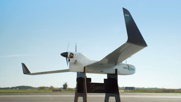
Photo: Boreal

Photo: Boreal

With a wingspan of 4.20 m, the BOREAL NRM remotely piloted aircraft integrates efficient photogrammetry devices for mapping large areas, even in areas inaccessible to traditional mapping aircraft. Its flight-control system is designed for image-capture management and optimal coverage of areas greater than 20,000 ha. The BOREAL NRM offers an overall and precise view of cultivated areas (1 cm to 3 cm per pixel), simplifying crop monitoring and facilitating human intervention in places that require it (such as water stress, treatment of pests).

Boreal, www.boreal-uas.com

ISR System

Developed for the Spanish Ministry of Defense
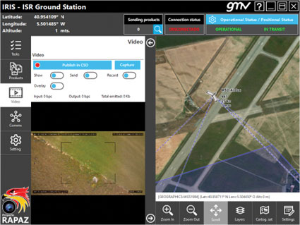
Photo:

Photo: GMV

The IRIS unmanned vehicle command-and-control system provides intelligence, surveillance and reconnaissance (ISR) interoperability — essential aspects of any military operation. The IRIS system integrates unmanned vehicles with other command-and-control systems for monitoring and gathering information for a variety of operational scenarios. IRIS uses each unmanned vehicle’s own communication systems and 5G technology to provide situational awareness for decision makers before and during operations. A simplified interface allows integration of sensors and platforms into a command-and-control network, providing interoperability with other command, control, communication and computer ISR (C4ISR) systems. IRIS performed well during NATO’s REPMUS 22 (Robotic Experimentation and Prototyping Augmented by Maritime Unmanned Systems) exercise in September.

GMV, gmv.com

Docking Station

Sends UAVs to complete missions
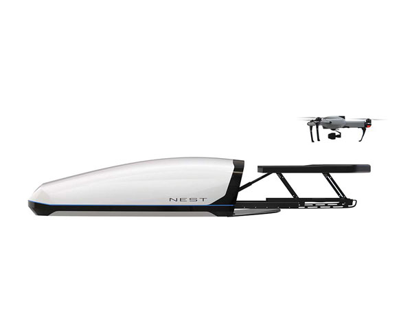
Photo: AtlasNest

Photo: AtlasNest

The AtlasNEST UAV system features a docking station to provide fully autonomous 24/7 readiness for infrastructure inspections, emergency situations and security missions requiring shared situational awareness and management. Using the AtlasSTATION interface, an operator sets a target destination, and the lightweight UAV deploys in less than three minutes. Sending a drone to collect visual data and reveal possible problems can help prevent putting personnel in unsafe circumstances. AtlasNEST has built-in artificial-intelligence technologies, including autonomous battery swapping. Using the AtlasSDK, AtlasNEST can be incorporated into current security systems.

Atlas, atlasuas.com

Line Painter

Robot built to paint lines on athletic fields

Photo: Turf Tank

Photo: Turf Tank

Turf Tank is an autonomous, GNSS-guided line-marking robot built specifically to paint lines on athletic fields. More than 550 Turf Tank robots are deployed across the United States, painting athletic fields at public schools, major colleges and universities, amateur and professional soccer clubs, local parks and recreation departments, and at two National Football League stadiums. The Turf Tank robots can paint a full soccer field in less than 30 minutes, compared to two or three hours for manual painting. Similarly, the robot can paint a football field in two or three hours compared to eight to 10 hours to paint a football field. The robots are eco-friendly — they’re powered by rechargeable batteries and use far less paint than most older paint machines.

Turf Tank, turftank.com

UAS Package

Takes users through project lifecycle
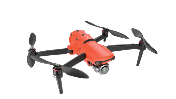
Photo: Autel Robotics

Photo: Autel Robotics

The Autel EVO II Pro Series combines Carlson’s software and hardware surveying and mapping solutions with a UAV from Autel Robotics. The Carlson suite is designed to take professionals throughout a project’s lifecycle: setting ground control points with the Carlson BRx7 GNSS receiver and RT4 data collector with SurvPC field software, the drone flight, PC photo and data processing, and creating finished plans in CAD.

Carlson Software, carlsonsw.com; Autel Robotics, autelrobotics.com


OEM

GPS Add-On Board

Provides PNT to design engineers
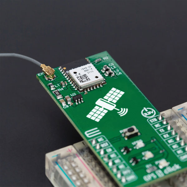
Photo: MikroElektronika

Photo: MikroElektronika

The GPS 5 Click is a compact add-on board that provides users with positioning, navigation and timing (PNT) services. The board features the M20050-1, a GPS module using the MediaTek MT3333 flash chip and an Antenova GNSS receiver for optimum performance. The receiver tracks three GNSS constellations concurrently (GPS + Galileo + GLONASS or GPS + Galileo + BeiDou) and has configurable low-power modes operating from a 3.3V power supply. In addition to the possibility of using an external antenna, backup power, and various visual indicators, the M20050-1 has an accurate 0.5 ppm TXCO ensuring short time-to-first-fix and multipath algorithms that improve position accuracy in urban environments.

MikroElektronika, mikroe.com

Timing Modules

Support for concurrent L1 and L5 reception
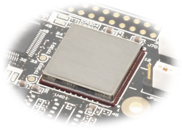
Photo: Furuno

Photo: Furuno

Modules GT-100, GT-9001 and GT-90 are time-synchronization GNSS receiver modules compatible with all GNSS systems. The three modules deliver nanosecond precision for 5G mobile systems, radio communications systems, smart power grids and grandmaster clocks. Each suits different applications based on supported frequency bands and output signals. GT-100 supports concurrent L1 and L5 reception and delivers three outputs including 1 pulse per second (1 PPS) synchronized with UTC as well as user-programmable frequencies. The outputs can be set to 10 MHz, 2.048 MHz and 19.2 MHz, reducing time to market and saving costs through reduced component needs. GT-9001 supports L1 and delivers high-stability 1PPS and programmable clocks on three channels. GT-90 supports L1 and provides a 1 PPS high stability output. All models have time stability of 4.5 ns (1 sigma) and are equipped with multipath mitigation to minimize degradation of performance in urban areas.

Furuno Electric Co., furuno.com

Firmware Update

Adds QZSS CLAS to ZED-F9R GNSS module

Photo: u-blox

Photo: u-blox

The latest firmware update for the u-blox ZED-F9R high-precision GNSS module adds support for Japan’s QZSS CLAS correction services (ZED-F9R-03B). The ZED-F9R also now supports u-blox SPARTN 2.0 correction data.

u-blox, u-blox.com

Smart Antenna

Has L-band, IP capability

Photo: Tallymatics

Photo: Tallymatics

The TW5390 smart antenna has IP network and L-band augmentation service capability. Along with a Tallymatics antenna, it has a high-precision u-blox F9R GNSS receiver and DS9 L-band receiver modules. The combination delivers a reliable and convenient smart antenna yielding <6-cm accuracy, with precise point positioning/real-time kinematic (PPP/RTK) augmentation services via the PointPerfect subscription service. The antenna provides superior multipath rejection with Tallysman Accutenna technology, a low noise amplifier, Tallysman’s eXtended Filtering (XF) technology, which mitigates saturation from nearby RF signals (targeting LTE and Ligado), a tight, measured phase-center offset and low axial ratio, enabling accurate and precise positioning, direct decoding of PointPerfect, SPARTN formatted augmentation packets (u-blox specific)

Tallymatics, tallymatics.com

GNSS Modem

Tracking enables potential applications and projects
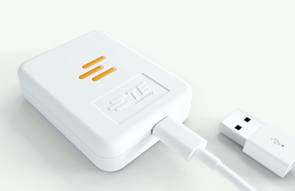
Photo: TE Connectivity

Photo: TE Connectivity

The Lembas LTE/GNSS USB modem provides plug-and-play GNSS tracking as well as LTE and CAT4 network connectivity via a robust USB interface to a variety of small-board computers utilizing the ARM chipset. Through a single-command setup process, users can have GNSS access to a wide variety of projects. The modem has been tested with Raspberry Pi Model B, Odroid XU4 and N2, ASUS Tinker Board, and NVIDIA Jetson Nano.

TE Connectivity, te.com


MACHINE CONTROL

Site Supervisor System

Base/rover system provides 3D grade control
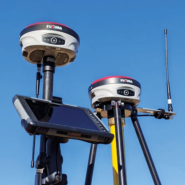
Photo: Futturas

Photo: Futtura

The universal construction site supervisor system is designed to help contractors manage all their job site activities. It includes the SiteMetrix Grade and the multi-frequency, multi-GNSS F631 RTK base and rover. SiteMetrix is user friendly, easy to understand and portable. Contractors can use the Futtura system to localize sites, check grade, configure base stations, set stakes and calculate volumes of material removed. Users will see the benefit of seamlessly performing data collection and layout, all in one easy-to-use application, the company says. The F631 GNSS receiver is powered by SureFix RTK technology, which offers a real-time dual-solution point verification. The F631 GNSS receiver is powered by Hemisphere GNSS’ Athena RTK technology. With Athena, F631 provides state-of-the-art RTK performance when receiving corrections from a static base station or network RTK correction system. With multiple connectivity options, the F631 allows for RTK corrections to be received over radio, cell modem, Wi-Fi, Bluetooth, or serial connection. F631 delivers centimeter-level accuracy with virtually instantaneous initialization times and robustness in challenging environments.

Futtura, futturaus.com

Cab Displays

Provide connectivity for the field

Photo: Trimble

Photo: Trimble

The Trimble GFX-1060 and GFX-1260 next-generation displays for precision agriculture applications enable farmers to complete in-field operations quickly and efficiently while also mapping and monitoring field information in real time with precision. Both displays feature an Android-based operating system and enhanced processing power for controlling and executing in-field work. The new flagship GFX-1260 is a 12-in (30.5 cm) display, while the GFX-1060 is a 10-in (25.6 cm) display, and both are compatible with the Trimble NAV-500 and NAV-900 GNSS guidance controllers. The displays are ISOBUS-compatible, which allows one display or terminal to control ISOBUS implements, regardless of manufacturer. The displays enable farmers to set up and configure their equipment through Trimble’s Precision-IQ field software, including manual guidance, assisted and automated steering, application controls, mapping and data logging, equipment profiles and camera feeds from attached inputs and other internet-based apps.

Trimble, trimble.com

Retrofit Kit

Enables affordable smart construction upgrades for fleets

Photo: Komatsu

Photo: Komatsu

The Smart Construction Retrofit kit turns a conventional Komatsu excavator “smart” with 3D guidance and payload monitoring. With a kit installed, an operator is no longer required to set up a laser or bench every time the machine moves. The kit’s GNSS receiver determines where a machine is on the job site and what the target grade is. The need for additional labor is reduced because the technology collects and delivers information directly to the operator. Designed to improve grading performance and provide more time- and cost-management tools, Smart Construction Retrofit kits can bring 3D to most Komatsu excavators in a fleet. The kit gives operators the latest design data, measures payload volumes and load counts, and allows managers to monitor production from the office by integrating Smart Construction applications. The payload meter helps prevent overloading trucks by promoting proper loading weights for on- and off-road vehicles, to reduce the potential for equipment damage and other risks.

Komatsu, komatsu.com

Precision Guidance

Entry-level system for farmers
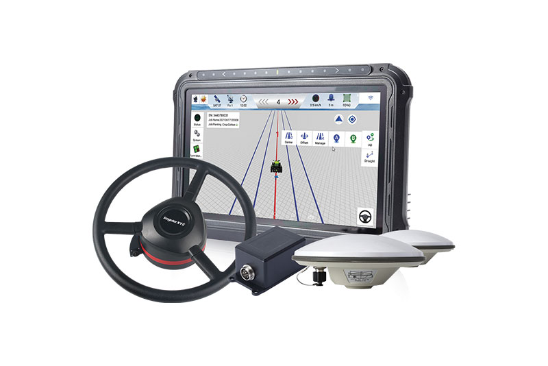
Photo: Singular XYZ

Photo: Singular XYZ

The SAgro10 GNSS is an upgradeable entry-level guidance system for precision agriculture, which can be easily upgraded to the SAgro100 automatic steering system. Equipped with a high-precision GNSS module, the SAgro10 tracks all constellations. For users with network coverage or a UHF base station, the SAgro10 system provides centimeter-level accuracy navigation in real-time kinematic mode. In the absence of base stations, it can still provide sub-meter navigation accuracy in single-point smoothing mode. The system is compatible with most agricultural tractors and can be installed in 15 minutes. It supports a 10-in sunlight-readable touchscreen with a clear graphic interface. The SAgro10 software can intelligently manage the work area and simplify user operations, such as recording the completed work area and planning the work route.

SingularXYZ, singularxyz.com

Publicerad den Lämna en kommentar

Are e-bikes the transportation of the future?

Photo:

Image: iStock/Getty Images Plus/Getty Images

Bikes have been used for centuries for transportation, exercise, and recreation. Now, thanks to developments in battery technology and growing environmental concerns, sales of e-bikes are exploding.

The Roundup has estimated that 300 million e-bikes will be used around the globe by next year, with annual sales reaching 10 million by 2024 and 17 million by 2030.

Mapbox, a platform that provides maps and location data for developers and works with such notable companies as Strava, General Motors, and Instacart, offers micro mobility solutions to help e-bike companies develop advanced navigation systems. E-bike maker Cowboy, and shared micro-mobility operator TIER Mobility, use Mapbox for their customizable navigation technology that provides turn-by-turn navigation with voice guidance, route optimization, traffic history and more.

Mapbox co-founder and principal evangelist Will White understands the capabilities and limitations of e-bikes that need to be considered when designing navigation technology for them. He pointed to two main obstacles to the adoption of e-bikes: rider safety and security from theft.

With these obstacles in mind, Mapbox is developing improvements in the ability to track the precise location of e-bikes by using their navigation platform. Additionally, White predicts that most e-bike companies will start to include radar devices to detect obstacles ahead and vehicles approaching from behind, as well as cameras, artificial intelligence and more to improve rider safety.

White is optimistic that e-bikes will be adopted as a mainstream form of transportation and is excited for Mapbox to be on the forefront of that innovative navigation technology.

Publicerad den Lämna en kommentar

Ukraine attacks changed Russian GPS jamming

Two Russian airbases deep inside the country were attacked on December 5: the Engels-2 base in the Saratov region and Dyagilevo near Ryazan. The next day an oil tank at the Kursk airfield closer to the border with Ukraine was hit and set on fire.

Reports from Russian witnesses and unofficial sources in Ukraine indicate that the attacks were carried out with UAVs operated by the Ukrainian military.

The Russian government has long interfered with reception of GPS signals, especially near and within its own borders. The early December attacks seem to have motivated an increase in this activity.

More Interference

Information displayed by the website GPSJam.org indicates that, on the first day of the attacks, GPS interference was detected around Moscow, at two airbases to the east, and near the Engels-2 airbase.

Photo:

Image: RNT Foundation

GPSJam.org uses anomalies in crowdsourced aviation ADS-B data as an indicator of unreliable GPS signals. Note that no such information is available for much of Ukraine as commercial aircraft have been avoiding the airspace since the beginning of the current conflict.

The GPSJam.org depiction of the region six days after the attacks is quite different and has stayed much the same ever since. It seems to show greatly increased interference in the vicinity of the Engles-2 airbase, and new interference around the Marinikova airbase to the south along the Volga River.

Photo:

Image: GPSJam.org

A History of Jamming and Spoofing

The Russian government has been deliberately and systematically interfering with GPS signals in some places since at least 2016.

An article in the Moscow Times that year bragged “The Kremlin Eats GPS for Breakfast.”

The article documented a tech podcaster’s discovery that GPS L2 and L5 signals were being jammed and GPS L1 was being spoofed in the vicinity of the Kremlin. The combination of jamming and spoofing caused receivers in the area to report that, rather than being downtown, they were at the Vnukovo international airport some 20 kilometers away.

The author of the article speculated the spoofing was to protect government officials and buildings from surveillance and attack by UAVs. Since 2013 most larger UAVs have been programmed by manufacturers with the locations of airports and to avoid them. Making UAVs near the Kremlin believe they were at an airport could be an effective part of an overall defense system by causing them to avoid the area.

In 2017 the Resilient Navigation and Timing Foundation examined maritime AIS data and found similar spoofing activity had been occurring in the Black Sea for at least two years. A 2019 report by the nonprofit C4ADS expanded upon this work and revealed spoofing activity at various times and places across Russia. Almost 10,000 instances were documented across ten locations between 2016 and 2018. The report also linked much of the spoofing to the Russian Federal Protective Service and movements of senior government officials. This reinforced the idea that the spoofing was part of VIP protection efforts.

Questions Abound

It is easy to conclude that Russia’s recent increases in interference activity were in reaction to the UAV attacks on December 5 and 6.

Western intelligence and military officials may be arriving at additional conclusions and asking themselves some intriguing questions. One might be why it took six days after the first UAV attack to implement the new interference scheme. The report by C4ADS made it clear that Russian equipment used for wide area spoofing is quite portable.

Perhaps the delay was one of decision making. Some observers have commented that much of the direction for the current conflict comes directly from the top, rather than being delegated to field commanders. It could well be that it took that long for the Kremlin to realize that UAVs were involved and direct equipment to be deployed.

Another question likely being asked is about the selection of locations where interference is being used. Interference activity was observed at the Engels-2 airbase before it was attacked. This seems to have greatly increased after the attack. Airfields at Dyagilevo and Kursk were also attacked, but no interference activity has been observed at either location.

At the same time, substantial new interference activity has been observed at the Marinikova airbase, which was not attacked. There are likely several contributing factors to why some locations have been protected with jamming and/or spoofing and some not.

While Russian forces have a fearsome reputation for electronic warfare and their ability to interfere with GPS signals, the amount of equipment and the number of trained operators may be limited. C4ADS’ finding that spoofing equipment was moved around with VIPs rather than permanently located around the nation could indicate a limited amount.

This would mean that the bases and facilities to be protected must be prioritized. The lack of interference around Kursk and Dyagilevo could mean Russia sees them as less important, or less likely to be attacked again. New interference at Marinikova could mean it is a high value target and in need of protection.

Conversely, some of the new activity could be designed to deceive and draw Ukrainian fire away from higher value targets and toward lower ones. Such is the potential nature of military strategy in war.

Analysts are also probably asking questions about the effectiveness of jamming and spoofing as a defense against a determined UAV-operating opponent.

Interference had been detected at Engels-2 before it was successfully attacked by one or more UAVs. This likely shows that Ukrainian forces disabled any geofencing that might have been originally included as part of the UAVs’ original design. They may have also upgraded the UAVs’ navigation receivers with hardware or software to make them much more resistant to interference from the ground.

Navigation Warfare Increasingly Important

Regardless, the UAV attacks and observed changes in interference activity reaffirm the importance of navigation warfare in modern conflicts. Knowing the location of your forces and of your targets has always been important. In an era of precision strike and autonomous systems, robust and resilient navigation that resists or overcomes interference is even more important.

The U.S. military has long recognized this, establishing its Joint Navigation Warfare Center in 2004. The center focuses on the intersection of positioning, navigation, and timing with electronic warfare and cyber operations. Undoubtedly Russia has identical concerns and probably an equivalent organization.

The current conflict in Ukraine will continue to raise questions for both sides. Not in question, though, is the importance of navigation warfare to this conflict, and that it will be increasingly important in future ones.

Publicerad den Lämna en kommentar

Climate change in the Big Basin mapped with GNSS and lidar technology

Photo:

Image: iStock/Getty Images Plus/Getty Images

CyArk, a California-based nonprofit, used UAVs, lidar and GNSS equipment to scan Big Basin Redwood State Park in Santa Cruz, California and create a model of it. The model shows drastic changes from climate change and the after-effects of the 2020 CZU Lightning Complex Fire.

CyArk was contracted by the California park system and Google Art & Culture to document climate-related changes in the state forest, including the 2020 CZU Lightning Complex Fire, which burned more than 97% of the oldest park in California, destroying historic structures and most of the park. The fire was detrimental to the park’s landscape, which is still plagued by drought.

DJI quad-rotor UAVs, a fixed-wing senseFly UAS, lidar and photogrammetry data brought in by RealityCapture software, and Topcon Positioning Group GNSS receivers among other technologies were used by CyArk to map the large-scale project.

The model created from the flyover of the Big Basin can be seen here.

CyArk digitally documents culturally historical places around the globe in 3D to preserve each site’s story using GNSS and lidar technology. They have worked at more than 200 sites in more than 40 countries.

Publicerad den Lämna en kommentar

EGNOS V3 passes System Critical Design Review

Photo:

Image: Airbus

On Dec. 7, the European Geostationary Navigation Overlay Service (EGNOS) V3, a satellite-based navigation augmentation system designed by Airbus, passed the System Critical Design Review (CDR). EGNOS V3 supports safety-critical aircraft applications and will soon provide services to maritime and land users.

New services provided by EGNOS V3 are based on multiple frequencies from GPS and Galileo constellations and will provide protection against cyberattacks. As it successfully passed CDR, this multi-constellation and multi-frequency satellite-based navigation augmentation system is a step forward in improving EGNOS accuracy, robustness, and overall coverage in Europe.

EGNOS V3 relies on three operation centers and 44 monitoring stations across Europe. It monitors the signals from satellite navigation systems and generates augmentation messages broadcast to all users using transponders and geostationary satellites. Airbus is currently designing more Galileo satellites, which will further improve EGNOS accuracy and robustness and the resilience of its signal.

EGNOS is a component of the European Union Space Program and is managed in partnership with the European Commission’s Directorate-General for Defense, Industry and Space, the European Union Agency for the Space Programme (EUSPA) and the European Space Agency (ESA).

Publicerad den Lämna en kommentar

NASA loses contact with CYGNSS hurricane satellite

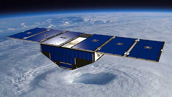
Artist's concept of one of the eight CYGNSS satellites in orbit. (Image: NASA/University of Michigan)

Artist’s concept of one of the eight CYGNSS satellites in orbit. (Image: NASA/University of Michigan)

Since Nov. 26, NASA’s Cyclone Global Navigation Satellite System (CYGNSS) team has not been able to make contact with one of the eight CYGNSS spacecraft, FM06.

The team is still working to acquire a signal and establish a connection.

The other seven spacecraft continue to operate normally and have been collecting science measurements since the FM06 anomaly.

CYGNSS is a constellation of eight small satellites taking measurements of ocean surface winds in and near the eye of the storm throughout the lifecycle of tropical cyclones, typhoons and hurricanes.

If the team isn’t able to reestablish contact, loss of the FM06 satellite would primarily affect the constellation’s spatial coverage. However, the CYGNSS constellation can continue to meet its scientific requirements and objectives.

CYGNSS was launched Dec. 15, 2016, and completed its prime mission science objectives on March 19, 2019. It has been operating in extended mission status since then.