Publicerad den Lämna en kommentar

Unmanned and autonomous news

Browsing through the news from the Consumer Electronics Show (CES) in Las Vegas last week, there seems to have been the regular number and variety of ‘robots’ demonstrating various capabilities from basic movement to almost complete human-like animation and speech. There were also a few more demos related to navigation and autonomy that could be of more interest to our readership. In particular, the case was made for more extensive use of drones for deliveries and in agriculture.

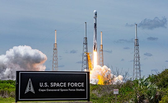
Apparently, the FAA was at the show – promoting the use of unmanned aerial vehicles (UAV) for ‘last mile’ deliveries. The gist of one presentation was that UAV deliveries could possibly reduce the need for people to drive to a store for a pick-up. If we drive, we periodically have accidents – probably someone has estimated the probability that anyone getting into a vehicle will have an accident and suffer varying degrees of damage to property, life or limb.

So, if drone and automated ground vehicle deliveries were to be universally accepted and implemented, lives would be saved, people’s lives wouldn’t be as disrupted and costs for hospital care and vehicle repairs would be reduced. All good, right? However, people are still not sold on UAV flying over their neighborhoods because they might fall out of the sky and hurt someone or damage property, make lots of noise and disturb their peace and quiet or use the opportunity to invade their privacy. Therefore, delivery start-ups are still struggling through FAA and local red-tape to get airborne — which at this stage is probably not a bad thing — as we get safety objectives straight, and train people well enough to reduce error rates to below acceptable limits.

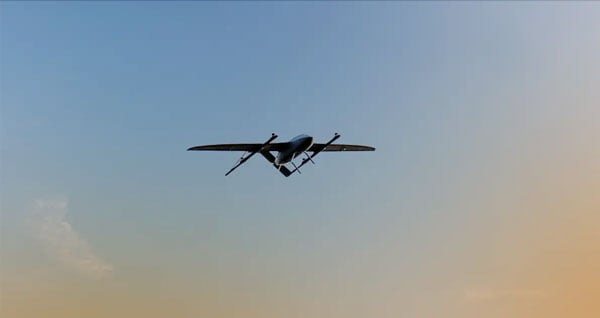
Another example used by the FAA at CES was the health risks for pilots of crop spraying aircraft, which are largely used on medium to large scale farms in the United States. The health hazard of the pesticide spray and aircraft accidents during aircraft crop dusting — rapidly, repeated ‘swoop’ to low over the field, low level overflight to spray, then rapid climb and turn maneuver — could be largely avoided by UAV spraying systems, which have already been implemented in many countries around the world. The problem, however, is that the adoption of UAV spraying has perhaps been slower than anticipated.

Photo:

A UAV delivering groceries. Image: Walmart

Photo:

Crop dusting. Image: Stefan Krause

Crop dusting aircraft can apparently treat about 600 acres/day on larger farms, while drones are only able to carry much smaller spray tanks, with a capacity of about 8 gallons, which enables spraying of 30 acres-per-hour. In addition, batteries on UAV need to be exchanged regularly, hopefully at the same time as spray tanks are refilled. While one pilot flies a crop duster aircraft, a UAV operation not only requires a skilled pilot to fly the UAV, but also a line-of-sight observer under FAA regulations. So, labor costs are higher, somewhat offsetting the lower operational costs of a UAV.

 Nevertheless, the limited number of crop dusters requires scheduling out days, several weeks even in the busy seasons. Whereas, if you own an agricultural UAV only the weather determines when you can treat your own crops.

So why is it taking time for this alternative approach to take off?

Let’s say you buy your own small UAV — one capable of 1-2 gallons-per-acre for a small farm. You would first need to take an operator’s course and qualify for a pilot’s license, then you would have to work city hall to obtain an aerial applicator’s license and a state pesticide applicator’s license. Then you would have to pass an FAA physical, and maybe obtain an exemption to fly a UAV over the standard 55 lb weight. If you wanted to fly after dark, you would also need a night operator’s license. If you wanted to fly several UAV simultaneously (a swarm) to get the job done quickly, you would need to train and become qualified. These things are a significant barrier to entry for individual farmers. Therefore, companies are springing up that will charge equivalent prices for turn-key UAV crop applications as for aerial crop dusting – say between $11 -14 per acre.

Photo:

Autonomous AG-116 crop-spraying drone. Image: Hilio

UAV do have a place in the business of agriculture for crop spaying, even alongside conventional crop-dusting aircraft, and costs seem to be competitive if a farmer were to buy turn-key spraying. The obstacles to overcome for someone to start a UAV spraying business seem somewhat prohibitive, but companies are taking on the challenge and offering services. Farm owners who want to manage their own regular pesticide and fertilizer applications using their own UAV have a steep learning curve to climb.

Publicerad den Lämna en kommentar

Encapsulation of GPS Space Vehicle ‘Earhart’ is complete

GPS III Space Vehicle 06 (SV06) was launched this morning from Cape Canaveral Space Force Station in Florida. It is the 18th GPS satellite to broadcast the L5 signal. On Jan. 12, the Space Force Space Systems Command (SSC) announced that SV06 had completed encapsulation within the Falcon 9 payload.

The space vehicle’s fairing protects it from the harsh transient environment, such as subsonic shock and extreme temperatures experienced during launch. The launch of SV06 contributed to the SSC’s objective to create resilient GPS, which ensures all users have access to stable positioning, navigation, and timing (PNT) services.

Lockheed Martin Space Systems is the main contractor for the GPS III SV06 space vehicle and SpaceX provided launch services. This is Falcon 9’s fifth GPS launch since SpaceX launched GPS III-2 in December 2018.

Publicerad den Lämna en kommentar

SiLC launches coherent vision solution

Photo:

Image: SiLC

SiLC Technologies has launched the Eyeonic Vision System. This system is a frequency-modulated continuous wave lidar solution, which delivers high levels of vision perception to identify and avoid objects with low latency.

At the core of the Eyeonic Vision System is SiLC’s fully integrated silicon photonics chip. It provides more definition and precision than legacy lidar solutions, with roughly 10 milli-degree of angular resolution coupled with millimeter-level precision. These features enable this solution to measure the shape and distance of objects with high-precision and at a large distance.

The system combines the Eyeonic Vision Sensor and a digital processing solution based on a powerful field-programmable gate array. The flexible architecture enables synchronization of multiple vision sensors for unlimited points per second.

SiLC demonstrated the Eyeonic Vision System at CES 2023. It was named by the CES award committee as an honoree for the CES Innovation Award.

The compact, powerful, vision solution is suitable for autonomous vehicles, smart cameras, robotics and other advanced products. It is available now. Pricing varies depending on configuration.

Publicerad den Lämna en kommentar

Hexagon and Ness provide digital maps for Czech Railways

Photo:

Image: LuPa Creative/iStock/Getty Images Plus/Getty Images

Ness Czech will supply the Czech Railway Administration with a Digital Technical Railway Map (DTRM) with help from Hexagon’s Safety, Infrastructure and Geospatial division. The DTRM project has been underway since September 2022 and will be implemented by 2025.

DTRM is a railway-specific geographic information system (GIS), that provides access to transport and technical infrastructure information to better prepare investments and repair work. The basis of the DTRM project is the Technical Map Information System (ISTEM) developed by Ness and Hexagon.

The project includes digitization and consolidation of all available Czech Railway Administration data, covering more than 9,200 km of tracks, 27,000 km of technical infrastructure and an area of 21,000 ha. The delivery also includes three data centers.

The project is a legislative obligation of the Czech Railway Administration as the state is developing a national map, which will be fully operational by 2024. The Digital Technical Map of the Czech Republic is being built across the country by connecting regional digital maps, maps from the Railway Administration and maps provided by the Directorate of Roads and Highways. The connection is provided by the Czech Land Surveying and Cadastral Office.

Publicerad den Lämna en kommentar

BVLOS flights with North Dakota drone system approved

Photo:

Image: uAvionix

uAvionix has received approval by the Federal Aviation Administration (FAA) to conduct beyond-visual-line-of-sight (BVLOS) small unmanned aerial flight in North Dakota. The test flight to secure approval took place at the Northern Plains UAS Test Site in North Dakota.

Vantis is North Dakota’s UAS network, which serves many UAS operators across different sectors. By leveraging Vantis, uAvionix demonstrated to the FAA it had established adequate risk mitigations to satisfy required safety standards for BVLOS operation within the national airspace system.

The Northern Plains UAS Test Site partnered with Thales USA to develop and implement Vantis. The UAS system enables UAS pilots to command and control the UAS and remain clear of other aircraft when flying BVLOS. Vantis includes ground-based aviation infrastructure, which lowers the barrier of entry to BVLOS flights for multiple users.

The FAA approval to conduct BVLOS UAS flights is another step in bringing UAS to commercial sectors. UAvionix continues to collaborate with FAA as regulations evolve to ensure Vantis meets all necessary requirements.

Publicerad den Lämna en kommentar

FAA approves Percepto for an HA BVLOS UAV inspection

Photo:

Image: Percepto

Percepto has announced the U.S. Federal Aviation Administration (FAA) has approved the use of its UAV-in-a-box solution to perform highly automated beyond visual line of sight (HA BVLOS) inspections and monitoring operations at a large solar power plant in Texas.

The HA BVLOS UAV will fly at 200 feet above ground, which is double the altitude of any previously approved operation in the United States. The ability to fly at a higher altitude will enable greater operational flexibility to monitor large areas and tall structures in the future, including mapping and modeling.

Percepto’s HA BVLOS UAV enables an automated detect and avoid cycle, eliminating the need for remote pilot in command interventions if other aircraft are detected.  Additionally, this capability negates the need for a pilot or visual observer on site.

The FAA approval for the solar plant deployment serves as a model for other industries including mining and oil and gas, to potentially increase site efficiency through automated remote inspection operation.

Publicerad den Lämna en kommentar

Crowd-Funding Call 2023

QGIS turned 20 last year. Help us get ready for the next 20+ years by becoming a sustaining member!

We want to ensure another 20+ years of sustainable development to keep on bringing the most user-friendly GIS to users worldwide. 

This year (2023), we, therefore, plan to focus on addressing long-standing infrastructure debt (particularly docs and web infrastructure). To make this infrastructure more sustainable, we had to make the difficult decision to move funds from our annual grant programme to rather support these infrastructure tasks. To address upcoming challenges (including but not limited to Qt6 support and next-generation installers) and to the grant programme back to full strength, we need additional funds. The best way to achieve this goal is to enlarge our sustaining member base. 

Our existing sustaining members contribute €130k per year. We are aiming to raise an additional €70k per year (equivalent to 1 new flagship, 3 new large, 4 new medium, and 8 new small sustaining memberships) to bring the total member contributions up to €200k.

The campaign to raise funds for our activities runs from 16th January 2023 until 16th February 2023.

Our funding progress so far:

To keep the lights on, become a sustaining member or donor.

Details: Sustaining Membership Program Overview

Every contribution counts. 


If you need to convince your boss … 

Executive summary

QGIS is a high-impact, global project. QGIS.org provides open access to best-in-class tools for visualizing, creating, editing, analyzing, and publication of spatially linked data and information products. QGIS.org does not prescribe how these tools should be used, but we make these tools freely available and accessible to everyone in the hope of fostering a more just society, better making, and furthering the goal of a more sustainable environment. Our cross-platform software is available on traditional desktop PC’s, on mobile devices, and in the cloud.

Who uses QGIS?

QGIS is used by governments, large multi-national organizations, corporate entities, and academic institutions all the way down to small businesses and hobbyist users. Our Open Source development model makes the software accessible to all of these users at a cost they can afford, excluding no one from the ability to benefit from QGIS.

QGIS is free of cost, not cost-free

It has taken, and will continue to take, a great deal of effort to develop high-quality tools like those provided by QGIS.org. Initially, this cost was borne exclusively through the efforts of dedicated volunteers. As the project matured, a financial ecosystem developed around the project. Customers began to contract community members to extend the QGIS project (software, documentation, online infrastructure) to better serve their needs.

In parallel with these directed funding efforts, we developed programmes for supporting the project with funds that we can use at our own discretion via donations and sustaining memberships. These discretionary funds allow us to provide all of the supporting infrastructure around the project. In addition, it enables us to fund:

  • Quality improvements to the software,
  • Host contributor meetings,
  • Hire technical contributors to improve broad-reach elements of the project, and
  • Grow the community around the project to strengthen its long-term sustainability.

A value-for-value model

Many of our users migrate to QGIS from proprietary alternatives which are financially unsustainable to use within their organizations. We celebrate the fact that we are able to open doors that would have otherwise been closed for those needing spatial tools such as QGIS. However, we also ask you to share some of the value gains that you realize from moving to QGIS with us. The funds you provide to us are used to the direct benefit of all users, who get to enjoy a more feature-rich, stable, and well-documented set of QGIS tools. This ‘value-for-value’ model helps to ensure the long-term sustainability and prosperity of the QGIS project. With nearly half a million daily active users, your contributions can make a huge impact on the lives of many people. The project has received in-kind and financial contributions from many well-known international organizations around the world, whom we thank deeply. We invite you to join the ever-growing number of organizations that see value in the work we do and share value back to us in the form of financial contributions to support our work.

View our financial reports →

Governance

QGIS.org is registered as a Swiss Verein (Association) that is operated in a non-profit manner. It is managed by an elected board and contributed to by hundreds of people from around the world. In the same way that the software we develop is open source, the project is operated with the same principle of openness, with all financial reports, board reports, and community decisions carried out in an open and transparent way.

View our annual general reports →

Nyhet från QGIS, orginal inlägg

Publicerad den Lämna en kommentar

UAvionix updates C2 solutions for UAS BVLOS operations

In December 2022, uAvionix announced its updated product line for unmanned aerial systems (UAS) beyond visual line of sight (BVLOS) command and control (C2). The SkyLine C2 management platform and muLTElink airborne radio systems (ARS) are designed to integrate, which enables a self-healing C2 network capable of both path and link diversity. This eliminates lost-link possibilities over broad terrain and altitude ranges.

Photo:

Image: uAvionix

Photo:

Image: uAvionix

MuLTElink ARS consists of two models — muLTElink915 and muLTElink5060, the core of the uAvionix C2 system. The muLTElink915 model combines globally licensed aviation LTE, enhanced with frequency hopping 902–928 MHz industrial, scientific and medical frequencies capability. The muLTElink5060 model combines global LTE with aviation-protected 5,030–5,091 MHz C-band for customers holding C-band licenses for control and non-payload communication (CNPC) operations.

Each muLTElink model allows up to one external CNPC radio to be optionally connected to allow simultaneous use of all three frequency ranges, higher power C-band operation or future radio integrations.

UAvionix updated its previous line of microLink and SkyLink ARS radios and relaunched them under the SkyLink ARS banner. Each SkyLink ARS can operate as a point-to-point radio or integrate with muLTElink and SkyLine for managed C2 operations. SkyLink915micro, formerly named microLink, offers a robust form factor and Lemo connector for UAS requiring hardened installations.

SkyLink5060micro and SkyLink5060 offer 100 mW and 10 W 5,030–5,091 MHz aviation protected C-band CNPC options.

Both platforms meet standards set by RTCA DO-362A and the U.S. Federal Aviation Administration’s draft Technical Standard Orders-C213a and may receive similar validated orders through other global aviation regulators.

Publicerad den Lämna en kommentar

TDK adds to its InvenSense SmartIndustrial family

Photo:

Image: TDK

On Jan. 4, TDK Corporation announced the addition of the IIM-42653 and IIM-42652-I platforms to its InvenSense SmartIndustrial family of compact and low-power sensor platforms. IIM-42653 and IIM-42652-I consist of 6-axis IMUs, which target industrial and navigation applications requiring high force sensitive resistor (FSR) performance or inertial navigation software.

The IIM-42653 platform—a robust, low-noise, low-power, 6-axis IMU—is capable of a gyro-programmable output of 4,000 dps and an accelerometer-programmable output of 32 g. These features make IIM-42653 ideal for applications including industrial-grade or high-end automated guided vehicles, automated mobile robots and unmanned aerial vehicles.

The IIM-42652-I platform, a compact 6-axis IMU, offers hardware authentication and can be integrated with TRACK dead reckoning software from Trusted Positioning, a TDK Group company. The TRACK software, which is available for purchase through a licensing agreement, filters GNSS multi-path errors and provides a continuous navigation solution when GNSS signals are unavailable.

IIM-42653 is available now for select partners and customers only and will be available at TDK distribution partners in April. IIM-42652-I is available now at InvenSense-authorized distributors.

Publicerad den Lämna en kommentar

Autel Robotics announce EVO Max 4T UAV

Photo:

Image: Autel Robotics

Autel Robotics has unveiled its EVO Max 4T UAV, an intelligent flight platform designed for enterprise and professional applications. The company made the announcement at CES 2023.

EVO Max 4T’s autonomous flight technology and artificial intelligence features give it self-reliance and navigation capabilities. It has omnidirectional obstacle avoidance and tri-anti-interference capability to ensure flight safety and stability in high-interference environments.

It is equipped with three high-quality cameras including a 48 MP telephoto camera, a 50 MP wide-angle camera and an infrared camera. The platform has a range of navigation and data-acquisition functions, including 3D flight routes, PinPoint Mode, Team Work, Polygon Mission, Waypoint Mission and Oblique Photography.

Autel Robotics also released the Dragonfish NEST and the EVO NEST. Dragonfish NEST is an automated electric vertical takeoff and landing (eVTOL) support system, with a range of up to 75 miles between units, and is suitable for long-range corridor inspections and large area coverage. EVO NEST is a base for automatic take-off, landing, charging and mission planning for EVO series UAVs. It is designed for all-weather operation and can be easily transported.