Publicerad den Lämna en kommentar

ICAO adopts international standards for Galileo and future SBAS

Image: Chalabala/iStock/Getty Images Plus/Getty Images

Image: Chalabala/iStock/Getty Images Plus/Getty Images

The International Civil Aviation Organization (ICAO) has adopted international standards for Galileo and future satellite-based augmentation systems (SBAS). This is a milestone for the aviation industry, as the European Union Agency for the Space Programme (EUSPA) can now fully leverage the potential of satellite navigation services developed in Europe — in combination with GPS — to make air travel safer, more efficient, and more reliable.

Galileo will provide advanced navigation capabilities to aviation, improving the availability and reliability of services. The risk of loss or interference will be significantly reduced with a more accurate and secure signal for positioning and timing.

Additionally, the evolution to the European Geostationary Navigation Overlay Service (EGNOS) v3 will augment Galileo and enable the use of its dual-frequency bands — E1 and E5, protected for aviation use — in combination with GPS. This enhances vertical guidance to enable precision approach and landing capabilities for all equipped aircraft across Europe.

The adoption of these international standards is a result of the work done by the European Commission Directorate-General for Defence Industry and Space, in partnership with EUSPA, DG-MOVE, European Aviation Safety Industry, the European Space Agency and in coordination with the EU Member States and their ANSPs.

Publicerad den Lämna en kommentar

UAV and AI update

A couple of stories about unmanned air vehicles in the war in Ukraine and a response to the recent Open Letter by the “Future of Life Institute” with more than 200,000 signatures on advanced AI, which urged a six-month moratorium to allow the development of seemingly much needed AI regulations.


The war in Ukraine

It has been reported that Ukrainian forces were operating the commercially available Chinese Mugin 5 UAV, presumably for surveillance of Russian forces inside Russian-occupied territory. The Mugin 5 can be bought commercially for $10-15,000 and is manufactured by Mugin, which is based in the port city of Xiamen, on China’s eastern coast. In a previous statement posted on the company’s website on March 2, Mugin Limited said that it “condemns” the use of its products during warfare and that it ceased selling products to Russia or Ukraine at the start of the war. However, Russian forces claimed in January 2023 that it had actually shot down one of these Chinese-made UAVs being flown by Ukrainian forces over their territory.

Then, just this week, Ukrainian forces apparently were able to track a low level, slow-moving air vehicle coming at them from Russian occupied territory. After some time, they were able to intercept the UAV, which carried a flashing navigation light, from the ground, and were able to bring it down using small arms. The remains of the crashed UAV were found in a clearing in the forest; a single 44 lb bomb was removed from the wreckage and safely exploded by the Ukrainian team.

Weaponized Mugin 5 following crash in Ukraine forest. (Image: Screenshot from video from Kanal13 Youtube)

Weaponized Mugin 5 following crash in Ukraine forest. (Image: Screenshot from video from Kanal13 Youtube)

Somewhat worse for wear, the Mugin 5 UAV appears to have been held together in places by duct tape and other patches. Is it possible that having shot down a Ukrainian surveillance UAV the Russians recovered these remains and crudely restored the unit to flying and navigating capability, then sent it back to Ukraine owners carrying a bomb? Anything is possible in this conflict.

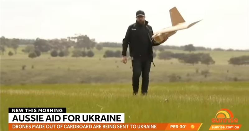
Staying with this conflict and the use of UAVs by both sides, its seems that Australia has come up with a low-cost surveillance UAV that is virtually undetectable and it’s proving quite popular with the Ukrainians. Most defensive detection involves some form of radar scanning, which relies on radar returns bouncing off a flying target. The Australian company SYPAC in Melbourne has developed the Corvo Precision Payload Delivery System (PPDS). It is a wax-coated cardboard UAV, held together with elastic bands and glue, but carrying sophisticated guidance and control electronics.

Image: Screenshot of video posted by 7 News Australia 

(Image: Screenshot of video posted by 7 News Australia)

SYPAQ has developed the CORVO UAV under an AU $1.1 m government contract with the objective of creating a low-cost, disposable UAV to deliver urgent needs — such as medical supplies or to resupply small arms ammunition to the Australian military. CORVO is autonomous once launched, using GNSS guidance, or dead reckoning if GNSS signal is lost or jammed. Apparently, hundreds of these disposable UAVs have already been shipped to Ukraine.

While a surveillance role was originally envisaged in Ukraine, it is reported that, “They have been very good at inflicting lots of damage on the enemy,” according to Ukraine’s ambassador to Australia. So, CORVO UAVs may well have already been weaponized.

Open Letter on AI development

Following a recent open letter supported by Elon Musk and Steve Wozniak that proposes a six-month halt on advanced AI development, I was recently approached on behalf of Professor Ioannis Pitas, director of the Artificial Intelligence and Information Analysis (AIIA) lab at the Aristotle University of Thessaloniki (AUTH) and management board chair of the AI Doctoral Academy (AIDA) with somewhat different views.

In order to further the on-going discussion, I thought it would be appropriate to give some space to an alternate view on AI development. So here are some paraphrased comments approved by Pitas:

Could AI research be stopped even for a short time? It is doubtful. Further AI progress is necessary for us to transition from an information society to a knowledge society.

Maybe we have reached the limits of AI research carried out primarily by Big Tech, which appears to treat powerful AI systems as black boxes whose functionality may be poorly understood.

It seems that the open letter reflects welcome and genuine concerns on social and financial risk management. Are expensive lawsuits in an unregulated and unlegislated environment inevitable as a consequence of ill-advised AI pronouncements?

However, it is doubtful whether the proposal for a six-month ban on large-scale experiments is the solution. It’s impractical for competitive commercial and geopolitical reasons, with very few benefits.

Of course, AI research can and should become more open, democratic and scientific.

Here are a number of suggested options:

  • Should elected parliaments and governments make the important decisions on AI rather than corporations or individual scientists?
  • Every effort should be made to facilitate the positive aspects of AI social and financial progress and to minimize any negative aspects.
  • The positive impact of AI systems can greatly outweigh their negative aspects if proper regulatory measures are taken.
  • It is possible that the biggest threat is that AI systems could deceive too many people who have little related knowledge. This can be extremely dangerous.
  • We should counter the big threat coming from the use of AI in illegal activities — cheating on university exams is a rather benign use — while the possibility of criminal exploitation may be very much worse.
  • The impact of AI on labor and markets will be very positive in the medium to long term.
  • AI systems should be required by international law to be a) registered in an ‘AI global register’, and b) users should be notified when they converse with or use the results of an AI system.
  • As AI systems have a huge impact on society, and in order to maximize their benefit and socio-economic progress, it is recommended that:
    o advanced key AI system technologies should become mostly open
    o AI-related data should be at least partially open.
  • However, strong financial compensation schemes should be established now for AI technology developers to compensate them for any component that becomes open source.

Well, this is a bit of a departure from our nominal UAV/AI report, but there does seem to be a growing number of voices calling for some form of AI regulation and more extensive discussion might well help this movement come to a conclusion. And it would seem that the U.S. administration is listening, as the U.S. Commerce Department has announced that it is seeking inputs from interested parties for methods to test the safety of AI systems — to ensure that they are “legal, effective, ethical, safe and otherwise trustworthy.” In order to enforce these standards, the department is investigating whether audits and inspections to certify AI systems should be required before their release on the unsuspecting public.

The U.S. Commerce Department is apparently not alone in these concerns, as China is also looking to ensure that systems such as Alibaba Cloud’s Tongyi Qianwen, a competitor to OpenAI’s ChatGPT, are socially beneficial. Meanwhile, following the release of ChatGPT and similar products from Microsoft and Google, awareness has grown of the capabilities of the latest AI tools that generate human-like text passages, and even new images and video. The UK Department for Science, Innovation and Technology and the Office for Artificial Intelligence on the other hand, seem to be looking for an approach to regulation that will not restrict AI innovation.

Publicerad den Lämna en kommentar

Launchpad: GNSS receivers, timing modules, survey applications

A roundup of recent products in the GNSS and inertial positioning industry from the April 2023 issue of GPS World magazine.


TIMING

Image: Furuno Electric

Image: Furuno

Global Timing Module
Supports L1 and L5 GNSS signals

GT-100 is compatible with all GNSS constellations. The GT-100 realizes high robustness and standard of time accuracy and stability. The GT-100 features advanced multipath mitigation, anti-jamming and anti-spoofing as well as short-term holdover, ensuring superior performance even if L1 or L5 are jammed. The module delivers nanosecond precision for 5G wireless systems, radio communications systems, smart power grids and grand master clocks. Along with the GT-100, GT-9001 and GT-90 achieve a level of time stability of 4.5ns (1σ) and offer superior features and performance.
Furuno, furuno.com
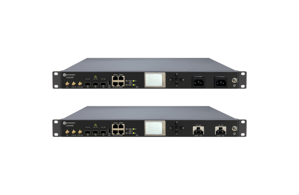
Image: UTStarcom

Image: UTStarcom

PTP Grandmaster
Designed for mobile networks

The SyncRing XGM30E precision time protocol (PTP) grandmaster is designed for mobile networks and other applications requiring accurate time and frequency synchronization. It is an addition to the SyncRing line of network synchronization equipment. The SyncRing XGM30E is an indoor PTP grandmaster offering echo time accuracy of more than ±40 ns, which can meet the stringent timing requirements of demanding applications, including 4G and 5G networks. The clock complies with the PTP IEEE 1588-2008 standard, supporting major ITU-T frequency and phase and time profiles. SyncRing XGM30E supports synchronous Ethernet (SyncE) output on all service interfaces for accurate frequency synchronization, and SyncE input for enhanced time holdover operation during GNSS outages. The grandmaster includes an indoor rack-mount design and power supply redundancy with AC or DC built-in options and has flexible management options. The SyncRing XGM30E is available now.
UTStarcom, utstar.com
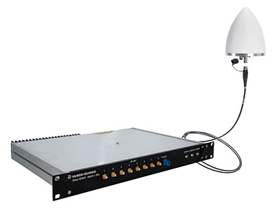
Photo: Huber+Suhner

Image: Huber+Suhner

Copper-Free Data System
For precise timing synchronization for high-performance networks

The GNSS and Power over Fiber GPSoF System receives, transmits and expands GNSS timing signals for the purpose of timing synchronization in data centers, central offices, distributed antenna systems or enterprise applications. It enables greater distances between the radio frequency source and the receiver system. It is also immune to RFI, EMI and EMP, contains remote control and monitoring via a web interface, and supports infrastructure installation due to direct GNSS signal evaluation.
Huber+Suhner, hubersuhner.com
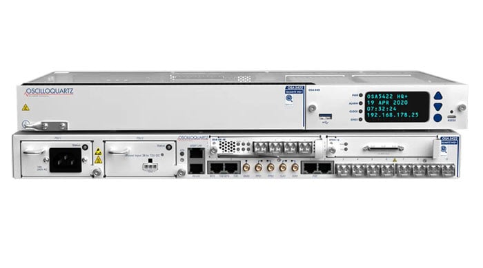
Image: ADVA

Image: ADVA

M-Code Device
With advanced timing for military applications

The OSA 5422 grandmaster clock meets key requirements of military networks by providing advanced positioning, navigation and timing (PNT) capabilities and improved resilience. The OSA 5422 grandmaster clock is integrated with a highly reliable M-code receiver, which meets stringent frequency and phase synchronization needs. The device is equipped with multi-band, multi-constellation GNSS receivers for when M-code is not available. The OSA 5422 also has long holdover and precision time protocol backup, which enables it to maintain accurate timing even in the event of M-code disruption. The OSA 5422 supports legacy interfaces such as BITS and IRIG and features eight field-upgradable 10G bit/s ports and 1G bit/s interfaces. The device is suitable for most demanding military edge applications.
ADVA, adva.com; Brandywine Communications, brandywinecomm.com


AUTONOMOUS
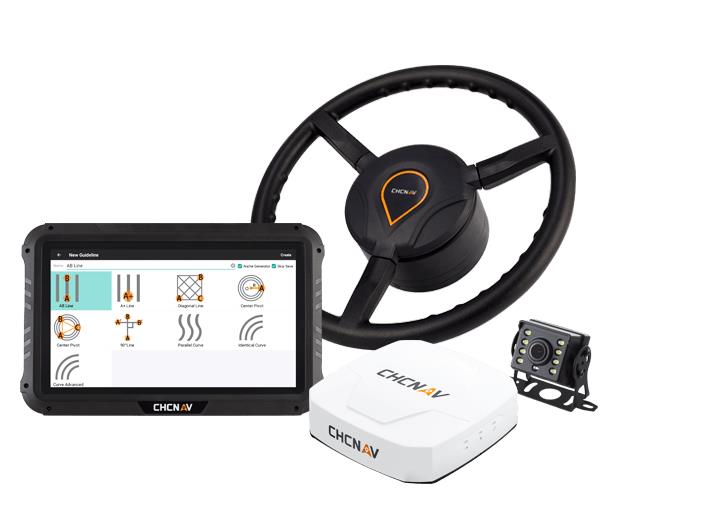
Image: CHC Navigation

Image: CHC Navigation

GNSS RTK Steering System
Suitable for agriculture applications

The NX510 SE Auto-Steer is an automated steering system that retrofits several types of new and old farm tractors and other vehicles. It can be connected to local real-time kinematic (RTK) networks or GNSS RTK base stations. NX510 SE is a guidance controller powered by multiple corrections sources and five satellite constellations: GPS, GLONASS, Galileo, BeiDou and QZSS. It has a built-in 4G and UHF modem that connects to all industry-standard differential GPS and RTK corrections to achieve centimeter-accuracy steering. NX510 SE contains GNSS and inertial navigation system terrain compensation technology, which maintains high accuracy in challenging environments and terrain. This makes NX510 SE suitable for ditching, planting and harvesting applications. In addition, AgNav multilingual software, operating on a 10.1 in industrial display, supports multiple guideline patterns that include AB line, A+ line, circle line, irregular curve and headland turn.
CHC Navigation, chcnav.com

Image: Trimble

Image: Trimble

Module for Rail Monitoring
For automated and semi-automated rail monitoring

The T4D Rail Module enables simple data collection and reduces office work required to automate movement detection for rail monitoring projects. The T4D software offers four main elements for automated monitoring: sensor management and data integration for GNSS; total station, geotechnical, vibration and environmental sensors; geodetic processing and adjustments for accurate results; analysis and visualization through several tools that provide real-time updates to support in-depth analysis and data presentation; and alarming and reporting. The T4D Rail module enables integration of rail as-builts collected with the Trimble GEDO system or with a track measuring bar paired with the Trimble Access Gauge Survey app. It also can automate calculations for track geometry parameters, generate analysis charts, and trigger alarms. The T4D software is offered in five editions to fit various project requirements. The editions include T4D Access, T4D Field, T4D Intermediate, T4D Geotechnical and T4D Advanced. T4D Access and T4D Advanced are the two editions that support the add-on Rail Module.
Trimble Geospatial, geospatial.trimble.com
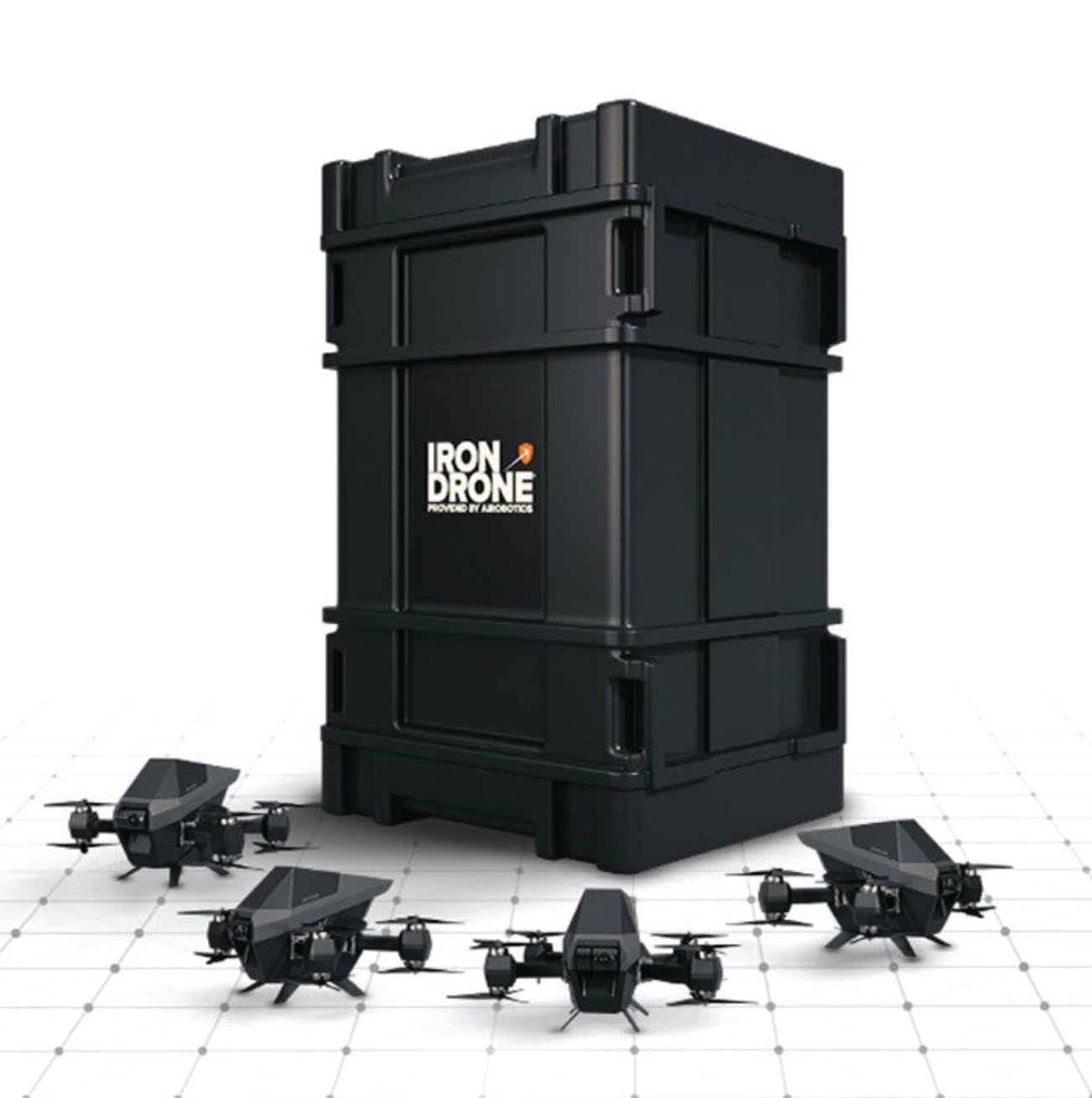
Image: Airobotics

Image: Airobotics

C-UAV Device
Anti-UAV protection device

The Iron Drone system is an advanced counter-UAV device, designed to defend against hostile drones in complex environments with minimal damage. Iron Drone is an automated intercepting system designed to eliminate small drones without using GPS or radio frequency jamming. The Iron Drone system is launched from a designated pod and flies autonomously towards targets under radar guidance. It identifies the target using computer vision capabilities. The intercepting UAV follows the target then uses a net and a parachute to incapacitate it, capture it and lower it to the ground.
Airobotics, airoboticsdrones.com
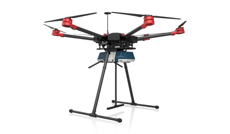
R&S EVSD1000 has been designed to provide a mounting adaptor for installation onto medium-size drone types. (Image: Rohde & Schwarz)

Image: Rohde & Schwarz

Drone-based analyzer
For UAV inspections

EVSD1000 VHF/UHF nav/drone analyzer provides highly accurate UAV inspection of terrestrial navigation and communications systems. The EVSD1000 VHF/UHF nav/drone analyzer is a signal-level and modulation analyzer for medium-sized UAVs. It features measurements of instrument landing systems, ground-based augmentation systems and VHF omnirange ground stations. The mechanical and electrical design is optimized for UAV-based, real-time measurements of terrestrial navigation systems with up to 100 measurement data sets per second. The analyzer provides high-precision signal analysis in the frequency range from 70 MHz to 410 MHz. This also includes the needed measurement repeatability to ensure that results from UAV measurements can be compared to flight and to ground inspections in line with ICAO standards. The EVSD1000 VHF/UHF nav/drone analyzer reduces runway blocking times, provides necessary measurement repeatability and offers measurement precision and GNSS time and location stamps. While streaming measurement data during a drone flight via the data link to a PC on the ground, the analyzer can also buffer data internally to ensure no results are lost if the data link is lost.
Rohde & Schwarz, rohde-schwarz.com


SURVEYING & MAPPING

SILC Eyeonic Vision System (Image: SiLC)

Image: SiLC

Coherent Vision Solution
Suitable for advanced products

The Eyeonic Vision System is a frequency-modulated continuous wave lidar solution, which delivers high levels of vision perception to identify and avoid objects with low latency. At the core of the system is a fully integrated silicon photonics chip. It provides more definition and precision than legacy lidar solutions, with roughly 10 milli-degree of angular resolution coupled with millimeter-level precision. These features enable this solution to measure the shape and distance of objects with high-precision and at a large distance. The system combines the Eyeonic Vision Sensor and a digital processing solution based on a powerful field-programmable gate array. The flexible architecture enables synchronization of multiple vision sensors for unlimited points per second. The compact, powerful, vision solution is suitable for autonomous vehicles, smart cameras, robotics and other advanced products. It is available now. Pricing varies depending on configuration.
SiLC Technologies, silc.com
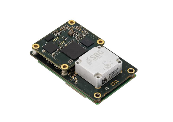
Image: SBG Systems

Image: SBG Systems

GNSS-Aided INS
Easily integrated with lidar or other third-party sensors

Quanta Plus is a GNSS-aided inertial navigation system (INS). The device combines a MEMS inertial measurement unit (IMU) with a resilient GNSS receiver to get reliable position and attitude, as well as providing real-time kinematic (RTK) fixes. Quanta Plus includes motion profiles, which enable users to optimize the sensor parameters to suit different use cases. The built-in precise time protocol server ensures sub-microsecond synchronization with external devices such as lidar. The device also has a built-in datalogger, Ethernet interface for easy integration, and a web configuration interface for simple setup and control. The INS can be integrated with Qinertia, SBG System’s post-processing software. Qinertia improves the performance of acquired data during a mission using reliable RTK corrections from a wide range of continuously operating reference station networks, or by importing base-station data during the process. Quanta Plus also improves the accuracy of the position and attitude using forward and backward processing and by integrating a tight coupling between GNSS and IMU data.
SBG Systems, sbg-systems.com
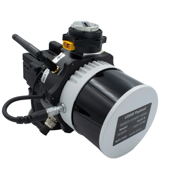
(Image: Inertial Labs)

Image: Inertial Labs

Survey Laser
Suitable for remote-sensing applications

The Resepi Hesai XT32 laser is designed for accurate remote-sensing applications. It can be used with commercially available lidar scanners, including Velodyne, Quanergy, Ouster, RIEGL, LIVOX and Hesai, as well as with UAVs. Resepi is completely modular, so users have full control for customization. The remote-sensing device uses a GPS-aided inertial navigation system with a NovAtel RTK/PPK single- or dual-antenna GNSS receiver, integrated with a Linux-based processing platform. It also comes with a 2 TB USB memory drive and has an embedded Wi-Fi cellular modem. Resepi has 3 cm to 5 cm point-cloud accuracy and can reach heights of more than 200 m above ground level. It is compatible with most UAV models; however, it is typically used with DJI M300, DJI M210 or DJI M600 models. The device is suitable for scanning and mapping, precision agriculture with lidar, simultaneous localization and mapping algorithm development, utility inspection and construction site monitoring. Resepi-supported software includes Hexagon NovAtel, PCPainter and PCMaster.
Inertial Labs, inertiallabs.com
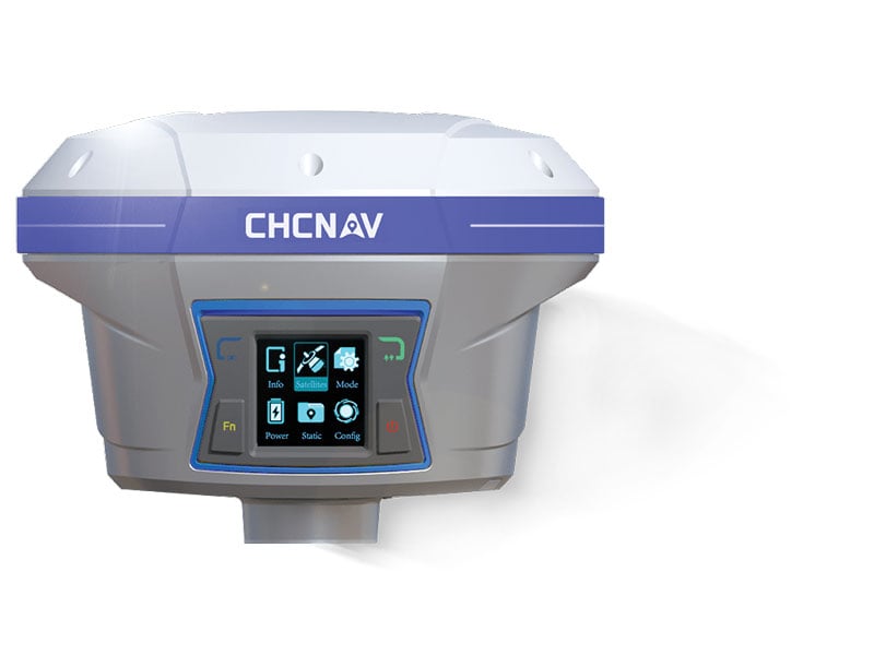
Image: CHC Navigation

Image: CHC Navigation

IMU-RTK GNSS Receiver
Provides robust and accurate positioning

The i90 GNSS receiver combines a GNSS real-time kinematic (RTK) engine, a high-end inertial measurement unit (IMU) sensor and advanced GNSS tracking capabilities to increase RTK availability and reliability. The embedded 624-channel GNSS receiver is compatible with GPS, GLONASS, Galileo and BeiDou signals. The i90 GNSS combines high-end connectivity modules: Bluetooth, Wi-Fi, NFC, 4G and a UHF radio modem. The internal UHF radio modem allows long-distance base-to-rover surveying up to 5 km. The built-in IMU ensures interference-free and automatic pole-tilt compensation in real time. An accuracy of 3 cm is achieved with pole-tilt range of up to 30°. The i90 GNSS receiver is suitable for construction and land surveying projects.
CHC Navigation, chcnav.com
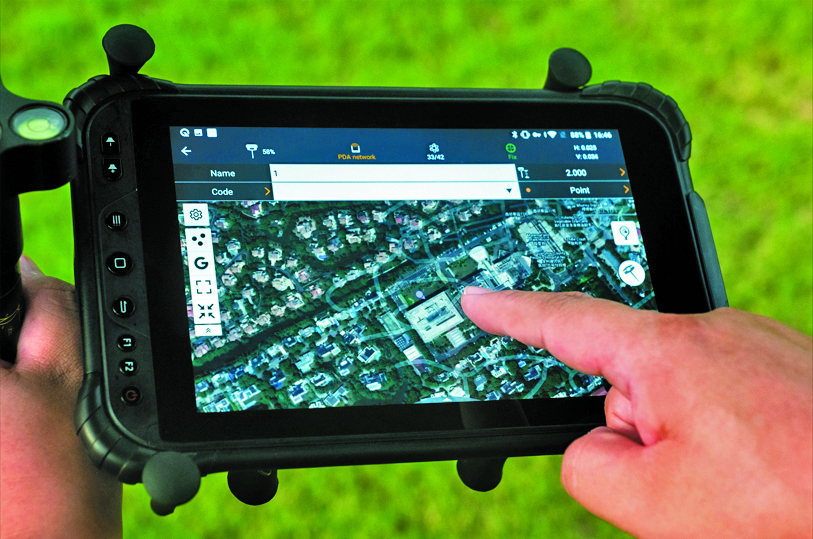
Image: CHCNAV

Image: CHCNAV

Field Application
For Android devices

LandStar8 is designed to be flexible and user-friendly for surveying and mapping tasks. It is versatile, modular and customizable for topographic tasks such as surveying, stake out, cadastral, mapping and geographic information systems (GIS). Building on the legacy of LandStar7, the LandStar8 provides features such as a refined user interface, streamlined workflows, faster operation, and integrated cloud services. Cloud connectivity is built in for backup, data storage or remote technical support. LandStar8 has a simple and intuitive layout with large map windows and sharp graphics. Users can hide features they rarely use and display only those they need. They also can copy coordinate settings, control and staking points from another handheld controller by scanning a QR code. Projects can be edited and sorted by history and attributes. Custom coordinate systems, geoid models and coding libraries can be updated at any time by using resource packages. LandStar8 also features a terrain calibration wizard designed for non-expert users.
CHCNAV, chcnav.com

Photo:

Image: Position Partners

Survey Rover
For accurate, survey-grade aerial mapping and photogrammetry

SmartSurveyor facilitates accurate, survey-grade aerial mapping and photogrammetry without the need for a connection between a camera shutter and a GNSS receiver. The fully compact, handheld aerial mapping survey rover is compatible with DJI Mavix 2 and 3 series and Phantom 4 Pro UAVs. The design is dissimilar from other UAV mapping systems in that it works from a UAV or smartphone and with two or more ground control points (GCPs) while using an ultra-matching technique. Once SmartSurveyor captures data, all photos and the GNSS file are uploaded to a PC and analyzed through the Agisoft UltraMatch workflow to confirm their accuracy before they are exported. Data can be managed in the cloud or on a local PC using software designed by MapSender. Additionally, this mapping tool works in tandem with the AllDayRTK subscription GNSS network service so that collected data can be uploaded to Tokara to remotely manage a project.

Position Partners, positionpartners.com


OEM

NB-IoT Industrial Module
Complete with GNSS geo-location capabilities
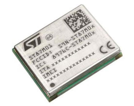
Image: STMicroelectronics

Image: STMicroelectronics

The ST87M01 is a fully programmable, certified LTE Cat NB2 NB-IoT industrial module that covers worldwide cellular frequency bands and integrates advanced security features. The ST87M01 is an integrated native GNSS receiver with multi-constellation access, which ensures enhanced and accurate localization. The module has a diminutive 10.6 mm x 12.8 mm land grid array footprint, making it suitable for applications where a small form factor is key. The STM8701 offers flexibility for product developers, presenting a fully programmable internet of things (IoT) platform enabling users to embed their own code into the module for simple applications. A variety of protocol stacks are available to handle popular IoT use cases. It targets wide-ranging IoT applications that require ultra-reliable low-power wide-area network connectivity and has ultra-low power consumption with less than 2 µA in low-power mode and transmit output power up to +23 dBm. Suitable applications for the module include smart metering, smart grid, smart building, smart city and smart infrastructure applications, as well as industrial condition monitoring and factory automation, smart agriculture and environmental monitoring. The module also can be combined with a separate host microcontroller, permitting many more use cases.
STMicroelectronics, st.com
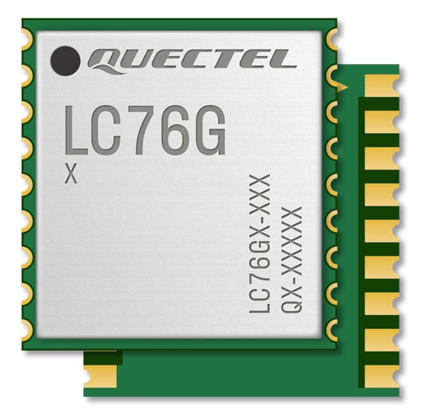
Image: Quectel

Image: Quectel

GNSS Module
Designed for battery-operated, ultra-low power GNSS devices

The LC76G module is a compact, single-band, ultra-low power GNSS module that features fast and accurate location performance. The module can concurrently receive and process signals from the GPS, GLONASS, BeiDou, Galileo and QZSS constellations. The LC76G has an internal surface acoustic wave filter and integrated low-noise amplifier, which can be connected directly to a passive patch antenna and provides filtering against unwanted interference. With a compact size of 10.1 mm × 9.7 mm × 2.4 mm, the footprint of the LC76G is compatible with other industry solutions, as well as Quectel’s legacy L76 and L76-LB modules. The LC67G is designed for battery-operated, ultra-low power GNSS devices, such as wearable personal trackers, wildlife and livestock tracking, toll tags, portable container trackers, as well as several traditional markets such as shared mobility and low-cost asset trackers.
Quectel Wireless Solutions, quectel.com
The INS-DH-OEM. (Photo: Inertial Labs)

The INS-DH-OEM. (Photo: Inertial Labs)

Inertial Navigation System
Incorporates NovAtel and Honeywell technology

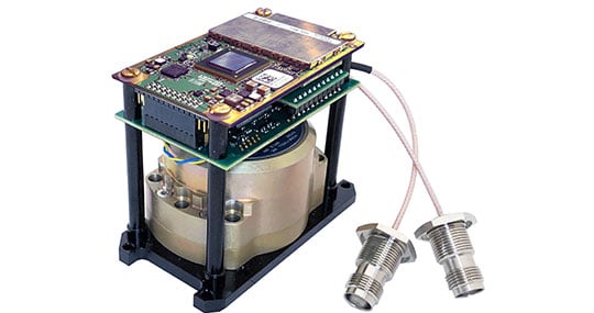
The INS-DH-OEM utilizes a dual-antenna NovAtel GNSS receiver and a Honeywell HG4930-CA51 inertial measurement unit (IMU). The INS-DH-OEM contains Inertial Labs’ on-board sensor-fusion filter, navigation and guidance algorithms, and calibration software. The INS-DH-OEM has three axes, a full operational temperature range, advanced MEMS accelerometers and new-generation tactical-grade MEMS gyroscopes to provide accurate position, velocity, heading, pitch and roll. It is small and lightweight, measuring 85.5 mm x 67.5 mm x 52.0 mm and weighing 280 g. The dual-antenna NovAtel GNSS receiver is operational with GPS, GLONASS, Galileo, BeiDou and QZSS constellations. The INS-DH-OEM is compatible with most commercially available lidars including Velodyne, Riegl and Faro. The algorithms are suitable for different dynamic motions of vessels, ships, helicopters, UAVs, gimbals and land vehicles.
Inertial Labs, inertiallabs.com

Image: MSO

Image: MSO

Speed Sensor
Multi-use sensor for workflow

The Speed Wedge MKII is a true-ground speed sensor and active motion detector for moving objects, based on radar doppler technology. This sensor is suitable for use in indoor and off-highway vehicles, conveyor belts, material flow and open channel water surface flow. The sensor contains a dead-reckoning system component for inertial measurement units and integrated management systems (IMS) in GPS/GNSS-denied environments such as in tunnels and underground mining operations. It also features sensor fusion with GNSS and IMS improving positioning accuracy, quality and reliability. Speed Wedge MKII deploys a radar front-end with planar antennas continuously emitting electro-magnetic waves at 24 GHz. It is designed for contactless measurement of speed and distance travelled independent on wheel/drive slip. For demanding applications Speed Wedge MKII is sealed and potted in a rugged encasing. Speed Wedge MKII is available in variants with pulse, serial RS232 and CAN-Bus output. High-speed up to 200 km/h is available.
MSO, mso-technik.de/home-en.html
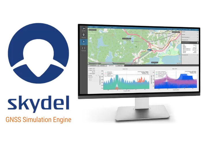
Image: Orolia

Image: Orolia

GNSS Simulations Software
For simulation and testing needs

Skydel GNSS simulation software can now generate more than 500 simulated satellite signals. This platform is suitable for GNSS users, experts and manufacturers, as well as users needing a low-Earth-orbit-capable simulation system. Skydel contains a feature that includes multi-constellation and multi-frequency signal generation, remote control from user-defined scripts, and integrated interference generation. In addition to generating a high channel and satellite count, Skydel also can produce navigation warfare signals without any additional hardware.
Orolia, orolia.com

Image: Mikroe

Image: Mikroe

Compact Add-On Board
Provides access to L-band GNSS corrections

LBand RTK Click is a compact add-on featuring the NEO-D9S-00B, a professional-grade, satellite data receiver for L-band corrections from u-blox. Operating in a frequency range from 1,525 MHz to 1,559 MHz, the NEO-D9S-00B decodes the satellite transmission and outputs a correction stream. This enables a high-precision GNSS receiver to reach accuracies down to centimeter-level. An independent stream of correction data, delivered over L-band signals, ensures high availability of position output. LBand RTK Click also uses several mikroBUS pins. In addition, LBand RTK Click contains an SMA antenna for connecting a Mikroe-brand antenna. This antenna easily allows positioning in space, supporting GNSS L-band frequencies. LBand RTK Click implements advanced security features such as signature and anti-jamming mechanisms. It also can be integrated with other GNSS receivers from the u-blox F9 platform.
Mikroe, mikroe.com

Publicerad den Lämna en kommentar

U.K. UAV surveying company creates specialized solution for rail clients

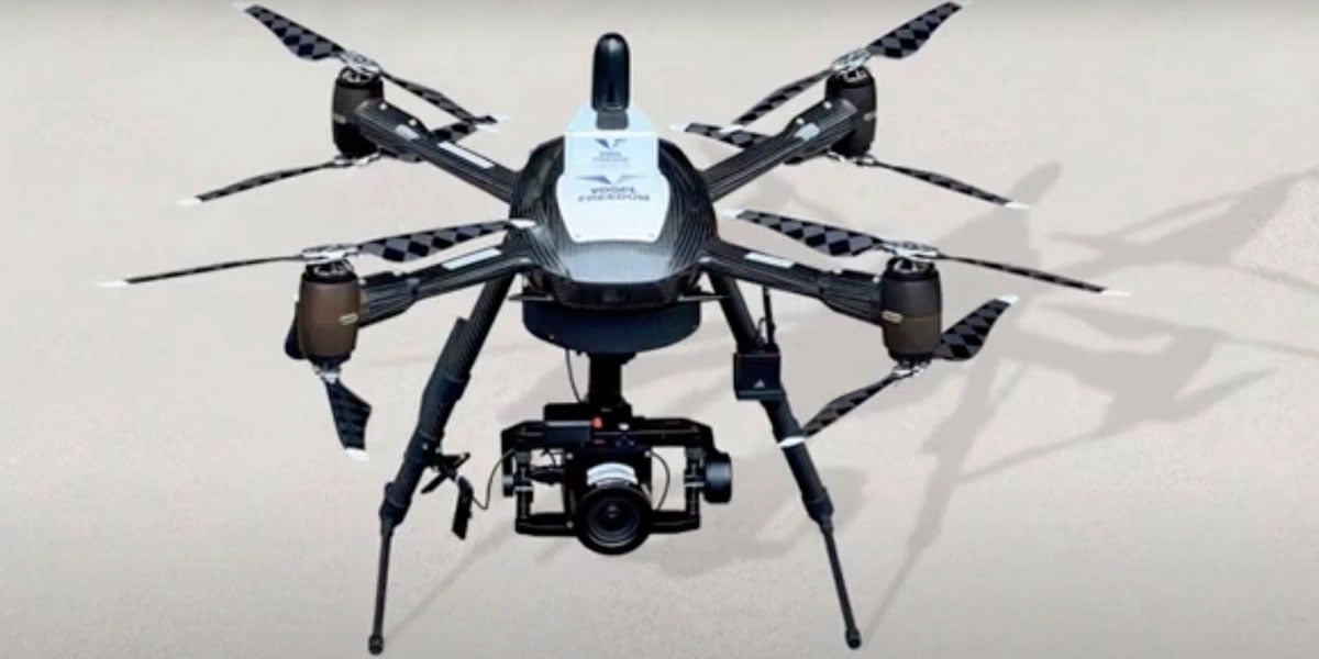
Image: Plowman Craven

Image: Plowman Craven

Plowman Craven, a United Kingdom-based aerial surveying company, has launched the Vogel Freedom UAV data collection solution designed for owners and operators of rail networks.

The Vogel Freedom UAV solution aims to solve issues rail operators face in carrying out network surveys, including traffic disruptions and dangers created for workers needing access to infrastructure for ground point sensors.

The platform requires fewer ground points to deliver topographical surveys. It can also produce sub-5 mm accurate rail system models using off-track sensor placement.

Operating from offices in London and Hertfordshire, Plowman and Craven is one of the largest infrastructure surveying and inspection businesses in the U.K.

“We developed Vogel Freedom in response to ever-increasing industry challenges and needs,” Steve Jones, head of new business at Plowman Craven, said. “It removes previous limitations to surveying and can add substantial value… all while improving workers’ safety and ensuring a safe and efficient rail service for customers.”

Publicerad den Lämna en kommentar

GPS Technology Helps Communities Across the Globe

The C-130 Hercules aircraft is used to rapidly drop cargo to provide relief after disasters or troops into battle zones. (Image: USAF Devin Doskey- 341st Missile Wing Public Affairs)

The C-130 Hercules aircraft is used to rapidly drop cargo to provide relief after disasters or troops into battle zones. (Image: USAF Devin Doskey- 341st Missile Wing Public Affairs)

GPS Innovation Alliance (GPSIA) member companies are leaders in technology, transforming the digital and physical world around us. With countless essential applications, GPSIA members improve the industries that feed, build, move and connect communities across the globe. In times of need, the GPS industry is proud to rise to the occasion, whether through agriculture technologies, surveying equipment, navigation systems, essential communications tools, or humanitarian relief efforts. Simply put, GPSIA members are continually investing in lifesaving services at home and abroad.

Take, for example, the urgent need for humanitarian relief created by the ongoing war in Ukraine. Trimble has stood united to support the many affected and displaced Ukrainians; in addition to contributing through the Trimble Foundation to relief efforts in Ukraine and neighboring countries, Trimble also has provided GPS signal corrections to Ukrainian farmers at no cost, supplied 3D scanners for surveying damaged buildings, and worked closely with The HALO Trust to support demining activities in Ukraine by providing funding and commercial surveying systems to assist in precision mapping of landmines and unexploded ordnances.

Lockheed Martin’s C-130 Hercules aircraft has assisted essential humanitarian relief across the globe. Since its inaugural flight in 1954, this aircraft has enabled aid delivery, natural disaster relief, medevac services, search and rescue and more. Now equipped with GPS technology, the C-130 fleet has provided aid across the globe for decades — with L3Harris’ missionization solutions often at work to maximize the C-130’s utility. Similarly, Collins Aerospace’s state-of-the-art navigational technology has provided essential support to U.S. Coast Guard helicopters, with avionics upgrades that help pilots save time in emergencies and enhance situational awareness.

Garmin inReach devices can send and receive messages, navigate routes, track and share journeys and can trigger an SOS if needed. (Image: Garmin)

Garmin inReach devices can send and receive
messages, navigate routes, track and share journeys and can trigger an SOS if needed. (Image: Garmin)

More broadly, Garmin inReach satellite communication devices have helped more than 10,000 individuals access emergency services, providing critical communications in natural disasters and humanitarian emergencies. In 2022, a powerful underwater volcanic eruption and tsunami devastated the island nation of Tonga, severing traditional communications channels for several weeks. Roy Neyman, a sailor equipped with this Garmin device, set up a communication center at a local restaurant to allow other residents to reach family and friends. Over two weeks, Tonga residents sent about 1,600 messages to loved ones around the world, offering peace of mind in the face of unthinkable destruction. Similarly, Apple recently launched an “Emergency SOS” service, which led to one of the first successful rescue efforts of two people who had driven off a highway in the Angeles National Forest.

CalAmp’s Fusion routers enable lifesaving emergency services to more than 400,000 residents in Oakland, California. Equipped with GPS, LTE and WiFi technology, these routers help Oakland Fire first responders quickly locate emergencies and access additional resources, such as building layouts or fire records, to provide the best possible emergency response. CalAmp’s technology provides an essential service to residents of Oakland and can be adapted to meet the changing needs of the community.

As the world of agriculture has come to depend on GPS technology, John Deere’s GPS-based agricultural services have helped farmers become more efficient. In turn, this has allowed farmers to harvest more crops for the masses and meet the ever-growing demand for food. With the annual growth in food demand estimated to be 1.4% over the next decade, John Deere’s critical investment in food banks in Mexico and training for farmers in Africa will help to ensure that all communities are able to access the food they need.

Across industries and government, GPS technology makes for a safer, more connected world. GPSIA is proud of its members’ dedication to global humanitarian efforts as well as critical services close to home. By constantly innovating, GPSIA member companies are creating technologies that provide critical services for everyday emergencies, natural disasters, and humanitarian crises across the globe.

Publicerad den Lämna en kommentar

Editorial Advisory Board Q&A: NATO Galileo and GPS integration

How do/will/should North Atlantic Treaty Organization (NATO) forces integrate GPS and Galileo for position, navigation and time?

Ellen Hall

Ellen Hall

For improved resiliency, it would be a great move for NATO to integrate Galileo with GPS into their system. The ‘how’ will be difficult. Some of the challenges are that the EU consists of more than a single nation with which to negotiate complex security issues, such as whether NATO will be treated as a ‘third nation entity’ for the use of PRS. The initial Galileo development was difficult for all these reasons and the Europeans managed to sort it all out, so I’m confident that, if the desire is to do this, it can be done successfully.

— Ellen Hall
Imminent Federal


Photo: Orolia

John Fischer

In the interest of operational robustness and the criticality of the use case, NATO should integrate GPS and Galileo capability at the earliest. Both GPS’ M-code and Galileo’s PRS are encrypted, providing anti-spoof capability and extra frequency diversity, making jamming of our forces more difficult. Crypto key management for both systems may be an extra burden, but a single receiver capable of operating with either system individually or both simultaneously would be key for interoperability — always a driving factor for NATO. The capability is available, and NATO should take advantage of it.

— John Fischer
Orolia

Publicerad den Lämna en kommentar

China launches remote sensing satellite

Image: Xinhua

Image: Xinhua

China launched the Yaogan-34 04 remote sensing satellite from the Jiuquan Satellite Launch Center in northwest China on March 31 at 2:27 p.m. Beijing Time, reported China Aerospace Science and Technology Corporation.

The satellite will be utilized for surveying, urban planning, crop yield estimation and disaster prevention and mitigation.

The Yaogan-34 04 remote sensing satellite was carried into space by a Long Marc

The Yaogan-34 04 remote sensing satellite was carried into space by a Long March-4C rocket and successfully entered its planned orbit.

This was the 470th flight for the Long March carrier rocket series.

Publicerad den Lämna en kommentar

China to use BeiDou SBAS in railway survey

Image: ximushushu/iStock/Getty Images Plus/Getty Images

Image: ximushushu/iStock/Getty Images Plus/Getty Images

China will use the BeiDou satellite-based augmentation system (BDSBAS) to provide positioning services in railway surveys and construction, reported the China Railway Siyuan Survey and Design Group and Xinhua Net.

Four satellite-based and 12 ground-based observation stations will be placed along the Wufeng-Enshi railway section located in the Hubei Province in central China.

The BDSBAS and the BeiDou ground-based augmentation system aim to further enhance railway survey efficiency.

Publicerad den Lämna en kommentar

UAvionix launches spoofing detection for SkyLine UAS BVLOS operations

Image: uAvionix

Image: uAvionix

uAvionix has introduced truSky ADS-B spoofing detection for its SkyLine Uncrewed Aircraft System (UAS) beyond visual line of sight (BVLOS) services.

The uAvionix truSky validation process uses a network of low-profile deployed dual-frequency ADS-B ground receivers to evaluate each signal transmitted from the aircraft. The system then compares the received signals to confirm that the signal originated from the aircraft’s position.

When used within the uAvionix SkyLine platform, each aircraft track point is color-coded based on its confidence score. The validation score is then transmitted along with the position updates of the aircraft using SkyLine API.

TruSky is being piloted in numerous locations in the United States and is available as a component of uAvionix’s SkyLine UAS BVLOS service or as an API for integration into UAS GCS, UTM, or ATM platforms.

Publicerad den Lämna en kommentar

First Fix: How GNSS helps farmers’ profits

Matteo Luccio

Matteo Luccio

Precision agriculture (PA) — which uses electronic information to better manage spatial and temporal variability in crops, livestock, forestry and other biological systems — is profitable, as proven by the rapid and widespread adoption of GNSS guidance for mechanized agriculture. Other enablers of PA include variable rate technology (VRT), remote-sensing using satellites and unmanned aerial vehicles, geographic information systems (GIS) and soil sampling.

In my introduction to our January cover story, I requested pointers to any “independent, reliable and comprehensive study” as to PA’s return on investment. In response, Professor Won Suk Lee, of the Department of Agricultural and Biological Engineering of the University of Florida Gainesville, introduced me to Professor James Lowenberg-DeBoer, who has more than 30 years of worldwide experience in agricultural research, teaching, outreach and leadership and was the president of the International Society of Precision Agriculture. His research focuses on the economics of agricultural technology.

Dr. Lowenberg-DeBoer wrote to me that “thousands of studies of profitability of precision agriculture” using “a wide range of methods and assumptions” arrive at “a relatively consistent set of conclusions.” He detailed them in a chapter on the economics of PA he wrote for a book published in 2019 (Precision agriculture for sustainability, edited by Dr. John Stafford, Silsoe Solutions, UK and published by Burleigh Dodds Science Publishing) and pointed out to me that additional studies of the topic conducted since then have not altered its conclusions.

Lowenberg-DeBoer used adoption of PA as a proxy for its profitability, because, he wrote, “Farming is a business and technology is adopted if it provides benefits for the farmer and farm household.” He focused on PA for crops on relatively large-scale mechanized farms, but the same principles and general conclusions apply to livestock, forestry and other biological production systems and to medium and small farms.

“Since GNSS guidance was introduced for ground-based agricultural equipment in the late 1990s,” he wrote, “almost all economic studies have shown positive economic benefits which could be quantified and substantial qualitative benefits which were more difficult to measure.”
He reported that within about 10 years of the introduction of both lightbars and autosteer, GNSS was used by about 80% of the dealers. Adoption of PA sensors, on the other hand, was slower. “While GNSS guidance is being adopted quickly almost wherever agriculture is mechanized, VRT is more likely to be found in ‘hot spots’ where the profit potential and soil variability combine to motivate adoption.”

Advances in autonomous robots will further revolutionize agriculture, Lowenberg-DeBoer predicted. “Implementing cropping tasks with swarms of small robots will change agronomic practices and the geography of agriculture. For example, with robotic pesticide application, it might be possible to spray each pest individually instead of broadcast application. This could reduce the amount of pesticide applied by [more than] 90% and reduce the negative effects on beneficial species.”

For more on how GNSS is central to PA and how Lowenberg-DeBoer’s vision is beginning to take shape, see “Integrity Is Integral to Precision Agriculture.

Matteo Luccio | Editor-in-Chief
mluccio@northcoastmedia.net