Publicerad den Lämna en kommentar

UAVOS, Bayanat partner to supply autonomous helicopters

Photo:

Image: UAVOS

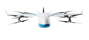
UAVOS has been selected by Bayanat, a provider of artificial intelligence-powered geospatial solutions, to deliver its unmanned aircraft system (UAS) for a variety of applications, including aerial photography and perimeter control. The UAS consists of two UVH 25EL unmanned autonomous helicopters powered by electric motors, a ground control station, and various sensor payloads — including a multispectral camera, lidar, and digital and thermal cameras.

The autonomous helicopter’s advanced capabilities of long endurance — up to 1.5-hours — along with its camera capabilities, enable the UVH 25EL to carry out accurate mapping within a radius of 67 km.

The UVH 25EL has a practical load weight of 5 kg. These capabilities enable high performance as well as maximum operational flexibility for applications such as coastal security, search and rescue, and advanced aerial photography missions.

UAVOS also provides full operational support, including training, and a fundamental review of the UAS’s possible uses.

Publicerad den Lämna en kommentar

Airbus tests UAS at sea in full operational configuration

Photo:

Image: Airbus

Airbus Helicopters and the French Armament General Directorate (DGA) tested the unmanned aerial system (UAS) VSR700 for the first time in an operational configuration from a ship at sea.

The VSR700 performed 80 fully autonomous take-offs and landings from a civil vessel off the coast of Brittany in the west of France at the beginning of May.

In 2022, the autonomous take-off and landing capabilities of the VSR700 were tested from the same vessel using an optionally piloted vehicle based on a modified Guimbal Cabri G2 equipped with the autonomous take-off and landing (ATOL) system, developed for the VSR700. This time the test campaign took place with the SDAM demonstrator and fully validated the capabilities of the system as part of the Système de Drone Aérien pour la Marine study that was awarded to Airbus Helicopters and Naval Group in 2017.

Autonomous take-off and landing capabilities are a key asset of the VSR700 and are made possible with the use of the Airbus DeckFinder system. This enables autonomous launch and recovery of UAVs with an accuracy of 10cm-20cm during challenging operations in harsh environmental conditions, independently of GNSS/GPS and regardless of degraded visual conditions.

This test campaign follows two series of trials that were conducted with the DGA in late 2022 and early 2023, from the Levant Island test center located in the south of France. During these trials, the SDAM prototype demonstrated its ability to operate in a maritime environment.

The handling qualities of the aircraft were tested as well as the capabilities of the sensors (a maritime surveillance radar, an electro optical sensor, and an AIS receiver) alongside the mission system developed by Naval Group.

The next development steps will see the second VSR700 prototype perform its maiden flight ahead of flight testing onboard a French Navy FREMM during the second semester of this year.

Publicerad den Lämna en kommentar

China completes multiple satellite launches that include replenishing the BeiDou constellation

Photo:

Image: Nikada/E+/Getty Images

On May 16, China launched a BeiDou satellite to replenish the constellation, reported Space News. This brings the constellation total to 56 satellites.

This backup satellite was aboard a Long March 3B rocket, which launched from the Xichang Satellite Launch Center in southwest China at 10:49 p.m. Eastern Time. The satellite aims to improve BeiDou’s stability, positioning precision and overall health.

In addition to launching the BeiDou satellite, China also launched satellites to study Earth and synthetic aperture radar test satellites (SAR) for disaster prevention.

On May 21, the Macau Science Satellite 1A and 1B launched on a Long March 2C rocket from the Jiuquan Satellite Launch Center at 4 a.m. Eastern Time. This satellite was designed to study the Earth’s magnetic field.

Also, on May 21, aboard the same rocket was the Luojia-2 (01), a Ka-band synthetic aperture radar test satellite for Wuhan University. The Luojia-2 (01) will test signal enhancement and integration of remote sensing imaging, meteorological detection and more.

The China Aerospace Science and Technology Corporation has planned more than 60 launches this year and has already completed 20 thus far.

Publicerad den Lämna en kommentar

Carlson Software releases multi-application tablet and GNSS solution

Photo:

Image: Carlson Software

Carlson Software has released the RT5 rugged tablet data collector and the RTk5 GNSS solution, which integrates the form factor of the RT5 with real-time kinematic GNSS performance.

The Carlson RT5 is designed for surveying, stake-outs, construction layout and GIS mapping, and is bundled with Carlson SurvPC — the Windows-based data collection program. The RT5 can run SurvPC with Esri OEM for use in the field.

The Carlson RTk5 adds an advanced GNSS solution to the RT5, enabling accuracy in a compact, light and versatile package. It comes with a custom-built pole and cradle, a survey-grade antenna, and a small portable helix antenna for handheld GNSS use. It is suitable for land surveyors, engineers, GIS professionals, and users in need of advanced GNSS positioning with an RTK rover.

Publicerad den Lämna en kommentar

Frontier Precision announces upgraded UAV platform

Photo:

Image: Frontier Precision

Frontier Precision has announced the availability of an upgraded flagship UAV platform, the Matrice 350 RTK.

This UAV platform features a new video transmission system and control experience, an efficient battery system, and more comprehensive safety features. It also offers robust payload and expansion capabilities.

The Matrice 350 RTK has a 55-minute max flight time and an IP55 rating. It features six-directional sensing and positioning, as well as a night-vision FPV camera, and 400 battery cycles.

Click here for more product information.

Publicerad den Lämna en kommentar

Hexagon, Hitachi Zosen partner to provide TerraStar-X Enterprise corrections in Japan

Photo:

Image: gremlin/E+/Getty Images

Hexagon’s Autonomy and Positioning division and the Hitachi Zosen Corporation have signed an agreement to bring the TerraStar-X Enterprise correction service to Japan.

Hitachi Zosen manages a network of 1,300 reference stations operated by the Geospatial Information Authority of Japan. Nippon GPS Data Service, a subsidiary of Hitachi Zosen, will provide Hexagon with GNSS data from this network.

With access to this data, Hexagon will provide the TerraStar-X Enterprise GNSS correction service, which is suitable for automotive applications. The service is now available for testing in the Tokyo area and will be expanded across Japan.

Hexagon has operational testbeds for TerraStar-X Enterprise in several locations in North America, Europe and China that provide reliable, lane-level accuracy in under a minute. With the addition of a testbed in Japan, vehicle manufacturers and technology providers can use the same design for all their correction service requirements.

By utilizing data created from GSI network observations, Hexagon’s TerraStar-X Enterprise will ensure fast convergence to lane-level accuracy and is available to support large-scale programs with functional safety requirements in Japan.

Publicerad den Lämna en kommentar

A2Z Drone Delivery launches delivery UAV

Photo:

Image: A2Z Drone Delivery

A2Z Drone Delivery, developer of commercial UAV delivery solutions, has released its delivery UAV, the RDSX Pelican. The Pelican leverages a hybrid vertical takeoff and landing (VTOL) airframe with no control surfaces to combine the reliability and flight stability of a multirotor platform, with the extended range of a fixed-wing craft.

With no ailerons, elevator, or rudder, the Pelican’s durable design eliminates common points of failure and extends operational time between maintenance overhauls. Designed to meet the 55 lb takeoff weight limitation for Federal Aviation Administration Part 107 compliance, the Pelican can carry payloads of 5 kg on missions up to 40 km, roundtrip.

The Pelican can be optimized for extended range operations or to deliver payloads from altitude with the company’s RDS2 UAV delivery winch.

Available in multiple configurations, the RDSX Pelican can be customized for an array of missions. The Pelican enables deliveries from altitude where spinning propellers are kept far from people and property, mitigating consumer privacy concerns of low-flying UAVs while abating intrusive rotor noise.

Alternatively, for missions in which the UAV can safely land at its destination, a simple servo-release mechanism can release payloads and expand the Pelican’s payload capacity.

Beyond logistics use cases such as residential deliveries, the Pelican is suitable for aerial mapping, UAV inspection, forestry services, search and rescue operations, water sample collection, offshore deliveries, mining, and more.

Publicerad den Lämna en kommentar

Tallysman and Mouser Electronics partner to distribute GNSS antennas

Tallysman Wireless has announced a distribution partnership with Mouser Electronics, a global authorized distributor of electronic components and semiconductors.

Under the agreement, Mouser Electronics will offer Tallysman’s full range of GNSS antennas, including the Accutenna, VeroStar and helical antennas, to its users worldwide.

These antennas feature advanced technology for enhanced precision and signal quality, making them suitable for demanding applications in industries such as automotive, aerospace, defense, surveying and precision agriculture.

For more information about the Tallysman GNSS antenna solutions offered at Mouser Electronics, click here.

Publicerad den Lämna en kommentar

Seabed 2030 Project and NORBIT Oceans collaborate on global ocean mapping

The Nippon Foundation­—General Bathymetric Chart of the Oceans (GEBCO) Seabed 2030 Project has partnered with NORBIT Oceans, a provider of underwater imaging and mapping technology. The organizations aim to advance the field of ocean science and obtain a complete map of the entire ocean floor.

Under the partnership, NORBIT Oceans will strengthen the capabilities of the Seabed 2030 Project and its network by providing solutions involving bathymetric survey data sets, research voyages, and general survey activities.

A collaborative project between the Nippon Foundation and GEBCO, the Seabed 2030 Project aims to inspire the complete mapping of the world’s oceans by 2030, and to compile all the data into the freely available GEBCO Ocean Map. GEBCO is a joint program of the International Hydrographic Organization (IHO) and the Intergovernmental Oceanographic Commission (IOC) and is the only organization with a mandate to map the entire ocean floor.

With a focus on providing technology solutions to global maritime markets, NORBIT Oceans is one of three segments within the global technology company NORBIT ASA, based in Norway. NORBIT Oceans offers solutions for seafloor mapping, environmental monitoring, tailored products for the aquaculture and security markets, as well as customized cables.

All data collected and shared with the Seabed 2030 Project is included in the free and publicly available GEBCO global grid.

Publicerad den Lämna en kommentar

KP Performance Antennas releases line of IoT antennas

Photo:

Image: KP Performance Antennas

KP Performance Antennas, an Infinite Electronics brand and a manufacturer of wireless network antennas, has released internet of things (IoT) multiband combination antennas. The antennas are designed to enhance connectivity for vehicle fleets and base stations.

The IoT multiband combination antennas have dedicated ports for cellular, Wi-Fi and GPS bands. They are also indoor and outdoor IP69K rated and can withstand harsh environmental conditions, such as extreme temperatures, water and dust.

The antennas are suitable for transportation emergency response and agriculture applications.

KP Performance Antennas’ IoT multiband combination antennas are in-stock and available now.