Publicerad den Lämna en kommentar

UAV update: MIL-SPEC drones lost, but progress for pseudolites

Some ups and downs for unmanned aircraft this month – good news that there is further progress on the pseudo-satellite front, but we also have mil-spec drones lost to shoot-downs and recent crash landings. Amazon continues to advance towards deliveries really soon after orders, and another police department takes up drone use for aerial observation.

High Altitude Pseudo-Satellite UAS

Photo: HAPSMobile

Hawk30 High Altitude Pseudo-Satellite. Photo: HAPSMobile

HAPSMobile (Softbank 95% & AeroVironment 5% JV) is funding further development and testing of the Hawk30 family of High Altitude Pseudo-Satellite (HAPS) solar-powered unmanned aircraft, with the expectation of long-duration flights above 65,000 ft – ‘..a super cell-tower up in the stratosphere …providing connectivity for everybody that needs it,’ according to AeroVironment President and CEO Wahid Nawabi.

HAPSMobile is collaborating with the Pan-Pacific UAS Test Range Complex (PPUTRC) which is managed by the University of Alaska (UA) Fairbanks, and with the University of Hawaii (UH) to conduct stratospheric test flights using the HAWK30 prototype HAPS vehicle. On behalf of this group, UA was recently granted a Certificate of Authorization by the US FAA (Federal Aviation Administration) to fly HAWK30 as a stratospheric telecommunications platform system over the Hawaiian island of Lanai.

The HAPSMobile team will prep test flights at Lanai during 2019, conducting safety verifications and working with island authorities to comply with local regulations. During the program, HAPSMobile will also explore contributions to environmental conservation and to agriculture. Hawaii – not a bad place to run test flights you might say…

Predator UAV downed

Following on from the shooting down of a US Global Hawk (really expensive) and one or two Iranian drones (not very expensive) in the Gulf or Hurmuz, US forces on Wednesday August 13th, just crash-landed an MQ-1C Grey Eagle (Predator UAV family) southwest of Baghdad on farmland in the town of Radwaniyah. The following pictures were released by a local news group:

Photo: Buratha News Agency

Photo: Buratha News Agency

Photo: Buratha News Agency

Photo: Buratha News Agency

The aircraft doesn’t appear to be too badly damaged, and seems to have been deliberately brought to rest in some soft undergrowth on the edge of a field. So ‘crash-landing’ might be an overstatement, rather an unplanned landing perhaps?  Then again, the landing gear appears to be significantly bent out of shape, so the ‘US Army 52178’ dronecontact with the ground might have been heavier than normal.

The news source indicated that the drone might have been brought down by ‘electronic interference or have been intercepted by a cyber-attack’ – perhaps references to potential jamming of some kind?Nevertheless, the aircraft landed safely and was then recovered by Iraqi Security Forces. There were no injuries or damage to property.

The U.S. Army MQ-1C Gray Eagle provides both combat and intelligence forces with a long-endurance, armed, Unmanned Aircraft System (UAS) with significant range, altitude and payload flexibility.

And another report hit the internet today that back in June, a £6mUK Watchkeeper WK050 drone on a training flight met a somewhat messy end after overshooting its landing and coming to rest in a tree. But the report also mentions that there was some indication of possible operator error.

Amazon Drone Deliveries?

Graphic: Amazon

Graphic: Amazon

Fresh on the heels of Fed Ex deciding to dump Amazon as a customer because they would appear to be developing a competing delivery infrastructure, Amazon is proposing a semi-autonomous drone which could automate short-distance deliveries.

In a recent letter to the FAA, Amazon is proposing trials in “sparsely populated” regions of the US using its latest 88lb MK-27 Prime Air delivery drone. The UAV apparently has well developed sense and avoid for the flight phase and uses optical capability for the delivery phase.

If obstacles were to be detected in flight (other UAVs, low flying manned aircraft/helicopters or birds perhaps) the MK-27 would avoid and fly round each obstacle. If an obstacle were detected during delivery (maybe the customer waving frantically to stay out of the cabbage patch) the delivery may be aborted and the drone would return to base. But would it automatically dispense one of those ‘we-called-while-you-were-out’ postcards, fluttering down into the back yard so you could go pick up your package later?

Seriously though – the initial trials would be managed by an operator who can command a return to base if the drone gets into any trouble, but Amazon claims that the fail-safe autonomy built into the MK-27 will make this unlikely. The hardware and software have gone through extensive simulated testing and the drone has already completed more than 10,000 simulated delivery flights into representative backyards.

Amazon’s objective seems to be to eventually deliver packages within 30 minutes after the customer places an order – to Prime customers within ~8.5 miles from an Amazon fulfillment center.

Growing Police use of Drones

The Oneida County (NY) Sheriff’s office just announced that they are now drone-trained and drone-equipped – with five certificated operators and a fleet of eight DJI Mavic drones for indoor and outdoor use.

Photo: WKTV; Rome Sentinel

DJI Mavic 2 flown by Oneida County Sheriff staff
Photo: WKTV; Rome Sentinel

Photo: WKTV; Rome Sentinel

Sheriff Rob Maciol introduces the drone project
Photo: WKTV; Rome Sentinel

The DJI drones will not be modified and will be used as is – Mavic 2 drones will provide all manner of aerial surveillance including flood & disaster monitoring. In addition, active shooter investigations and the like could involve initial indoor surveillance using Mavic Air drone(s) to provide armed police with situation awareness prior to any take-down efforts. Accident investigations, location of missing persons, house fires, and rescue efforts are among other applications for the drones.

The Sherriff’s department has been preparing for drone use for two years – five officers have already completed FAA certificated drone training, and others are also expected to undertake training over time.

Summary

So potential stratospheric ‘cell towers’ being tested over Hawaii, landing accidents, preparations for potential rapid deliveries by Amazon drones, and another police department launches a drone unit – some of the expanding uses for drones and the unfortunate reality that drones can sometimes get into operational difficulties.

Tony Murfin

GNSS Aerospace

Publicerad den Lämna en kommentar

Topcon to demo BIM, construction technology at Intergeo 2019

Topcon Positioning Group will be showcasing its vertical construction, construction management, and structural health and inspection technology at Intergeo 2019. (Photo: Topcon)

Topcon Positioning Group will be showcasing its vertical construction, construction management, and structural health and inspection technology at Intergeo 2019. (Photo: Topcon)

Topcon Positioning Group will be demonstrating its technology offerings across vertical construction, construction management, and structural health and inspection at Intergeo 2019.

Topcon will present its new building information modeling (BIM) technology at the show, which includes the Topcon vertical construction workflow. The Topcon vertical construction work flow includes the Laser Scanning Robotic Total Station GTL-1000, MAGNET Collage and ClearEdge3D Verity software.

According to the company, the full workflow is designed to offer a powerful instrument for single-operator layout and scan on a single set up. It will also be releasing new innovative digital layou

t solutions alongside the GTL-1000 to enhance the VC portfolio and widen the options available to customers for this critical task.

Topcon will also be showcasing its inspection, assessment and monitoring solutions, which are designed to keep infrastructure assets in operation by providing reporting tools for site engineers and monitoring structural health.

Topcon added that it will be demonstrating its GTL-1000 and accompanying software MAGNET and ClearEdge3D Verity at the show. Its booth will also feature interactive displays that will provide virtual looks at job sites.

“Productivity is a huge talking point in our industry, so this year at Intergeo we’re proving that Topcon is always one step ahead, working in partnership with the construction and infrastructure sectors to provide solutions and products to address the big issues,” said Ian Stilgoe, vice president of Geopositioning Europe at Topcon Positioning Group. “Whether it’s quicker, simpler verification, or smart inspection and monitoring of aging assets, the need for digital innovation is greater than ever.”

Topcon’s demonstrations will be taking place at its booth, F3.013, in hall 3.

Publicerad den Lämna en kommentar

Live from Intergeo 2019

Logo: Intergeo 2019The GPS World staff is reporting from Intergeo Sept. 17-19 in Stuttgart, Germany. The massive trade show, dubbed the “global hub of the geospatial community,” brings together more than 19,000 visitors from more than 114 countries and features approximately 640 exhibitors. Check out the latest industry news, as well as photos and videos from the event.

News

Past Coverage

Publicerad den Lämna en kommentar

Epson displays SureColor T5470M at Esri UC 2019

Epson’s Matt Kochanowski offers an overview of the company’s SureColor T5470M printer and scanner at the 2019 Esri User Conference in San Diego. According to the company, the SureColor T5470M, which combines a 36-inch printer and integrated scanner, can produce accurate A1/D-size prints in as fast as 22 seconds.

Publicerad den Lämna en kommentar

Lidar USA partners with Teledyne Optech on UAV sensor integration

Teledyne Optech, a Teledyne Technologies company and global leader in advanced lidar sensors, has announced that its new compact lidar sensor, the CL-90, is available for purchase through its first integration partnership with Lidar USA.

For more than 20 years, Lidar USA has been building UAV sensor systems that meet the demands of a growing number of applications.

Lidar USA has sold thousands of systems worldwide. Its ability to support numerous industries with cutting-edge integration makes them an ideal partner for Teledyne Optech’s compact lidar sensors, Teledyne stated in a press release.

Lidar USA’s products are used for surveying-related tasks ranging from topography work, to highways and land development. They are also used for agricultural work for forestry and plant growth, and have applications in archeology as well.

Teledyne Optech’s CL-90 sensor features exceptional canopy penetration for excellent ground coverage, long-range performance for maximum productivity at UAS ceilings, and best-in-class data precision for tight-tolerance applications; an ideal companion to Lidar USA’s robust and dynamic integration capabilities.

“Our customers face many challenging projects and they need tools that can deliver. Whether it’s greater range, more accuracy, or better penetration of vegetation, using the new Optech CL-90 gives us the means of providing the tool to get the job done” said Lidar USA CEO Jeff Fagerman.

Teledyne Optech Executive Vice-President and General Manager Michel Stanier said in a statement:
“Teledyne Optech is pleased to partner with Lidar USA to bring our compact lidar sensors to market. Lidar USA is a premier UAV solution provider. As a result, we are confident that their integration expertise and strong global market presence will provide the ideal platform to deploy the CL-90’s rich, unique feature set into the UAV marketplace.”

Lidar USA will be at InterGEO this year and can be found at ICS Foyer Stand 2 featuring a fully integrated CL-90 solution. Teledyne Optech will be featuring some of its new Compact Lidar (CL) suite of products this year at InterGEO Booth B3. 042 from September 17-19 in Stuttgart, Germany.

Publicerad den Lämna en kommentar

Drone Rescue supports German Aerospace Center’s FALCon project

The FALCon research project has already carried out initial flight experiments with unmanned small aircraft. Drone Rescue Systems (Photo: Drone Rescue Systems)

The FALCon research project has already carried out initial flight experiments with unmanned small aircraft. Drone Rescue Systems (Photo: Drone Rescue Systems)

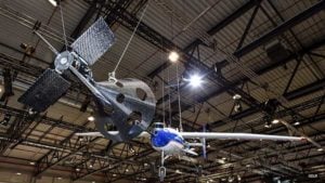
The parachute safety solution manufacturer Drone Rescue Systems GmbH is supporting the European research project FALCon, the “Formation flight for in-Air Launcher 1st stage Capturing demonstration.”

Under the leadership of the German Aerospace Center (Deutsches Zentrum für Luft- und Raumfahrt; DLR), research is being conducted on how launch vehicles can be returned to the launch site as efficiently as possible for re-use.

The aim of FALCon is to achieve cost-efficient and environmentally friendly satellite transport. The focus of the project lies on the return of rocket stages after launch. To be able to reuse these stages, efforts are being made to recapture them in the air using a “rocket catcher.”

For the next three years (March 2019 to February 2022) the focus will be on the development and flight demonstration of a technical solution for this idea. While still in the air, rocket stages are to be captured by a transport aircraft over the sea and pulled into the vicinity of the landing site. There, the stages are to land independently.

“We are proud to be part of the FALCon research project together with five international partners and DLR as part of HORIZON2020 (EC grant 821953), the EU’s largest research and innovation program to date. The capture and towing of rocket stages in flight, that is, an autonomous and safe landing, is a particularly interesting topic for us as a manufacturer of parachute safety solutions,” said Andreas Ploier, CEO of Drone Rescue Systems GmbH.

The research project has already carried out initial flight experiments with unmanned small aircraft.

Publicerad den Lämna en kommentar

IdeaForge provides specialized UAVs to Indian market

The Ninja UAV. (Photo:: ideaForge)

The Ninja UAV. (Photo:: ideaForge)

Lynx–Lawrence & Mayo, an Indian engineering equipment providers, has expanded its portfolio to include specialized drones, through its partnership with ideaForge, India’s largest UAV manufacturer.

As part of the agreement, ideaForge’s drones equipped with more than a decade of UAV design expertise, will be accessible to Lynx – Lawrence and Mayo for applications across urban development, weather monitoring and testing, agro-technology and other sectors.

Developed by a team of Indian Institute of Technology Bombay graduates, ideaForge has been celebrated for its innovations in the unmanned aerial vehicle (UAV) domain. It built a small, light autopilot in 2009 and India’s first autonomous quadcopter UAV. Their designs have led the development of world class, indigenous UAVs for security and surveillance, reconnaissance, mapping, photogrammetry and other industrial applications. Now, their UAVs even come with the capability to meet the DGCA regulations, to ensure NPNT compliance.

Through this partnership, Lynx–Lawrence & Mayo will have access to ideaForge’s fleet of UAVs for inspection, surveillance, traffic and crowd management, and disaster management. The fleet includes:

  • Switch UAV – A fixed-wing vertical take-off and landing (VTOL) hybrid for terrain-independent deployment with long range, high endurance and high altitude capabilities.
  • Q-Series UAV – Enterprise specialist VTOL quadcopter built with military design philosophies.
  • Ninja UAV – Lightweight and economical micro UAV built specifically for mapping and advanced surveillance.
  • Netra Pro – Rugged quadcopter for maximum redundancy in extreme conditions.
  • Netra V-Series – Field-proven UAVs for mission-critical applications, integrated with high zoom HD real-time video transmission.

“We at Lynx have been driving innovation and excellence in advanced precision equipment for engineering and industry. With the addition of innovative UAVs from ideaForge, we are delighted to add a range of advanced and futuristic drones to our portfolio,” said Glenford D’souza , Lynx senior general manager. “We will be strategically deploying these products to create an integrated and specialised service/solution offering to our existing and potential clients. We look forward to a long term and fruitful partnership.”

IdeaForge has deployed more than 700 systems and has trained more than 1,200 pilots in services including the Indian Army, Navy and Air Force; state police forces; Indian railways; and many more agencies.

IdeaForge drones have been used in defense and homeland security for border monitoring, anti-terror operations, counter insurgency operations, disaster management, traffic monitoring, campus surveillance, crowd management and more.

With the flexibility to customize their drones for an array of requirements, ideaForge also provides end-to-end UAV solutions and services to the industrial and commercial sectors.

Publicerad den Lämna en kommentar

Laser scan data improves response in active shooter simulation

A security technology firm reduced the time needed for public-safety personnel to engage a simulated active shooter by providing the team with site floorplans created from 3D laser scan data.

Before the exercise, the firm scanned the entire 112,000-square-foot building interior in just 2.5 hours with the GeoSLAM ZEB-HORIZON 3D mobile scanner.

Entropy Group’s Robert Myers scanned the interior and exterior of a 112,000-square-foot facility in less than three hours using a GeoSLAM handheld 3D laser scanner. (Photo: GeoSLAM)

Entropy Group’s Robert Myers scanned the interior and exterior of a 112,000-square-foot facility in less than three hours using a GeoSLAM handheld 3D laser scanner. (Photo: GeoSLAM)

“In the role-playing scenario staged at a mega-church, the off-duty police officers reached the shooter in up to 21 percent less time using a 2D floorplan generated from the laser scans,” said Robert W. Myers, CEO of Entropy Group LLC. “However, we expect engagement times to drop considerably by leveraging the 3D scan data to create virtual reality training simulations.”

Based in San Ramon, Calif., Entropy Group was established to save lives during active shooting incidents at schools and churches by providing law enforcement with the situational awareness information they need to reach perpetrators more quickly inside complex building spaces.

Handheld mapping. The firm uses the GeoSLAM ZEB-HORIZON handheld mapping device to capture 3D scans of school and church interiors, including small offices, classrooms and closets. The GeoSLAM software generates highly accurate 2D floorplans for use by responders, either hardcopy or digital, to navigate the interior of the building.

The same data set can also be used to create virtual environments where multiple officers train on computers to respond to attack scenarios in realistic, immersive 3D simulations of actual schools and churches in their jurisdictions.

“Eventually, we plan to utilize machine learning technology that will allow individual officers of first responder teams to be dispatched to specific locations within the facility in real time to quickly reach shooter engagement locations within the buildings,” Myers said.

The ZEB-HORIZON handheld 3D scanner. (Photo: GeoSLAM)

The ZEB-HORIZON handheld 3D scanner. (Photo: GeoSLAM)

The handheld ZEB-HORIZON laser scanner allows users to map interior and exterior spaces in 3D at walking speed. The lightweight device captures up to 300,000 points per second with an accuracy of 1-3 centimeters up to 100 meters from the user.

SLAM technology ensures points are tied to local coordinate systems even in interior spaces where GPS/GNSS coverage is poor. Large multi-room buildings that might take days to scan with a stationary scanner can be mapped in a few hours with the ZEB-HORIZON.

“Mobile laser scanning technology is the fastest and most cost-effective way to create the 2D and 3D building information tools public safety personnel need to prepare for a variety of emergency scenarios,” said Shelley Copsey, GeoSLAM CEO.

The GeoSLAM Hub software creates a fully integrated data collection and mapping workflow, enabling ZEB-HORIZON users to process, view, merge, edit and output 2D and 3D deliverables within minutes of data capture. Outputs include 2D floorplans, CAD, as well as an integrated workflow for the creation 3D building information models (BIMs).

Entropy Group is working directly with school districts and places of worship to provide scanning services and develop standardized procedures for the capture of 3D data inside their buildings. These reality capture data sets and derived 2D and 3D products will be provided to local public safety organizations for use in generating hardcopy and digital representations.

Publicerad den Lämna en kommentar

NavTechGPS offers GNSS and INS courses in New Orleans

NavtechGPS is offering the following multi-day training sessions on GNSS/GPS technology in New Orleans this December. Both courses will take place at the InterContinental New Orleans Hotel.


Photo: InterContinental New Orleans Hotel

Photo: InterContinental New Orleans Hotel

Dec. 9-12 (4 days)
Course 346: GPS/GNSS Operations for Engineers and Technical Professionals
Instructor: Dr. Chris Hegarty, MITRE

Take this 4-day course to gain a comprehensive understanding of GPS/GNSS system concepts, design and operation, including information on GPS signal processing by the receiver; techniques by which GPS obtains position, velocity and time and a brief introduction to differential GPS (DGPS) and Kalman filtering.


Dec. 9-13 (5 days)
Course 557: Inertial Systems, Kalman Filtering and GPS/INS Integration
Instructors: Dr. Alan Pue, Johns Hopkins, APL; Mr. Michael Vaujin, Aerospace, Navigation & Defense Consultant.

Expanded to a full five full days based on attendee requests, this course on GPS-aided navigation will thoroughly immerse you in the fundamental concepts and practical implementations of the various types of Kalman filters that optimally fuse GPS receiver measurements with a strapdown inertial navigation solution. The course includes the fundamentals of inertial navigation, inertial instrument technologies, technology surveys and trends, integration architectures, practical Kalman filter design techniques, case studies, and illustrative demonstrations using MATLAB.

Five fulls days allow for a fuller and detailed development of the design of an aided navigation system, combined with a detailed discussion of the use of lower quality IMUs, and advanced filtering techniques.


For more information, visit the NavtechGPS website.

Publicerad den Lämna en kommentar

Komatsu dozing control logic combines GNSS/INS for machine control

Photo: Komatsu

Photo: Komatsu

Komatsu America Corp. has introduced Proactive Dozing Control logic, a fully-integrated dozing control system that allows operators to perform auto-stripping, auto-spreading and high production dozing, as well as finish grading.

Built on the company’s intelligent machine control, the system uses GNSS positioning in conjunction with an inertial measurement unit (IMU) to calculate precise position. The two sensors work together to calculate exactly where the tracks are on the ground.

The machine control system communicates with the dozer’s hydraulic controllers, engine controllers and the machine controller. Through cylinder sensor technology, the position of the blade is calculated in relationship to the machine body.

The Proactive Dozing Control logic measures the surrounding ground and determines what has been done on the area being graded, then stores that data and information. When the dozer prepares to go back over that area to cut or work it more, the system understands what it was like from its previous track and, therefore, follows the existing terrain — the very terrain that was just created.

Proactive Dozing Control logic provides real-time position of the machine on the job site to create a highly accurate elevation for the system to drive the blade to the precise grade needed. Using real-time conditions, the system understands what the terrain around the machine looks like and makes calculated decisions — whether it should cut and carry material, whether it should spread or fill that material, or whether it should be finish grading.

The new system is available on the Komatsu D51EXi-24, D51PXi-24, D61EXi-24 and D61PXi-24 dozers.

Photo: Komatsu

Photo: Komatsu

“Proactive Dozing Control logic opens up a world of application possibilities for machine control technology,” said Derek Morris, Product Marketing Manager, Intelligent Machine Control and Smart Construction for Komatsu. “Traditionally, GPS machine control focused on finish grade, which meant operators only used the technology approximately 10 to 20% of the time. Proactive Dozing Control logic is a game-changer because the integrated system now lets operators use automation any time, whether for general site clean-up, backfilling trenches and more.”

“A key differentiator is that our system collects data at the tracks, while aftermarket solutions collect data at the blade,” Morris noted. “Because data is collected at the track, the system provides a real-time picture of the ground around the machine, allowing the system to make calculated decisions based on the current terrain. By collecting data at the track level, we’ve created machine control that is far more advanced, offering an entirely new level of efficiency, whether you’re an operator who has 20 years’ experience or someone new to the job, our Proactive Dozing Control logic provides precision work every time, making operation easier and more productive.”

With Komatsu’s Proactive Dozing Control logic, operators can use the dozer to its full capacity, leading to increased utilization, better ROI and better production. Owning and operating costs are also lowered because wear and tear on the machine is reduced by automating operation, Komatsu stated in a press release.

By significantly minimizing track slip during operation, undercarriage wear is reduced, thereby lowering O&O costs, since 50% of the ownership cost of a dozer is the undercarriage.