Publicerad den Lämna en kommentar

Research Roundup: Soft information for IOT positioning

Soft information for IOT positioning

A new system enables interconnected smart devices to cooperatively pinpoint their positions in noisy, GPS-denied environments. (Image: Christine Daniloff, MIT)

A new system enables interconnected smart devices to cooperatively pinpoint their positions in noisy, GPS-denied environments. (Image: Christine Daniloff, MIT)

The billions of interconnected devices and sensors embedded in other devices, vehicles and even humans that collectively constitute the much-heralded internet of things (IOT) collect and share data used in myriad applications. This requires them to know their location, which is a challenge in GPS-denied environments, such as most indoor locations, tunnels and urban canyons.

A new approach helps networks of smart devices cooperate to find and communicate their positions in such environments. This “localization of things” could be helpful in applications ranging from autonomous vehicles to asset tracking, from supply-chain monitoring to smart cities and real-time mapping.

Traditional network localization methods estimate a single value for each geospatial variable, such as the distance between two nodes. Therefore, accuracy drops sharply in environments where multipath, a limited view of the sky, and other problems severely degrade GNSS and wireless signals. A paper by researchers at four institutions outlines a system to capture location information even in these challenging environments by fusing positional data of various kinds as well as digital maps.

The new method fuses data from various sensing measurements — such as radio, optical and inertial signals — and analyzes features of each signal — including its power, angle of arrival, and time of flight. It uses machine-learning techniques to weigh this “soft information” — the researchers call it that because their method does not favor any single “hard” number — to create a probability distribution of distances, angles and other metrics.

It also exploits contextual information from digital maps, dynamic models and node profiles to verify what is possible. For example, two nodes could not be 20 meters apart if they are both in an area with a maximum dimension of 10 meters.

To reduce the complexity and size of the data that it must collect to function, the new method identifies the most and least useful aspects of the received waveforms for the purpose at hand on the basis of a “principal component analysis.”

In simulations of challenging scenarios, full of reflections and echoes, the new system’s performance significantly surpassed that of traditional ones and consistently approached the theoretical limit for localization accuracy, while the accuracy of traditional systems dropped dramatically.

Citation:Soft Information for Localization-of-Things” by A. Conti, S. Mazuelas, S. Bartoletti, W. Lindsey and M. Win, Sept. 9, 2019, Proceedings of the IEEE.


Principle of the spoofing detection and direction-finding procedure. (Source: IEEE paper authors)

Principle of the spoofing detection and direction-finding procedure. (Source: IEEE paper authors)

Algorithm helps civil aircraft fight spoofing

Evolution in civil aviation foresees a greater role for GNSS in onboard navigation systems as opposed to traditional terrestrial navigation aids. This will require improvements in managing the threat posed by RF interference.

Fortunately, the availability of more GNSS constellations and two carrier frequencies now enables GNSS equipment used aboard civil aircraft to not only detect and monitor spoofing, but also determine from which direction it is coming.

A recent paper details a procedure to do this. It consists of a detection module that employs an algorithm to identify which signals tracked by the receiver are counterfeit, if any, followed by a direction-finding module that implements an efficient direction-of-arrival (DOA) estimator. The procedure requires three GNSS antennas and the same number of receivers, time-synchronized with a common clock, plus a signal processor that implements the detection and DOA estimation algorithms. The paper presents the design of the chain of algorithms and their preliminary tests in a laboratory setup, with the simulation of several spoofing attacks, assumed realistic in a civil aviation scenario.

Citation:  “An Algorithm for Finding the Direction of Arrival of Counterfeit GNSS Signals on a Civil Aircraft” by G. Falco, M. Nicola, E. Falletti and M. Pini, presented on Sept. 20, 2019, at the ION GNSS+ conference in Miami, Florida.


Joint Galileo/GPS Project on the ISS

The European Space Agency (ESA) and NASA conducted a joint Galileo/GPS space receiver experiment aboard the International Space Station (ISS). The objectives of the project were to demonstrate the robustness of a combined Galileo/GPS waveform uploaded to NASA hardware already operating in the challenging space environment — the SCaN (Space Communications and Navigation) software defined radio (SDR) testbed (FPGA) — on-board the ISS.

The activities included the analysis of the Galileo/GPS signal and on-board position/velocity/time (PVT) performance, processing of the Galileo/GPS raw data (code and carrier phase) for precise orbit determination, and validation of the added value of a space-borne dual GNSS receiver compared to a single-system GNSS receiver operating under the same conditions. A recent paper provides a general overview of the experiment (called GARISS) and describes its design, test, validation, and operations. It also presents the various analyses conducted in the context of this project and the results obtained, with a focus on the (Precise) Orbit Determination results.

Citation: “The joint ESA/NASA Galileo/GPS Receiver onboard the ISS – The GARISS Project” by W. Enderle, E. Schönemann, F. Gini, M. Otten, P. Giordano, J. Miller, S. Sands, D. Chelmins, O. Pozzobon, presented on September 20, 2019, at the ION GNSS+ conference in Miami, FL.

Publicerad den Lämna en kommentar

Seen & Heard: Animals crossing, Tesla, search and rescue

“Seen & Heard” is a monthly feature of GPS World magazine, traveling the world to capture interesting and unusual news stories involving the GNSS/PNT industry.


Photo: i viewfinder/Shutterstock.com

Photo: i viewfinder/Shutterstock.com

It’s their land, too

Animal tracking is helping biologists see how many animals rely on wildlife crossings over or under highways. In the United States, specially designed crossings protect pronghorn antelope (Wyoming), panthers (Florida), mule deer (Nevada), moose (Utah) and grizzly and black bears (Montana), while crossings in Asia benefit rhinos, tigers and elephants. With crossings, mortality drop as much as 90%, says The Washington Post. In New Mexico, state agencies and tribes are tagging animals with GPS collars to identify roads that hinder migration. Meanwhile, engineers in Southern California are designing the world’s largest animal crossing, an $87 million overpass that will span a 10-lane Los Angeles freeway for the region’s mountain lions.


Tesla, come to me

Photo: Tesla

Photo: Tesla

The new Tesla Smart Summon feature in Autopilot v10 autonomously drives the car to meet its owner, such as in a parking lot. Smart Summon has been used more than 550,000 times, Tesla CEO Elon Musk said on Twitter. But it has a few glitches: Owner tests have resulted in fender-benders, near crashes, ignored stop signs and a police run-in. And don’t test it with another Tesla nearby — the cars get confused.


Help, I’m shark bait!

Photo: European GNSS Agency

Photo: European GNSS Agency

The Galileo Search and Rescue (SAR) service was demonstrated Sept. 26 off the coast of Belgium. In Operation Shark Bait, a volunteer “victim” — Australian broadcaster Tara Foster — operated her Galileo-enabled SAR beacon from a life raft off the port of Ostend. The service quickly triggered, with the rescue initiated in under four minutes.


Photo: Route4U

Photo: Route4U

Wheelchair navigation

A new app launched in Portsmouth, England, helps people with limited mobility plan their travel routes. The Route4U pavement navigation app benefits both wheelchair and pram (stroller) users, allowing them to discover safer, more accessible routes across the city. The app indicates pavement obstacles, surface quality, curb heights and widths, inclines and travel distances.

Publicerad den Lämna en kommentar

SBG Systems discusses Horizon IMU at Intergeo 2019

SBG Systems’ Raphaël Siryani discusses the company’s product line at Intergeo 2019, which took place Sept. 17-19 in Stuttgart, Germany. Siryani also explains the features of SBG Systems’ Horizon, a FOG-based high performance inertial measurement unit (IMU) designed for large hydrographic vessels surveying harsh environments.

Publicerad den Lämna en kommentar

TomTom highlights autonomous vehicle push

To grab a larger piece of the burgeoning connected and autonomous vehicle markets, digital mapmaker TomTom launched its self-driving test vehicle and is integrating navigation and diagnostic capabilities in the Microsoft Connected Vehicle Platform.

While the company has tested the technology for years, TomTom officially announced the availability of its own autonomous test vehicle, which Arnold Meijer, TomTom strategic manager, business development, said is a critical advantage to quickly develop maps and services for that industry.

“We can continuously test our mapping technology on the roads, get insights and high-quality data on how it performs in a multitude of circumstances and, right away, feed this into our AI-driven mapmaking process,” he said.

Currently, the vehicle is testing TomTom’s high-definition map; a crowd-sourced map update called Roadagrams; and a map-streaming service, AutoStream, which will deliver map data to vehicles on demand.

The company announced in September at the International Motor Show (IAA 2019) in Frankfurt, Germany, that its digital maps have doubled to more than 1 million Level 1 and Level 2 autonomous vehicles from several automakers.

Showcasing TomTom HD Maps

At IAA 2019, TomTom also demonstrated proof-of-concept high-definition map features that can work through Microsoft Azure cloud services, Meijer said. “Some of the navigation intelligence, which also includes traffic information and HD map services, can also be used in vehicles for navigation apps, as well as context while driving autonomously,” he said.

The demonstration allows TomTom to send telemetry data to Microsoft Azure. “[This includes] application usage data such as what menu items the end-user clicked on and what screens of the TomTom NavApp they opened for app analytics purposes,” he said.

Other features include GPS location during a driving simulation, vehicle speed and heading for driver behavior, and usage of apps that are not navigation-related, such as for music. Other testing included road speed limit, the number of times users drive a planned route, destination details planned by a user, and travel time.

TomTom navigation integrated into the Microsoft Connected Vehicle Platform allows automakers to quickly access precise navigation and driving behavior, “while of course adhering to TomTom’s privacy principles,” Meijer said. “This data could, for instance, be used to predict the range of an electric vehicle based on driving behavior and planned route more accurately. Or to work out, based on navigation behavior, what connectivity package for online navigation would be best suited for a driver.”

The TomTom test vehicle prototype hits the road in San Francisco. (Photo: Kevin Dennehy)

The TomTom test vehicle prototype hits the road in San Francisco. (Photo: Kevin Dennehy)

Voyage Forges Ahead…

While recent press reports have said autonomous vehicle development is slowing because of technology limitations and consumer doubt, Palo Alto, Calif.-based Voyage has raised millions of dollars and continues to test self-driving cars in retirement communities in California and Florida.

The company recently raised $31 million in Series B funding from Franklin Templeton, Khosla Ventures, Jaguar Land-Rover’s InMotion Ventures and Chevron Technology Ventures. Voyage has raised a total of $52 million since its 2017 founding, said Oliver Cameron, company co-founder and CEO.

With the new funding, Cameron said the company hopes to triple its workforce, increase its second-generation fleet of self-driving cars, invest more in the technology and roll out a third-generation vehicle.


See the GPS World cover story about Voyage here.


“We are taking a unique, focused approach to delivering truly driverless cars in communities where there are limited mobility options, customers who need an autonomous ride-hailing service, and lower speeds,” he said. “Many residents within our communities don’t have access to transportation options that work for them, so they’ve welcomed our fleet of self-driving vehicles. We’ve started with self-driving cars that can travel point-to-point within our communities at speeds of up to 25 mph.”

Cameron said the community-based approach allows the company to quickly design and deploy autonomous technology. “For the past two years, because we are taking this focused, community-based approach to designing and deploying advanced self-driving car technology, progress has been rapid. Our vehicles intelligently and autonomously navigate the complex neighborhoods of our communities and safely transport our passengers door-to-door,” he said.

The company said its engineers are transitioning software to a safety-critical middleware, shipping a new prediction engine with better capabilities and creating triple redundancy in the vehicle’s perception system.

G3 Vehicle? Not Yet. Voyage, which began testing self-driving with a retrofitted Ford Fusion, doesn’t have a timetable planned for a third-generation system, Cameron said. Instead, the company plans to continue to use the self-driving Chrysler Pacifica hybrid minivan in its testing projects.

“Before we launch our [third generation] self-driving car, we are going to build and scale more G2 self-driving cars to better serve the communities in which we operate. We haven’t announced a timeframe for the launch of our electric, truly driverless and highly scalable G3 self-driving car,” he said.

The company is growing its ranks as it has hired its first chief operations officer, Nina Qi. She believes the biggest hurdle autonomous vehicles have is the basic challenge to deliver safe and cost-effective services to make the industry economically sustainable.

Publicerad den Lämna en kommentar

Editorial Advisory Board PNT Q&A: Terrestrial PNT

Which of several proposed terrestrial PNT technologies is best suited to complement and back up GPS?

Jules McNeff

Jules McNeff

“Seeking PNT resiliency for critical functions, a layered, multi-source terrestrial RF backup strategy could include eLoran for continental coverage and Locata, or similar system(s), for high-precision, localized service where needed. However, don’t forget feature-aided navigation using optical, radar, lidar, etc., and positioning/timing from ‘validated’ signals of opportunity in data-rich environments.”
Jules McNeff
Overlook Systems Technologies

Headshot Terry Moore

Terry Moore

“No single technology can provide a backup to GNSS to match the ubiquity of satellite-based PNT. However, placing inertial navigation systems at the core of our PNT solution, and focusing on bounding the growth of the positioning errors using whatever other space or terrestrial measurements are available, could provide an alternative paradigm to resilient positioning and navigation.”
Terry Moore
University of Nottingham


Members of the EAB

Tony Agresta
Nearmap

Miguel Amor
Hexagon Positioning Intelligence

Thibault Bonnevie
SBG Systems

Alison Brown
NAVSYS Corporation

Ismael Colomina
GeoNumerics

Clem Driscoll
C.J. Driscoll & Associates

John Fischer
Orolia

Ellen Hall
Spirent Federal Systems

Jules McNeff
Overlook Systems Technologies, Inc.

Terry Moore
University of Nottingham

Bradford W. Parkinson
Stanford Center for Position, Navigation and Time

Jean-Marie Sleewaegen
Septentrio

Michael Swiek
GPS Alliance

Julian Thomas
Racelogic Ltd.

Greg Turetzky
Consultant

Publicerad den Lämna en kommentar

GSA announces 2019 winners of MyGalileoApp competition

First place winners ARGEO accept their prize. (Photo: GSA)

First place winners ARGEO accept their prize. (Photo: GSA)

News from the European GNSS Agency

The winners of this year’s MyGalileoApp competition were announced at a
ceremony held at the European GNSS Agency (GSA) headquarters in Prague on
Nov. 7.

First prize of EUR 100,000 went to ARGEO, a mobile app based on geolocation, augmented reality and blockchain that allows users to discover content such as prizes, coupons and shopping cards geo-located around the streets of a city.

Second prize, worth EUR 50,000, went to the Tractor Navigator app, which provides guidance for farmers driving tractors, enabling them to visualise their position and trajectory in an open field. Finally, the EUR 30,000 third prize went to Ready Park, an app that makes parking easier by pairing drivers leaving a spot with users looking for one.

The 10 finalists from eight countries made their pitches to a panel of jurors throughout the afternoon of Nov. 7, after which the jury reached its decision on the winning apps.

Welcoming the competitors to the finals, GSA Executive Director Carlo des Dorides noted that the 10 finalists had been selected from a total of 150 competing teams, representing more than 35 nationalities.

“The MyGalileoApp competition is the largest app development competition ever organised within the Galileo programme. After reaching 1 billion smartphones equipped with Galileo earlier this year, the next big challenge is to develop applications that will make best use of the Galileo differentiators,” des Dorides said.

Following the pitches was an investors’ panel, with presentations by experts from various institutions, including venture capital firms and accelerators, providing information on how apps can bridge the gap between great ideas and viable business opportunities.

“Private and public investors will have an opportunity today to expand their investment portfolio with the Galileo apps generated by the competition, helping to transform the apps into commercial successes,” des Dorides said, adding that the goal of the MyGalileoApp competition was not just to make beautiful apps, but to create jobs and generate economic growth. For a full agenda of the day’s events, click here.

Publicerad den Lämna en kommentar

China leads world with plan for ‘comprehensive’ PNT

Speaking at the annual Stanford Positioning, Navigation, and Timing (PNT) Symposium, a Chinese representative described how her nation is building the world’s first resilient and robust, in her words “comprehensive,” PNT architecture.

Xiaochun Lu presents at Stanford PNT Symposium on Oct. 30, 2019. (Photo: Stanford University)

Xiaochun Lu presents at Stanford PNT Symposium on Oct. 30, 2019. (Photo: Stanford University)

Xiaochun Lu of China’s National Timing Service Center described a multi-source PNT system that will be “more ubiquitous, more integrated, more intelligent.”

Centered around continually upgraded BeiDou GNSS at medium earth orbit (MEO), it will incorporate a wide variety of other PNT sources. These will include a PNT constellation at low earth orbit (LEO), Loran-C, inertial sensors, and systems like quantum navigation that have yet to be developed.

A new PNT constellation at LEO was mentioned several times in the presentation according to Rich Lee, CEO of iPosi, who attended the symposium. Lee has advocated the benefits of LEO PNT and suggested the U.S. should pursue such a system to augment GPS.

Research has shown that received signals from PNT constellations at LEO will be stronger and more difficult to disrupt than those from MEO. When combined with MEO PNT signals, they will also enable much more precise positioning.

In discussions after her presentation, Lu indicated that China has an application pending at the ITU for 120 LEO PNT satellites flying at 700 km.

Also noteworthy was inclusion in the architecture of China’s existing Loran-C terrestrial PNT system. China has operated this system for decades and regularly coordinates its integrated use with Russian and South Korean systems as part of the Far East Radio Navigation Service (FERNS).

Xiaochun Lu discusses China’s Comprehensive PNT Plan with Rich Lee of iPosi and Logan Scott of Logan Scott Consulting at 2019 Stanford PNT Symposium. (Photo: Stanford University)

Xiaochun Lu discusses China’s Comprehensive PNT Plan with Rich Lee of iPosi and Logan Scott of Logan Scott Consulting at 2019 Stanford PNT Symposium. (Photo: Stanford University)

The United States terminated Loran-C service in 2010 over the objection of its national PNT advisory board. Europe’s Loran system was taken off the air at the end of 2015. This was despite the United Kingdom’s implementation of a more accurate and automated eLoran version at the beginning of that year.

Today the United States is in the process of establishing a terrestrial backup system for GPS timing that could be expanded to include positioning and navigation services.

Europe has acknowledged that GNSS alone is insufficient for critical and safety of life applications. Officials are examining what that means in terms of systems required.

China”s announcement at Stanford is the first for a plan to build a comprehensive national PNT architecture.

Graphic: Xiaochun Lu, China National Timing Center

Graphic: Xiaochun Lu, China National Timing Center

Both Europe and the United States have published radionavigation plans, though these tend to be more descriptions of current systems than forward looking and actionable plans.

The United States published a “National Positioning, Navigation, and Timing Architecture Study” in 2008. Little action was ever taken to implement its recommendations. A graphic from this document was included in Lu’s Stanford presentation indicating that the U.S. study may have helped inspire and motivate China’s plan.

Xiaochun Lu presents at Stanford PNT Symposium on Oct. 30, 2019. (Photo: Stanford University)

Xiaochun Lu presents at Stanford PNT Symposium on Oct. 30, 2019. (Photo: Stanford University)

In August 2019, the U.S. Department of Defense publicly released its PNT strategy. It is similar in many ways to the Chinese plan described by Lu, calling for the use of multiple and diverse sources of PNT. As part of this, Army Futures Command is working with the University of Texas to leverage for PNT thousands of yet-to-be-built communications satellites planned to be deployed at LEO.

U.S. military PNT efforts, though, are unlikely to help protect the American populace. The defense department strategy says that civil use of GPS has hindered the ability to leverage it for military purposes. Future U.S. military PNT systems will be “increasingly classified” and therefore not available for civil use.

Publicerad den Lämna en kommentar

CGSIC meeting material available for download

CGSIC logo

By Rick Hamilton, CGSIC Executive Secretariat, U.S. Coast Guard Navigation Center

The 59th meeting of the U.S. Civil GPS Service Interface Committee was held Sept. 16-17 at the Hyatt Regency Miami hotel in Miami, Florida, in conjunction with the Institute of Navigation’s GNSS+ (ION-GNSS+) conference.

For readers who were unable to attend, a synopsis of the meeting is provided below. The full agenda and presentations are available for download from the GPS.gov website.

The meeting of the CGSIC is an annual event, free and open to the public, conducted to provide updates from U.S. GPS program officials and ensure effective information exchange between the U.S. government and civil GPS users.

The two-day meeting is hosted by the U.S. Department of Transportation (DOT) and the Coast Guard Navigation Center (NAVCEN). DOT serves as the civil lead for GPS and chairs the CGSIC in this capacity. NAVCEN is assigned duties as Deputy Chair and Executive Secretariat for the CGSIC.

Engaging sessions were conducted throughout the day of Sept. 16 for the CGSIC Timing, Surveying Mapping and Geo-Sciences, and International Information Subcommittees. The plenary session of the full committee was held on Sept. 17.

Keynote. Diana Furchtgott-Roth, deputy assistant secretary, Office of the Assistant Secretary for Research and Technology, U.S. Department of Transportation provided the keynote for this year’s plenary session.

She conveyed to the audience the importance of the U.S. GPS for transportation safety and numerous other civil applications and that its spectrum must be protected from harmful interference.

However, given threats from jamming and spoofing, the U.S. is committed to leading the world in positioning, navigation and timing (PNT) and to building and using the best possible PNT solutions to maintain resiliency.

James Platt, director at the PNT Program Management Office of the U.S. Department of Homeland Security, highlighted the need to understand cyber vulnerabilities in critical infrastructure supply-chain management.

The meeting included many other interesting briefings related to the status of the U.S. GPS program and the use of GPS around the world, including presentations from the National Space-Based PNT Coordination Office, U.S. Air Force, State Dept., FAA, DOC and NASA.

Presentations during the plenary session focused on the operational status of the GPS constellation and ground control system modernization, U.S. Space-Based PNT policy, GPS augmentation systems, U.S. engagement with other international GNSS providers, as well as a variety of topics related to the status and progress of ongoing GPS programs in the U.S. government.

If you have suggestions for topics to include in upcoming CGSIC meetings, would like to present a topic, or if you found information from past meetings useful and would like to hear more, contact Hamilton via the Navigation Center “contact us” form. Be sure to select “Civil GPS Service Interface Committee (CGSIC)” from the pull-down menu.

From a GPS operational perspective, civilian non-aviation users can submit GPS-related inquiries or report signal interference or degradation to the U.S. Coast Guard Navigation Center online or to the 24 hour watch desk at 703-313-5900.

Civil aviation users within the United States should contact the Federal Aviation Administration for GPS user support. The GPS Operations Center at Schriever Air Force Base, Colorado, is the lead in the Department of Defense for operational issues and questions from military users of GPS.

Publicerad den Lämna en kommentar

FAA grants CMC Electronics approval for ADS-B Out compliance solutions

The U.S. Federal Aviation Administration (FAA) has approved two Supplemental Type Certificates (STCs) for CMC Electronics, to help airplanes comply with automatic dependent surveillance-broadcast out (ADS-B Out) requirements.

Boeing 737 Next-Generation Aircraft

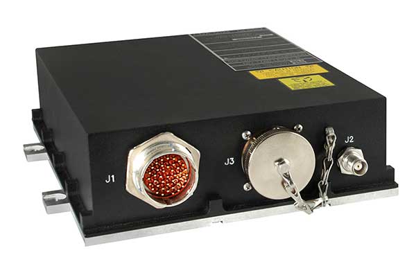
CMA-5024. (Photo: CMC Electronics)

CMA-5024. (Photo: CMC Electronics)

The FAA has approved an STC to install the SBAS-capable CMA-5024 GPS on Boeing 737 Next-Generation aircraft to comply with worldwide ADS-B Out mandates as well as SBAS/GPS navigation enabling the first localizer performance with vertical guidance (LPV) approaches for B737NGs.

CMC’s solution, developed in collaboration with the FAA’s Navigation Programs office, offers operators the advantage of a cost-effective alternative to replacing their current multi-mode receiver (MMR).

The CMA-5024 is an approved DO-260B ADS-B Out positioning source that may be paired with any DO-260B compliant transponder, allowing operators to meet FAA and EASA ADS-B Out requirements, the UAE’s ADS-B Out and RNP requirements mandated by GCAA as well as India’s GAGAN requirements.

The CMA-5024 is the only solution available that is approved to introduce LPV on B737NG aircraft. With the CMA-5024, the B737NG aircraft can take advantage of satellite-based augmentation system (SBAS) navigation throughout all phases of flight.

An LPV approach is the highest precision GPS instrument approach available not requiring specialized crew training. It aims to reduce costs associated with flight delays or cancellations and provides airlines with a safe approach into airports when ILS is unavailable.

The CMA-5024 meets the requirements for an IFR civil certified GNSS and is compatible with all SBAS systems operating around the world such as WAAS, EGNOS, GAGAN and MSAS. SBAS augments GPS to provide an extremely accurate navigation solution throughout all phases of flight, from departure to en-route, through LPV CAT-l equivalent approach. The CMA-5024 complies with published Communication Navigation Surveillance/Air Traffic Management (CNS/ATM) navigational mandates.

EASA approval of the STC is in progress. Future growth to GBAS GLS precision approach capability can be obtained by upgrading to CMC’s new CMA-6024 GPS/SBAS/GBAS receiver system.

For Business Jets

CMC Electronics and DAC International received an FAA STC (ST00934DE) for aircraft equipped with Honeywell’s Primus II avionics suite.

The new STC provides a low-cost alternative to upgrading the existing onboard Honeywell equipment while meeting the DO-260B ADS-B Out worldwide mandate. This is achieved by replacing the existing non-compliant Primus II transponder with the Becker BXT6553 Diversity Transponder, paired with CMC Electronics’ CMA-3024 GPS/SBAS (GNSSU) receiver.

The STC extends the operating life of a broad range of aircraft such as Bombardier’s Challenger 600 series, Hawker 800/800XP, Learjet 45, Gulfstream G-IV and GIV-X, Cessna Citation II and V, and many more.

This is the latest addition to already existing STCs (ST03424CH and ST04159CH), which pair CMC’s CMA-3024 with the Rockwell Collins TDR-94/94D or Honeywell RCZ-8XX Primus II Com/Transponder to meet the DO-260B ADS-B Out standards mandated by the UAE’s GCAA, FAA and EASA for 2020.

Claude Chidiac, Vice President, Sales and Marketing, at CMC Electronics said: “These STCs bring together the best that CMC and DAC have to offer to economically support business jet operators. They combine the respective technological strengths of both companies, namely the most advanced GPS receiver with DAC’s worldwide distribution channels and FAA approved kits. Our joint ADS-B Out solutions deliver high integrity and the cost-effectiveness that business aviation has been waiting for.”

The CMA-3024 aviation sensor provides fully ADS-B compliant SBAS/GPS primary means navigation for business, regional, commercial air transport and helicopter aircraft. It is fully compatible and operational with all SBAS signals worldwide.

With SBAS coverage, differential corrections are incorporated to further improve RNP capability, providing RNP0.1 with outstanding navigation system availability.

Full installation kits, including the CMA-3024 and STC package, are provided by DAC International.

Publicerad den Lämna en kommentar

AgilLOC antenna element combats GNSS jamming at sea

Photo: ST Engineering

Photo: ST Engineering

With the proliferation of jamming devices readily available, maritime vessels need to be situationally aware of GNSS interference and disruption. The threat of GNSS jamming is made even more critical in situations that require navigation through narrow straits under poor visibility, with no sea lane markers in sight.

Case in point being the British-flagged oil tanker Stena Impero, which was seized by Iran’s Revolutionary Guards while sailing through the Strait of Hormuz. Iranian Islamic Revolutionary Guard Corps stated that Stena Impero had taken a wrong route when entering the Strait of Hormuz.

This happened during a time when an advisory warning by the U.S Maritime Administration had already been released, stating that vessels operating in the Persian Gulf, Strait of Hormuz and Gulf of Oman may encounter GPS interference, bridge-to-bridge communications spoofing or other communications jamming with little to no warning.

This episode could have been avoided if better awareness of the navigation system was employed.

Jamming protection at sea. ST Engineering has developed AgilLOC Antenna Element Compact (AEC), which provides GNSS protection against three simultaneous jamming/interference sources with its adaptive nulling algorithm for the maritime sector, ensuring continuous GNSS protection to connected systems.

AgilLOC AEC was designed for easy integration with new or existing legacy systems that required uninterrupted GNSS reception. Despite its lightweight and compact design, AgilLOC AEC provides a robust response to narrow and wideband interference, the company said.

When disruption happens. In a disruption, the crew onboard can only rely on radar or cross bearings using compass, terrestrial radio navigation or even sextants.

The loss of GNSS input to the ship’s surface search radar, gyro units and electronic chart display and information system (ECDIS) will result in a lack of GNSS data for position fixing, radar over ground speed inputs, gyro speed input as well as the loss of collision avoidance capabilities on the ECDIS radar display. It is imperative that all ship’s crew are aware of the status of their GNSS reception.

Many GNSS receivers currently installed onboard vessels do not provide for jamming monitoring or mitigation. Deliberate or unintentional GNSS inference are becoming more prevalent, increasing the risk of receivers being overwhelmed by elevated levels of interferences.

Satellite navigation is essential for all maritime applications under all weather conditions. The AgilLOC AEC protects the GNSS signals for a smooth navigation and precision landing alongside with other navigational systems.