Publicerad den Lämna en kommentar

INTERGEO 2023: JAVAD GNSS

About the Author: Matteo Luccio

Matteo Luccio, GPS World’s Editor-in-Chief, possesses more than 20 years of experience as a writer and editor for GNSS and geospatial technology magazines. He began his career in the industry in 2000, serving as managing editor of GPS World and Galileo’s World, then as editor of Earth Observation Magazine and GIS Monitor. His technical articles have been published in more than 20 professional magazines, including Professional Surveyor Magazine, Apogeo Spatial and xyHt. Luccio holds a master’s degree in political science from MIT. He can be reached at mluccio@northcoastmedia.net or 541-543-0525.

Publicerad den Lämna en kommentar

Point One Navigation joins STMicroelectronics Partner Program

Image: Point One Navigation

Image: Point One Navigation

Point One Navigation has joined the STMicroelectronics Partner Program. The program aims to deliver reliable navigation and positioning solutions to a diverse spectrum of ST customers in the U.S. and Western Europe.

Because of Point One’s navigation software and real-time kinematic (RTK) network, developers using ST Teseo GNSS solutions now have a more efficient path to create precise navigation solutions in industries such as agriculture, construction, last-mile delivery, and autonomous vehicles.

Point One’s Polaris Cloud is a GNSS correction network that enables GPS based localization, while allowing users to choose the performance and price point that best fits their application. With coverage across the U.S. and most of Western Europe, Polaris Cloud provides a readily available solution for precise localization.

FusionEngine software, developed by Point One, further enhances precision navigation by integrating additional sensors like IMUs and wheel speed sensors. This allows users to achieve a desired level of accuracy, even in situations where satellite signals are absent or in challenging urban environments. The software also offers automatic calibration, fault detection and compatibility with a range of host processors.

Publicerad den Lämna en kommentar

When GNSS does not work

Image: Just_Super/iStock/Getty Images Plus/Getty Images

Image: Just_Super/iStock/Getty Images Plus/Getty Images

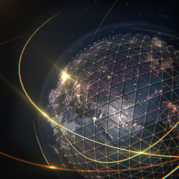
GNSS is like opium. Highly addictive, pleasing to the user, but laced with peril when you’re hooked. GPS World readers are well aware of the vulnerabilities, and probably aware of the serious concerns governmental bodies have about our reliance upon it. Here, we consider not so much how it can fail as what the impact of failure is on society, and what mitigations exist to minimize those impacts.

Impact on society
The most commonly cited causes of GNSS failure are jamming (unintentional and intentional) and spoofing. Less well appreciated are solar weather, satellite system errors, receiver system errors and, most importantly, cybersecurity-related errors. Any of these can cause a significant disruption to how society functions today.

The U.S. Department of Homeland Security identified that 15 out of the 18 Critical National Infrastructure sectors were vulnerable to GNSS failure: communications, emergency services, information technology, banking and finance, healthcare and public health, energy (electric, oil and gas), nuclear, dams, chemical, critical manufacturing, defense industrial base, postal and shipping, transportation, government facilities, and commercial facilities.
The threat is real and present. Conflicted areas are routinely jammed and spoofed. Even in peace, GNSS is fragile. In the past year, GNSS interference led to a runway at DFW airport being closed, a 33-hour GNSS outage in the Denver metro area, and even a recent Melbourne Formula One race had to be stopped for 40 minutes due to GNSS data problems.

Mitigations
In most cases, no alternate references are in place, and without them, it is difficult to know that the GNSS data being received is wrong. The ship Stena Impero, for example, was seized by Iran for being in its territorial waters. It is thought to have been victim to spoofing that led it there, but proving it is difficult.
Alternate references exist at low cost, but they generally divide “PNT” into “PN” and “T”, and whether on land, at sea or in the air. On land, most requirements are related to “T” because most applications, such as broadcast facilities and data centers, don’t move, and even when they do, there are enough landmarks available to at least make a sanity check. At sea and in the air, by contrast, motion is the reason we are there, there are few landmarks to confirm location, hence “PN” dominates.

For “T”, armageddon clocks can provide holdover for brief interruptions. However, they must be sufficiently tested to ensure that they succeed. In the Denver incident, radio systems had rubidium clocks for backup, but they drifted too far during the outage to be useable, whereas cellular networks, with alternate terrestrial timing sources, continued to work. Terrestrial time distribution systems over existing IP infrastructure, which Hoptroff supplies, work well globally, but are restricted to land-based time synchronization applications.

For “PN” and “T”, in air, sea and land, low-Earth orbit satellite services such as Satelles, Starlink and OneWeb provide global solutions. Their signals are much stronger than GNSS and therefore are much harder to jam or spoof, but they remain susceptible to interferences such as space weather, which destroyed 40 Starlink satellites on launch last year. However, as the Denver incident shows, until you test the solution, you never really know what might go wrong. eLoran terrestrial wireless solutions are very effective but limited in reach to within a few thousand miles of terrestrial transmitters. Such systems are being installed in South Korea and Saudi Arabia due to their proximity to hostile neighbors. They are likely to be installed in North America and Europe within the next decade.

What all these solutions have in common is that, while they are not expensive, they are not free, and are only available under license. Sovereign GNSS providers have, to date, provided PNT signals at no cost to the consumer. It must be accepted in the new landscape, not just that PNT is no longer free, but also that the supplier can choose its customers. Sovereign GNSS access could be restricted at the whim of a president. Private services are already selective — Starlink chose to provide the Ukraine with service during the current conflict, but it has no obligation to continue to do so.

Get on with the risk register
One of the biggest problems with preparing alternatives to GNSS is that the risk is ignored until it has started to have an impact on business and society. This can be addressed by ensuring that resilient PNT is on corporate and institutional risk registers. It is starting to happen now that governments have started to raise concerns. However, we have a way to go before inclusion on risk registers is a foregone conclusion.

Publicerad den Lämna en kommentar

FJDynamics releases reality capture and visual positioning systems

FJDynamics has released the Trion P1, a compact handheld lidar scanner and the Trion V10i GNSS system, both with visual positioning. These systems were unveiled at INTERGEO 2023.  

Trion P1 lidar scanner

FJD Trion P1 lidar scanner. (Image: FJDynamics)

FJD Trion P1 lidar scanner. (Image: FJDynamics)

The simultaneous localization and mapping (SLAM)-based lidar scanner allows users to accurately digitize environments. With the ability to capture indoor, outdoor and underground environments, this compact scanner can be used across a variety of industries such as property management, disaster preparation, forestry and more.

“Our goal at FJDynamics is to bridge the gap between advanced technology and practical applications,” said Mike Zhao, senior product manager. “With the Trion P1 lidar scanner, we’re putting the power of reality capture into the hands of both seasoned professionals and those curious about 3D scanning.”

Key features of the scanner include a lidar capacity of 200,000 points per second, and real-time point cloud visualization on mobile devices via Trion Scan. In addition, it can calculate distance, area and volume.

Trion V10i GNSS system with visual positioning

FJD Trion V10i GNSS system with visual positioning. (Image: FJDynamics)

FJD Trion V10i GNSS system with visual positioning. (Image: FJDynamics)

The FJD Trion V10i GNSS System integrates two cameras for vision-guided surveying operations, an inertial measurement unit (IMU) for tilt surveys and an OLED screen for easy status checks. This technology is designed to enhance productivity in the field, even in hard-to-access locations.

The technology features IMU-based tilt compensation for precise measurements of up to 60 ° with no calibration needed. It also comes with a built-in 4G LTE and UHF and supports NFC, WiFi and Bluetooth. It also offers users seamless connectivity through Trion Survey Cloud for real-time data sharing between field and office teams.

Publicerad den Lämna en kommentar

Ligado sues U.S. government for using its licensed 5G spectrum

Ligado Networks has sued the U.S. federal government for $39 billion, alleging officials at the U.S. Departments of Defense (DoD) misappropriated Ligado’s exclusively licensed L-band spectrum to support secret DoD systems without permission or compensation. 

“The lawsuit, filed in the U.S. Court of Federal Claims against the United States, the Defense Department, the Commerce Department and NTIA, seeks just compensation for the government’s physical, categorical, regulatory and legislative takings of Ligado’s property,” the company said in a press release. 

According to the company’s lawsuit, the DoD embarked on a “misinformation and disparagement campaign” against Ligado starting shortly after the company received its FCC approvals in 2020. That campaign, according to the lawsuit, sought to revive concerns that Ligado’s 5G plans would interfere with GPS services. 

Ligado alleges the DoD’s claims about spectrum interference “are a pretext” to conceal secret Pentagon systems that depend on Ligado’s spectrum. 

The company claims multiple former and current senior government officials have acknowledged the DoD wants Ligado’s spectrum for its own, undisclosed purposes, and that the DoD’s activities cannot co-exist with Ligado’s authorized use of its spectrum. 

“High ranking U.S. government officials have acted deliberately to deprive an American company of its rightfully licensed property,” said Ivan Seidenberg, chairman of Ligado’s board of managers. 

Its Complaint states the DoD, U.S. Department of Commerce (DoC) and the National Telecommunications and Information Administration (NTIA) have deprived Ligado of all the economic benefits it could have expected from using and developing its exclusively allocated and licensed spectrum for terrestrial services. 

Ligado is asking the court for “just compensation in an amount to be determined at trial for its past, present, and future taking of Ligado’s rights.” 

Publicerad den Lämna en kommentar

SpaceX to launch European satellites

Photo:SpaceX has signed a deal to launch four of Europe’s flagship navigation and secure communications satellites into orbit, reported The Wall Street Journal. The European Commission and the European Union (EU) member states have yet to give a final approval for the deal, the report added.

SpaceX and the European Space Agency recently signed an agreement for two launches next year, each carrying two Galileo satellites.

The deal states the satellites will be launched from the U.S. on SpaceX’s Falcon 9 rocket

European space officials said last month they face crucial timing decisions in the coming weeks on the return to flight of Europe’s flagship space launchers following a series of delays.

Publicerad den Lämna en kommentar

CNH Industrial completes purchase of Hemisphere GNSS

CNH-Industrial-LogoCNH Industrial has completed its purchase of the global satellite navigation technology company Hemisphere GNSS for a total consideration of USD $175 million.

The acquisition, first announced in March 2023, is said to strengthen CNH’s capabilities in precision, automation, and autonomy technology. It also furthers the company’s efforts in vertical integration to provide cutting-edge technology to customer fleets.

With Hemisphere’s expertise and network, CNH says that it can accelerate its strategic plan to develop its automation technology, expedite the delivery of a fully autonomous farming cycle, and extend and enhance automation and autonomy across a broad range of construction applications.

“Bringing Hemisphere’s talent and resources into CNH reflects the energy and momentum of our investments in tech innovation,” said Marc Kermisch, Chief Digital & Information Officer at CNH. “From 2024 onwards, we will bring notable value to customers through significant advancements in our journey from automating certain tasks to fully autonomous operation.”

Publicerad den Lämna en kommentar

GPS: A Celebration of the First 50 years

Image: David Grim

Image: David Grim

This year marks 50 years since the U.S. Department of Defense approved the design for GPS and first funded the program. It is also the 30-year anniversary of an important milestone – initial operational capability of GPS. Please don’t let its longevity fool you into thinking it is past its prime! GPS is, and will remain, one of the most innovative systems ever designed, funded and operated by the U.S. government.

Today, GPS represents a highly successful public and private partnership, one in which diverse stakeholders continue to coordinate through fora such as the National Executive Committee for PNT and its Advisory Board. and the Civil GPS Service Interface Committee. How did this system become a military, public safety, critical infrastructure, and economic success? The world-class GPS community is made up of the teams and individuals who design, develop and operate these critical technologies as well as the people and organizations that benefit from its applications. From pioneers, scientists, engineers, and Guardians to civil servants, lawmakers, and entrepreneurs, the GPS community has transformed, is transforming, and will continue to transform lives across the globe, and soon, the moon.

GPS World highlighted the important roles played by many early GPS pioneers in a two-part series aptly titled, “Heroes” in the May and June 2010 issues. It has also covered Dr. Gladys West, who is one of the most consequential mathematicians and programmers to contribute to the global success of GPS. Her geodetic models helped refine our understanding of Earth’s shape, which proved fundamental to the success of GPS and its myriad applications. In 2021, the Trimble Foundation established the Dr. Gladys West Scholarship Program. Virginia State University (her alma mater!), North Carolina A&T State University, and Florida International University award four-year scholarships to one student per year to honor Dr. West’s achievements as a woman of science and a woman of color.

A celebration of GPS must also recognize our lawmakers — the people who authorize and appropriate funding for GPS and its augmentation programs. Nearly every U.S. federal department and agency uses these systems to fulfill their missions on behalf of the American people. They also leverage their technical, programmatic, operational, and experiential expertise to ensure that GPS and its augmentation systems remain the best in the world. This work is possible thanks to congressional committees, members of Congress, and staff. The Senate Appropriations and House Appropriations committees, the Senate Armed Services and House Armed Services committees, the Senate Commerce, Science and Transportation and the House Energy and Commerce committees, the GPS Caucus and many more members of Congress, provide critical oversight and funding. Their support ensures that GPS continues to bring $1.7 trillion and counting in economic benefits to the U.S. economy, creating hundreds of thousands of jobs while enhancing national security, public safety and critical infrastructure.

The future is bright for GPS manufacturers and those developing new applications. To realize their success, projects funded by the Infrastructure and Investment Jobs Act and the Inflation Reduction Act will depend on GPS to continue to deliver signals that are accurate, have integrity, and are available and continuous in nature. The next enterprising GPS entrepreneur is waiting in the wings

Thanks to a network of determined individuals, GPS-driven technologies — used to support precision agriculture, safe transportation, synchronized global banking, cutting-edge emergency response, elite and amateur sports, and more — are transforming our lives, creating jobs, and promoting growth across the economy.

GPSIA joins other members of the GPS community by celebrating 50 years of GPS and looks forward to the innovations and applications that will shape the next 50 years and beyond.

Publicerad den Lämna en kommentar

Septentrio introduces new open-source projects

Image: Septentrio

Image: Septentrio

Septentrio has introduced two new open-source hardware projects available to integrators of satellite-based positioning.

By expanding their ecosystem of open-source hardware and software, Septentrio aims to make reliable GNSS positioning more accessible to integrators and developers.

The first project, mosaicBus, is a reference design of a board compatible with mikroBUS add-on board standards primarily used in embedded systems. MikroBUS enables easy plug-and-play sensor integration into development boards from major companies such as MikroElektronika, who developed the mikroBUS standard.

The second project, called mosaicAlto, is a carrier board embedding the mosaic-X5 or mosaic-H GNSS receivers, which transforms Arduino Pro Portenta into a single-board computer with a GPS/GNSS receiver.

The mosaicBus board can be used in applications such as automation, robotics or Internet of Things (IoT).

Mosaic is a compact high-precision multi-frequency GPS/GNSS receiver module known for its performance in harsh environments and resilience to jamming and spoofing. The module is designed for systems where accuracy and reliability are required. It has been widely adopted through existing projects such as the mosaicHAT, a shield board for Raspberry Pi and Mowi, a wireless communication board using the mosaic receiver.

In addition to hardware reference designs, Septentrio also supports ROS and several other UAV autopilots.

Publicerad den Lämna en kommentar

Institute of Navigation announces “International GNSS Day”

Image: ION

Image: ION

In recognition of the indispensable role GNSS plays in shaping the modern world, the Institute of Navigation (ION) has established “International GNSS Day,” which would occur annually on October 23.

This date, written as 10/23, was chosen in honor of the frequency of 10.23 MHz, the original heartbeat of all GPS satellites, signals and receivers. This frequency was later adopted by all GNSS service providers and serves as the basis of L-band signals for over 100 navigation satellites today.

International GNSS Day aims to highlight the global impact of satellite navigation in diverse sectors, including transportation, agriculture, aviation, surveying and more. It provides a platform to recognize the collaborative efforts of nations, organizations and individuals in advancing GNSS technology. ION pays special tribute to the developers of GPS, celebrating 50 years since its inception this year.

By declaring “International GNSS Day,” ION seeks to raise awareness and appreciation for the critical role GNSS plays in navigating the course of our interconnected world.