Publicerad den Lämna en kommentar

Rep. Wexton working behind the scenes to secure GPS and backups

Rep. Jennifer Wexton

Rep. Jennifer Wexton

Reading her biography, you might not think that Jennifer Wexton, U.S. Representative for Virginia’s Tenth District, would be very connected to technology issues. As an attorney and government leader, she has spent a lot of time advocating for families, veterans and federal workers.   

Yet she is also co-founder of the Congressional Task Force on Digital Citizenship and has become an advocate for protecting the nation’s vital positioning, navigation and timing (PNT) services.  

“We all use GPS every day whether we know it or not, and we need to ensure it stays the gold standard for satellite navigation,” she said. “But as the National Security Council said last year, it has become a single point of failure for America. So much of our critical infrastructure depends on GPS, from the navigation apps on our phones to the military to our financial and energy sectors, and it is past time that we address its critical vulnerabilities and develop and implement reliable backup technologies.” 

Wexton says that she has been aware of and concerned about the issue almost since the day she took her seat in Congress.  

“I am a member of the House Appropriations subcommittee that oversees funding for the Department of Transportation, and civil GPS and PNT issues fall squarely in DOT’s jurisdiction,” she said. “In 2018, Congress passed a law requiring DOT to ensure we have a backup for GPS, and we updated that law earlier this year to ensure that all appropriate types of technologies are included in this effort. I don’t know how we can be comfortable with autonomous drones and self-driving cars if we don’t have technologies in place to support and back up GPS. They are certainly available.” 

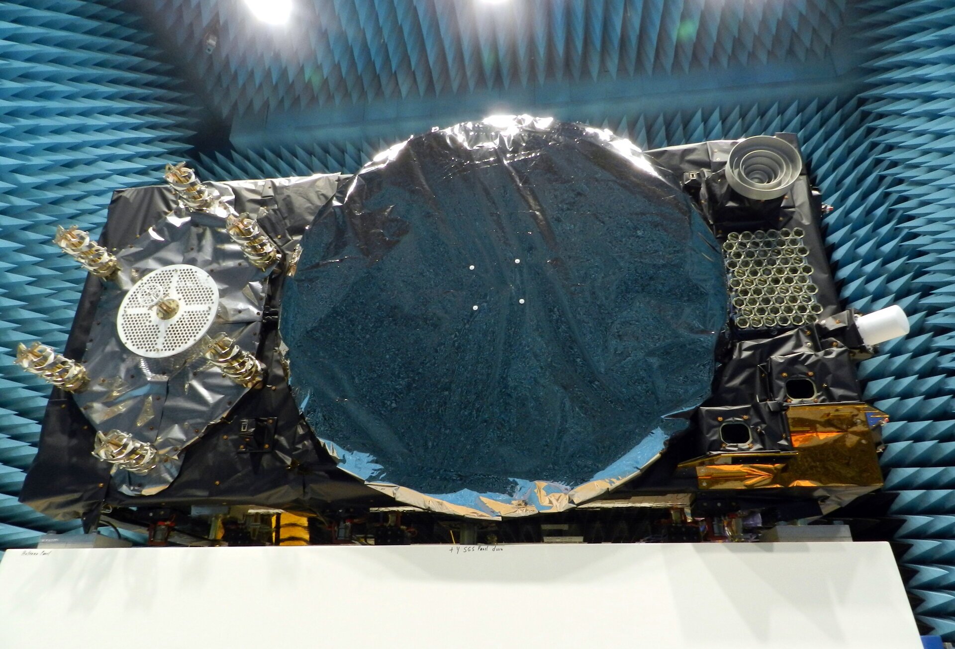
The fact that her district includes a huge swath of Virginia’s high-tech corridor has added to her knowledge of the problem and range of possible solutions. In addition to many big names in technology and government contracting, several smaller companies focusing on resilient PNT have offices in her district. These include Echo Ridge, Hellen Systems, Satelles and UrsaNav. All four participated in the Department of Transportation’s Complementary PNT and GPS Backup Technologies Demonstration.  

Adding to her concern are increasing threats to GPS satellites and signals. At a recent hearing with DOT Secretary Pete Buttigieg, she mentioned Russia’s anti-satellite tests and ongoing GPS jamming in Ukraine as examples. 

“And that might not even be the worst of it,” she later said. “We need to be cognizant of Chinese capabilities in cyber and in space. They have shown how they can physically grab one satellite with another and toss it out of orbit.” 

At the hearing, she gently prodded Secretary Buttigieg about DOT’s progress toward protecting the nation.  

“…in the FY-22 Omnibus we created a program which is housed at DOT and provided $15M to help develop the needed requirements and standards and conduct additional testing. […] How’s it going?” 

Buttigieg temporized saying the department was working on the Congressional tasking in the appropriation with the funding available. That tasking focused on testing and developing standards as opposed to contracting for signals to begin making one or more alternatives to GPS widely available for adoption.  

Funding for such an effort has been problematic since a 2018 law required DOT to establish a timing backup for GPS. Administrations have justified inaction by saying that Congress had not funded the effort. Yet hill staff report that for several years administration representatives vigorously opposed any funding at all during annual budget development negotiations. The $15M to establish the program within DOT this fiscal year, which Wexton supported, was the first time any allocation had been made. 

Rep. Wexton is also a big supporter of GPS modernization. “GPS is the gold standard for satellite navigation and America’s gift to the world,” she said. “We have to continually modernize it to support both military and civil uses. That’s a no-brainer.” 

She also sees deploying alternative timing and navigation systems a step to making GPS more secure. “Unlike the Russians and Chinese, we don’t have one or more systems widely deployed domestically if GPS is unavailable for some reason. This makes GPS satellites and signals prime targets for our adversaries, terrorists, and criminals. Having one or more alternatives will create redundancy and make GPS a much less attractive target.” 

Providing one or more alternatives that could be widely adopted could be a relatively inexpensive proposition for the government, certainly when compared to the cost for GPS. More than $2 billion was appropriated for GPS operations and modernization this year. Industry sources estimate that contracts for the suite of alternative PNT sources described in the 2021 DOT report would cost a small percentage of that. 


Dana A. Goward is President of the Resilient Navigation and Timing Foundation.

Publicerad den Lämna en kommentar

Quectel launches high-performance GNSS positioning module

Photo: Quectel

Photo: Quectel

Quectel Wireless Solutions, a global IoT solutions provider, has released the LC76G module, a single-band compact GNSS module featuring fast and accurate location performance as well as ultra-low power consumption.

The LC76G is on display at Embedded World Nuremberg, Booth No 171, Hall 5, June 21- 23.

The LC76G has already entered mass production with sufficient supply to meet the needs of the global positioning market. Based on the Airoha AG3352 platform, the LC76G can concurrently receive and process signals from all four global constellations and the regional QZSS.

The LC76G module can receive signals from up to 47 satellites and achieve 1.5 m (CEP50 open-sky) positioning accuracy representing a 40% improvement over previous generations of devices.

Available in a cost-optimized version as well as a low-power version, the LC76G low-power version consumes less than 9 mA@3V with all four constellations enabled, allowing for a 72% reduction in power required compared to what was previously possible.

This makes the LC76G suitable for battery-operated devices such as wearable personal trackers, wildlife and livestock tracking, toll tags, portable container trackers and a host of traditional markets such as shared mobility and low-cost asset trackers.

Featuring an internal SAW filter and integrated LNA, the LC76G can be connected directly to a passive patch antenna and provides filtering against unwanted interference, ensuring excellent performance even while driving through dense urban canyons.

EPO and EASY improve TTFF

Integrated assisted-GNSS technology Extended Prediction Orbit (Quectel’s EPO) is supported on the LC76G module. EPO reduces the time to first fix (TTFF) with a hot start taking less than 1 second, a warm start within 2 seconds, while the cold start can obtain accurate tracking fixes within 15 seconds. The faster GNSS fixes make it possible to use accurate positioning and navigation services anytime and anywhere with a smaller power budget than previously possible.

While EPO requires manual download of predicted orbits, the LC76G also supports the Embedded Assist System (EASY), where predicted orbit information is collected directly from the satellites and provides for up to three days of accelerated fixes.

Both EPO and Easy are available for each constellation, allowing for faster TTFF and reduced dependency on any particular constellation.

Featuring an LCC form factor and an ultra-compact size of 10.1 × 9.7 ×2.4 mm, the footprint of the LC76G is compatible with other industry solutions as well as Quectel’s legacy L76 and L76-LB modules, allowing for a smooth migration of existing designs to the latest low-power GNSS technology.

In addition, Quectel offers a wide range of off-the-shelf and customized high-performance antennas which boost wireless connectivity significantly. The C76G can be combined with a selection of GNSS L1 antennas to enable various positioning requirements. Customized connector type and cable length as well as comprehensive antenna design and test support are also available.

Publicerad den Lämna en kommentar

Galileo satellites undergo magnetic testing at ESTEC

News from the European Space Agency (ESA)

Within ESA’s Maxwell EMC Facility, each Galileo satellite is switched on as if it were already operating in space. The test procedure is a check of the satellite’s electromagnetic compatibility; all its systems are run together to detect any harmful interference between them.

Once Maxwell’s main door is sealed, its metal walls form a Faraday Cage, screening out external electromagnetic signals. The anechoic foam pyramids covering its interior absorb internal signals – as well as sound – to prevent any reflection, mimicking the infinite void of space for satellite testing.

In the photo here, sheathed in multi-layer insulation, the 2.5 x 1.2 x 1.1-meter satellite’s main 1.4-m diameter antenna transmits L-band navigation signals. To its left is the hexagonal search and rescue antenna that will pick up distress signals and relay them to local emergency services, contributing to saving more than 2,000 lives annually.

A Galileo satellite is tested in the Maxwell EMC Facility before heading for space. (Photo: ESA)

The Face of Galileo: A Galileo satellite is tested in the Maxwell EMC Facility before heading for space. (Photo: ESA)

To the bottom right of the navigation antenna are a pair of infrared Earth sensors to keep the navigation permanently locked onto Earth by homing in on the contrast between the heat of Earth’s atmosphere and the cold of deep space.

Above them is the laser retro-reflector: lasers are shone up to this from International Laser Ranging Service stations to perform an independent check of the satellite’s orbital position down to an accuracy of less than a centimeter, as a backup of standard radio ranging.

Above that is the circular C-band antenna, which every 45 minutes or so receives the navigation messages from the Galileo ground segment. These signals incorporate corrections for slight clock errors, orbital drift or satellite malfunctions that user receivers can process as they perform positioning fixes, helping ensure Galileo delivers meter-scale positioning to users around the globe.

What resembles a white baton on the end of the satellite is its S-band antenna, employed to return “housekeeping” telemetry data to mission control on Earth and pick up telecommands to operate the satellite platform and payload – as well as performing the ranging used to estimate the satellite’s position in space.

The Maxwell EMC Facility is part of the ESTEC Test Centre in ESA’s technical heart in Noordwijk, the Netherlands – Europe’s largest satellite testing facility, which has flight-tested all but two of the 28 Galileo satellites already in orbit, and is doing the same for the next 10 satellites planned to join the constellation.

Publicerad den Lämna en kommentar

OriginGPS showcases new modules, tracker at Embedded World

New products include a low-profile GPS module, a new-gen dual-frequency GNSS module and a super-mini IoT tracker

Photo: OriginGPS

Photo: OriginGPS

OriginGPS will showcase new GPS and GNSS modules and a tiny tracker at Embedded World, Nuremberg, June 21-23, and at Electronica, Munich, Nov. 15-18.

Among products exhibited are:

  • the 7 x 7 mm ORG4572-MK05 GNSS module with a 10-Hz update rate
  • the new generation dual-frequency L1+L5 ORG4600, which provides centimeter-level accuracy with RTKLIB and NMEA with raw data in parallel
  • a low-profile GPS antenna module, the ORG1511-MK05
  • a new waterproof super-mini tracker measuring 4.9 x 2.7 x 1.4 cm and equipped with magnetic charging
  • high-performance solutions for a myriad of industries, from fish finders and oil and gas monitors to cargo tracking and gun control.

OriginGPS specializes in miniature GNSS modules and cellular internet of things (IoT) systems. Its high-performance solutions are suitable for every type of device designed to monitor and track valuable assets, whether stationary, in motion or both.

OriginGPS today offers a broad range of high-efficiency solutions, including traditional miniature GNSS modules and cellular IoT systems and devices to dramatically shorten time to market.

“When we realized that the component shortage was here to stay a while, we revisited our roadmap and added two GNSS modules, the ORG1510-MK05 and the ORG4572-MKO5,”said Amir Benyamini, vice president of research and development, OriginGPS. “These new models are based on available chipsets and boast a lead time of just 12 weeks. We also offer a similar lead time for our dual-frequency module.”

Publicerad den Lämna en kommentar

oneNav to open European office in Finland

Advanced GNSS digital receiver IP core developer seeks to add expertise to global engineering team with the establishment of new subsidiary oneNav Finland Oy

oneNav logoSilicon Valley, California-based technology company oneNav is opening its first European office in Tampere, Finland.

oneNav Finland Oy will be led by Florean Curticapean, director of position engineering. He has more than two decades of professional experience in GNSS and mobile communications.

oneNav is developing a next-generation GNSS receiver for smartphones, wearables and tracking and augmented reality (AR) devices. The oneNav pureL5 GNSS solution was built from the ground up to fully leverage the modernized E5/L5/B2 signaling band deployed on multiple constellations including GPS, Galileo and BeiDou.

The new E5/L5/B2 signal has considerable benefit over the legacy L1 signal that has been used since the 1980s, according to oneNav. E5/L5/B2 enables higher precision and better multipath mitigation, improves coverage and reliability, and is a unified signal, ensuring global interoperability.

The oneNav pureL5 system utilizes machine learning and artificial intelligence to improve its solution by removing reflected signal errors that most commonly cause GNSS inaccuracy in deep urban environments.

Devices powered by oneNav’s technology will produce high accuracy in challenging signal conditions while benefiting from reduced component bulk and complexity, oneNav said.

“Talent is the key to attract such investments, but this does not appear overnight or by accident. Our businesses are benefitting from many years of research and education at Tampere University, more specifically in the Electrical Engineering Unit, in fields such as GNSS, system-on-chip, network-on-chip, embedded processor architecture, software-defined radio and more,” said Oliver Hussey, senior business advisor for the Tampere subsidiary.

Tampere is the host of the ICL-GNSS Conference, welcoming a global audience to address the latest research on wireless and satellite-based positioning techniques to provide reliable and accurate position information with low latency.

Publicerad den Lämna en kommentar

U-blox launches its smallest GPS module, the MIA-M10

Photo: u-blox

Photo: u-blox

U-blox has announced its smallest GNSS module series to date, the u-blox MIA-M10.

Built on the ultra-low-power u-blox M10 GNSS platform, MIA-M10 offers a power-efficient solution for size-constrained battery-powered asset tracking devices. The module targets an expanding market for people, pet and livestock trackers, as well as industrial sensors and consumer goods.

The 4.5 x 4.5-mm form factor of the M1A-M10 allows developers to design more attractive and comfortable solutions, further driving the adoption of positioning technology in consumer and industrial solutions. The module offers ultra-low power consumption without compromising GNSS performance, the company said. Moreover, its power-save modes can double the battery life by optimally balancing position accuracy and power consumption.

Like all u-blox M10 modules, the MIA-M10 concurrently receives four GNSS constellations (GPS, Galileo, BeiDou and GLONASS) for maximum satellite signal availability. Combined with its superior RF sensitivity, the module offers robust positioning performance for solutions with small antennas as well as for devices operating in weak signal environments such as deep urban canyons.

Support for u-blox AssistNow assisted GNSS service, which delivers orbital data via the internet, cuts the time it takes the MIA-M10 to determine its initial position at startup, allowing it to immediately track satellites without having to wait for slow satellite data downloads to complete. And applications requiring extra-long power autonomy can use u-blox’s CloudLocate service, which extends the life of internet-of-things applications by offloading power-hungry position calculation to the cloud.

The chip-sized, ready-to-use GNSS module requires no external components, reducing engineering and testing efforts, saving costs and resources, and speeding time to market.

Two Variants

MIA-M10 is available in two product variants.

  • The MIA-M10Q is for a growing market of highly size-constrained battery-powered tracking devices, wearable devices and highly dynamic applications such as small drones, cameras, bike computers and battery-powered sensors.
  • The MIA-M10C targets customers requiring more flexibility to combine the module with an active or custom antenna circuit.

The MIA-M10 will be on display at the Sensors Converge and Embedded Technologies trade show in San Jose, California, at booth 1228. First samples will be available in July.

Publicerad den Lämna en kommentar

Unjammable GPS anti-jam system successfully tested on DeltaQuad VTOL UAV

Photo: Deltaquad

Photo: Deltaquad

DeltaQuad has successfully integrated an advanced GPS anti-jamming system into its unmanned aerial vehicle (UAV). The DeltaQuad drone equipped with the system was flown in autonomous mode close to an active military jamming system.

Even while being hit directly by a military-grade GPS jamming platform, the system maintained a solid GPS lock and the vehicle managed to autonomously resume its mission without interruption.

For testing purposes, a ruggedized GPS-based navigation system was installed with the standard GPS-based navigation system. As the vehicle came in range of the GPS jamming system, the standard solution quickly lost all positional awareness, while the ruggedized system maintained a number of satellite locks, even while flying directly over the jammer at close range.

Test results. (Image: Deltaquad)

Test results. (Image: Deltaquad)

In addition to the ruggedized GPS solution, the DeltaQuad UAV is equipped to maintain live aerial intelligence, even in tough environments. The transmission system on the DeltaQuad uses frequency hopping spread spectrum  (FHSS) techniques to mitigate attempts to disrupt the communication links, and also uses redundant video and communication links.

The DeltaQuad is an industrial-grade vertical takeoff and landing (VTOL) fixed-wing UAV that performs fully autonomous surveillance missions. The platform offers a live video stream from a surveillance sensor for real-time reconnaissance missions.

Publicerad den Lämna en kommentar

New Telit GNSS receiver provides advanced power modes

Photo: Telit

Photo: Telit

Telit has released the SE873K5 multi-constellation GNSS receiver in the L1 band. The SE873K5 simultaneously tracks and navigates all four GNSS constellations — GPS, Galileo, GLONASS and BeiDou — providing GNSS information over a UART, I2C or SPI interface serial port using the NMEA protocol.

Based on the AG3335 system-in-package from Airoha, the SE873K5 is the latest addition to Telit’s SE873 family of modules and the natural migration path from SE873 and SE873Q5.

The module is a 7mm x 7mm x 2.25mm QFN-like semiconductor package with embedded SPI flash, RTC and TCXO. With its compact size, the latest generation chipset and the advanced power modes, the SE873K5 has the benefits of low cost, small form factor and good electrical and thermal performance — suitable for wearables, fleet tracking, drones and more.

The SE873K5 low-power processing core delivers customizable power-saving modes. It optimizes current draw at module wake-up by supporting both local- and server-based assisted GNSS (A-GNSS) for improved time to first fix, while satellite-based augmentation system (SBAS) corrections from WAAS, EGNOS, MSAS or GAGAN increase positioning accuracy.

The internal flash memory allows firmware updates and customization, as well as ephemeris predictions storage.

Features of the SE873K5 include:

  • Frequency bands: GPS L1, GLONASS L1, Galileo E1, BeiDou B1, QZSS L1
  • Standards: NMEA
  • SBAS (EGNOS, WAAS, GAGAN and MSAS) or QZSS L1S capability
  • Real-time clock for efficient power management
  • Low-power modes
  • Jammer rejection
  • Local and server-based A-GPS/A-GNSS
  • RoHS compliant
  • RED/UKCA certification
Publicerad den Lämna en kommentar

Safran’s SkyNaute navigation system to equip H160M Guépard helicopters

Photo: Safran

Photo: Safran

Airbus Helicopters has selected Safran Electronics & Defense to supply its SkyNaute navigation systems to equip future H160M helicopters, developed as part of the France’s joint light helicopter program. The contract follows a December 2021 order from the French Ministry of the Armed Forces for 169 Guépard helicopters.

SkyNaute is an ultra-compact hybrid GNSS/inertial navigation system based on Safran’s patented technology —  the hemispherical resonator gyroscope crystal. It offers virtually unlimited service life, a robust design for severe environments and ultra-high reliability, Safran said.

With its combination of high integrity and precision, the SkyNaute navigation system guarantees a high level of performance, even when GNSS signals are absent or jammed. It will enable H160M crews to perform their missions in challenging theaters of operations, the company said.

Publicerad den Lämna en kommentar

Trimble deploys custom Applanix positioning system for autonomy

Customizable system provides robust positioning without added site infrastructure for IHI Corp.

Photo: Trimble

Photo: Trimble

Trimble has announced the first deployment of its map-based localization system for land-based autonomous vehicle applications.

IHI Corp., a heavy industry manufacturer based in Japan, will retrofit its existing container and haulage trucks with a customized Applanix POS LV system as part of its broader autonomy capabilities for the transport of goods around industrial facilities.

Map-based localization provides precise positioning and orientation estimation, augmenting GNSS/inertial data, which is critical for safe and efficient autonomous vehicle operations. The ability to provide IHI Corp. a full workflow and real-time data ensures seamless integration into IHI’s truck design.

The custom-built, locally supported system leverages Trimble’s engineering capabilities and technology to provide reliable performance across a variety of challenging environments, the company said. Using this system, IHI Corp. can provide robust positioning for its autonomous fleet without additional site infrastructure, lowering capital expenditure costs and improving scalability.

Tailoring POS LV to work within IHI’s unique specifications and existing autonomous platform, the map-based localization system couples an inertial navigation system (INS) with simultaneous localization and mapping-based (SLAM) capabilities, and works with several types of sensors, including lidar. POS LV provides an accurate base map using post-processed data and localizes vehicle positioning in real time, enabling the reliable and safe autonomous operation of industrial vehicles.

IHI continually enhances its work environments, while also compensating for varying labor scenarios and personnel shortages. This makes the need to automate transportation critical to operations. The complexities of the evolving industrial manufacturing environment require solutions that can be tailored to a customer’s specific application requirements.

By partnering with Trimble, IHI can develop a retrofit system that addresses two major challenges — affordability and reliability — within the autonomous operation of large-scale industrial equipment.