A roundup of recent products in the GNSS and inertial positioning industry from the August 2019 issue of GPS World magazine.
GNSS module
Ultra-low-power for wearables
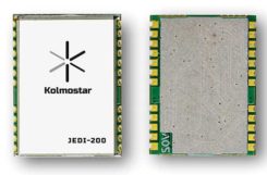
Photo: Kolmostar
The JEDI-200 reduces the energy for one position fix by up to 150x compared to traditional GNSS sensors, providing a positioning solution for location-based internet-of-things applications.JEDI-200 specification highlights include 10-mW ultra-low-power consumption (measured) at 1-Hz navigation rate; 1-second ultra-fast time-to-first-fix from cold start, and 2-meter CEP high positioning accuracy. It supports GPS and BeiDou. It offers 100-byte compressed ephemeris (EPH) to enable A-GPS with speedy download via low-power wide-area network (LPWAN) technologies such as LoRaWAN and narrowband internet of things (NB-IoT).
Kolmostar, www.kolmostar.com
Inertial navigation
For GPS-denied environments

Photo: Emcore
The EMCORE EN-300 precision fiber-optic inertial measurement/navigation unit is a high-accuracy inertial system designed to be form, fit and function compatible with a legacy equivalent, but with better performance needed for GPS-denied navigation, precise targeting and line-of-sight stabilization. The EN-300 incorporates EMCORE’s proprietary integrated optics devices to enhance performance. The internal signal processing provides full stand-alone or aided navigation, and as an option can provide standard IMU delta velocity and delta theta. With the option of full navigation capability including coning and skulling compensation and sophisticated Kalman filtering, the unit also is able to statically find north to less than one degree through gyrocompassing.
Emcore, www.emcore.com
GNSS board
For positioning and heading

Phantom 40. (Photo: Hemisphere GNSS)
The Phantom 40 positioning board is the first Lyra-based offering in a line of low-power, high-precision boards. Its multi-frequency, multi-GNSS receiver processes 700 channels with access to Hemisphere’s Atlas GNSS global corrections network. The 60 x 100 mm module with 24-pin and 16-pin headers is a significant upgrade for existing designs using this industry-standard form factor. The new Lyra II digital ASIC and Aquila wideband RF ASIC designs will be available with the new board, as well as Cygnus interference mitigation technology.
Hemisphere GNSS, www.hemispheregnss.com
Helical antennas
Available in housed and embedded OEM versions

The new helical antenna in both housed (left) and unhoused form. (Photo: Tallysman)
The first three products of a new range of helical antennas include the HC871, HC872 and HC600. The active GNSS helical antennas feature a low-current, low-noise amplifier (LNA), and include integrated low-loss pre-filters, to protect against harmonic interference from high amplitude interfering signals, such as 700-MHz band LTE and other near in-band cellular signals. The HC871 is a housed, dual-band, active GNSS antenna supporting GPS L1/L2, GLONASS G1/G2, Galileo E1, and BeiDou B1 (25 grams). The HC872 is a housed, dual-band, active GNSS antenna supporting GPS L1/L2, GLONASS G1/G2, Galileo E1, BeiDou B1, and L-Band services (36 grams). The HC600 is a housed, passive Iridium antenna (18 grams).
Tallysman, www.tallysman.com
Fiber extension KIT
Carries signals up to 10 kilometers
ViaLiteHD Blue OEM module, one of the available formats for the GPS RF over fiber link. (Photo: VitaLink)
ViaLite’s new GNSS/GPS Fiber Extension Kit has been qualified for use with Microsemi’s timing and synchronization products, and carries timing signals over optical fiber links to 10+ kilometers. The kit includes the ViaLiteHD GPS Link, designed to provide a remote GNSS/GPS signal or derived timing reference to equipment located where there is no reception, such as inside buildings, tunnels and mines. The kit is suitable for GPS, Galileo, GLONASS and BeiDou bands, and the links provide a wide dynamic range with negligible signal degradation from noise or interference.
ViaLite, www.vialite.com
Lidar scanner
3D mobile scanner for urban areas, roads

Photo: Viametris
The second generation of the vMS3D lidar scanner is now more compact and simplified in both electronic and ergonomic terms to make it more robust and stable in adverse conditions and challenging environments. Despite being lighter, the second generation offers the same technological capacities as its predecessor, but is simpler to use and can be mounted on a vehicle in minutes. The system component (including the sensors) and the element to affix the device to the vehicle (the frame) previously formed one unit, but are now separated in a design that limits vibrations and prevents any strain on the mechanics during acquisition. The scanner’s receiver is a Septentrio AsteRx-m2a and its inertial measurement unit is an SBG Systems Ellipse2-D.
Viametris, www.viametris.com
Job-site monitoring
Real-time 3D construction management gets remote support

Sitelink 2.0.
(Photo: Topcon)
Sitelink 2.0 is the latest edition of Topcon’s real-time 3D job-site monitoring and management system. The update includes a new pay-as-you-go point-based service model, new features to Sitelink Support Desk, and a new Haul Truck application. Remote configuration via the support desk allows Topcon personnel to directly access and configure receiver components on connected machines, while simultaneously retaining an active remote session of Topcon’s 3D-MC grade-control software for machine control.
Topcon, www.topconpositioning.com
Data collector
Connected smartphone for the field

Photo: Trimble
The TDC600 handheld is an ultra-rugged, all-in-one smartphone and GNSS data collector for geographic information system (GIS) and field inspection applications. The rugged handheld runs on Android 8.0 and has a bright sunlight-readable 6-inch display, 2.2-GHz processor, 4-GB memory and an enhanced-capacity all-day battery. It supports the Trimble Catalyst GNSS positioning service that delivers subscription-based accuracy on demand for Android devices. Its built-in receiver supports GPS, GLONASS and BeiDou plus satellite-based augmentation system (SBAS) capabilities for real-time positioning. It is rugged for GIS users in organizations such as environmental management, utilities and government agencies. Wi-Fi, Bluetooth 4.1 and 4G LTE cellular connectivity support data and voice calls, so field workers can use the TDC600 as they would any consumer smartphone, communicating between the field and office, sending emails and texting.
Trimble, www.trimble.com
Vehicle scanner
1,200 scan lines per second

Photo: Cepton
The SORA-P60 is designed to provide accurate 3D scans and to enable automated classification of objects and volumetric scanning, including high-velocity vehicle scanning and classification. Cepton’s Micro-Motion Technology (MMT) lidar in combination with its edge-compute hardware SORA-Edge makes it a powerful, mobile object classification and volumetric measurement device that can send its data over Ethernet, Wi-Fi or LTE to a central processing server. The SORA-P60’s three scan lines, each scanning at 400 Hz, enable accurate scanning for classification of objects traveling at highway speeds — 400 Hz translates to a scan line every 5 centimeters for an object traveling at 50 miles per hour. For example, users can measure the size of a tow hitch and trailer on a vehicle traveling on a highway in real time. The SORA-P60 sensor is free of rotational or frictional components, making it impervious to mechanical wear and tear. In addition, the new SORA-P60 features rugged housing designed to withstand harsh environments, cold climates and salt spray.
Cepton Technologies, www.cepton.com
UAV
Long-flight demonstrator
Completed maiden flight

Photo: U.S. Defense Department
The XQ-58A Valkyrie from National Security Solutions provider Kratos completed its maiden flight on March 5 at Yuma Proving Grounds in Arizona. Kratos Unmanned Aerial Systems (KUAS) and the Air Force Research Laboratory (AFRL) partnered on the development of the XQ-58A Valkyrie. During its 76-minute maiden flight, the UAV completed its test objectives. The runway-independent UAV is capable of long-range flights at high-subsonic speeds. Its development falls within AFRL’s Low Cost Attritable Aircraft Technology (LCAAT) portfolio, which has the objective to break the escalating cost trajectory of tactically relevant aircraft.
Kratos Defense & Security Solutions, www.kratosdefense.com
Fuel cells
Long-duration power solution for commercial UAVs

Photo: Ballard
The FCair hydrogen fuel cell can extend UAV flight time to up to 90 minutes, almost three times that of lithium-ion battery-powered drones. The product line includes FCair-600 and FCair-1200 liquid-cooled fuel-cell power systems, with built-in hybrid battery control and charging and delivering 600 and 1200 watts of power, respectively. These systems are in ongoing field trials, having previously been proven in harsh environments and at high altitudes. FCair includes a hydrogen fuel-cell power system, hydrogen storage vessels, pressure regulators, refueling solutions and hydrogen gas supply. The product line supports commercial UAV manufacturers and operators in the delivery of fuel-cell-powered UAV benefits, including: three times the flight duration of batteries; five times the reliability and a fraction of the noise of small internal combustion engines; and significantly reduced operational expenses.
Ballard, www.ballard.com
Lidar platform
Compact for uav deployment

Photo: Teledyne
The CL-90 is a lightweight compact lidar platform for UAV deployment. It features exceptional canopy penetration, offering low-noise, high-quality survey-grade data to deliver high-quality performance in data accuracy and point precision. The CL-90 provides full lidar performance across the entire operating altitude range of the UAV, and offers a variable field-of-view capability that eliminates the need for multiple passes over a target.
Teledyne, www.teledyne.com
Drone countermeasure
Lightweight, compact handheld gun

Photo: DroneShield
DroneGun MKIII is a portable pistol-shape drone jammer weighing under 2 kg. DroneGun MKIII is designed to be an alternate product rather than a replacement for the previously released DroneGun Tactical unit. It has a shorter effective range of 500 meters versus 1–2 kilometers for DroneGun Tactical. DroneGun MKIII can be used in combination with other DroneShield products, including the RfPatrol body-worn detection device and the DroneSentinel stationary multi-sensor detection system.
DroneShield Ltd., www.droneshield.com