
Image: Esri
Esri has released ArcGIS IPS, an indoor positioning system. ArcGIS IPS adds a blue dot to indoor maps, enabling users to locate their current position inside a building in the same way GPS enables outdoor location indicators.
ArcGIS IPS is designed to enable new use cases to improve on-site experiences, workplace operations and efficiencies. It uses an alternative technology to enable real-time positioning inside buildings that unlocks a variety of use cases, the company said.
Use cases inside buildings include:
- real-time localization and positioning
- real-time navigation and wayfinding
- live location sharing and tracking
- live location tracking
- location data capture and analytical insights
- real-time localization and positioning.
ArcGIS IPS is available for users of ArcGIS Indoors, an indoor mapping system for smart building management, and ArcGIS Runtime SDKs, which enables the indoor positioning capability in custom-built apps.
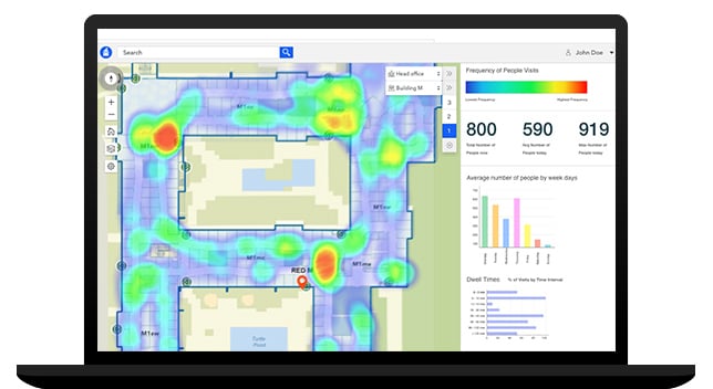
Image: Esri
ArcGIS IPS comes with the mobile ArcGIS IPS Setup app, which allows collection of radio signals from Bluetooth Low Energy (BLE) beacons inside buildings to enable an indoor positioning system. It can make use of an existing or new beacon infrastructure and is vendor agnostic.
ArcGIS IPS geoprocessing tools are also included to set up and author an IPS environment in ArcGIS Pro.
Users can navigate to specific points of interest — places, assets or people — in real time. This requires an existing app based on ArcGIS Runtime to support routable networks. ArcGIS Indoors can also display the route to a destination.