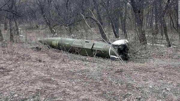
A Russian short-range ballistic missile, believed to be an unexploded Iskander missile, was found near Kramatorsk, Ukraine, in this photo released March 9 by Ukrainian authorities. (Photo: National Guard of Ukraine handout via Reuters)
As a geopolitical and devastating humanitarian crisis unfolds in Ukraine, the HALO Trust is partnering with Esri to map unexploded ordnance as part of an immediate humanitarian response.
More than 10 million Ukrainians have been displaced by the war and many are forced to move across a landscape littered with unexploded rockets, bombs and landmines.
In response, Esri has committed its cutting-edge geographic information system (GIS) software resources, expertise and staffing in support of HALO’s mission in Ukraine.
The organizations’ collaboration will allow them to map areas contaminated with explosives so HALO can remove the hazards when conditions allow. This will provide safe land to house displaced families and clear routes for humanitarian aid to reach those in desperate need.
HALO is already using GIS to map the heaviest conflict zones, and the partnership with HALO will support planning for future clearance operations.
As experts in their field, HALO is the world’s largest humanitarian landmine clearance and weapons disposal organization, clearing more than 13.9 million landmines and unexploded ordinance across 28 countries torn apart by conflict.
In addition to technical expertise, HALO staff provide safety education for those in contaminated areas to avoid life-changing injuries and death, emergency medical aid, and humanitarian support for displaced persons as they face conflict, and in many cases are forced to flee their homes.
Esri has collaborated with HALO since 2008 helping to map war-ravaged regions where specific locational awareness of landmines and other hazards is necessary to protect the lives of people in those areas.