Publicerad den Lämna en kommentar

ACSER upgrades GPS receiver

Image: ACSER

Image: ACSER

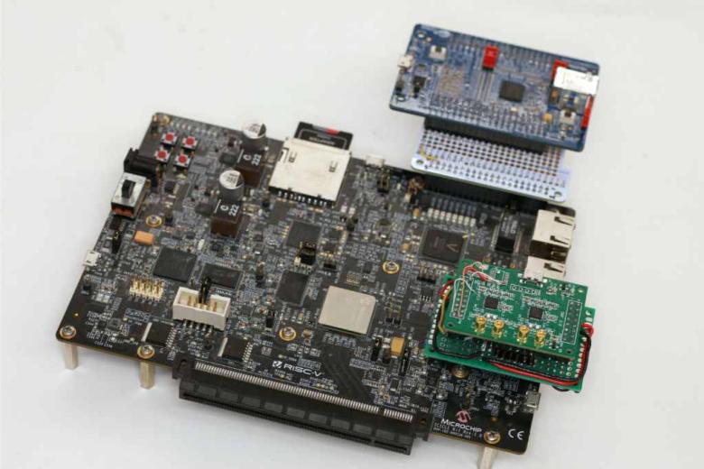
The University of New South Wales has developed an advanced GNSS receiver that can receive signals from GPS and Galileo satellites across multiple frequencies. The Australian Space Agency provided funding for the project via the International Space Investment initiative.

The receiver may play a key part in the future for Australian space missions.

Professor Andrew Dempster, director of the Australian Centre for Space Engineering Research (ACSER), led the development of the receiver and notes that it is an upgrade of Kea, a receiver made in Australia and New Zealand.

“The idea was to take that work (on Kea) and upgrade it for this multi-frequency, multi-system solution,” Professor Dempster said. “We needed to scale up the performance of many of the components on the boards – in particular, where the digital processors and hardware live.”

ACSER aims to have the receiver support upcoming satellite missions. The receiver can provide precise positioning, timing and velocity information. It enables satellites to produce higher quality images from space with better pointing.

Publicerad den Lämna en kommentar

Inertial Labs launches IMU-P

IMU-P.jpg

Image: Inertial Labs

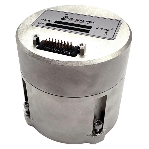
Inertial Labs has launched its inertial measurement unit-P (IMU-P). It is an advanced MEMS sensors-based, compact, self-contained strapdown, industrial- and tactical-grade inertial measurement system and digital tilt sensor that measures linear accelerations, angular rates and pitch-and-roll with three-axis, high-grade MEMS accelerometers and three-axis, tactical-grade MEMS gyroscopes.

Angular rates and accelerations are determined with high accuracy for both motionless and dynamic applications.

Like Inertial Labs IMU-FI-200C, the IMU-P is fully calibra

ted, temperature compensated, and mathematically aligned to an orthogonal coordinate system. IMU-P demonstrates less than 1 deg/hr gyroscopes and 0.005 mg accelerometers bias inrun stability with low noise and high reliability.

The IMU-P models collect data from an external source of GNSS to output full spectrum inertial navigation system data consisting of positions, attitude, velocity and time.

The IMU-P is suitable for applications such as antenna and line of sight stabilization systems, GPS-aided INS, UAV & AUV/ROV navigation and control and more.

Publicerad den Lämna en kommentar

Geospatial and location intelligence capabilities highlight GCA 2023

Geo Connect Asia (GCA) 2023, Asia’s leading international geospatial industry event, will take place March 15-16 at Marina Bay Sands Expo and Convention Centre, Singapore.

GCA 2023 will be held alongside Digital Construction Asia (DCA) 2023, and co-located with the launch of Drones Asia 2023. The three-in-one event, held fully in person, is expected to bring together more than 2,500 delegates and attendees from around the world.

With the theme “Advancing sustainable and resilient geospatial solutions for an interconnected world”, a key focus of GCA 2023 will be the use of advancements in geospatial technology and data interoperability to address regional challenges.

Supported by the Singapore Land Authority (SLA), the event will feature more than 70 exhibiting companies and demonstrate the role played by the mix of geospatial, location intelligence, remote sensing and drone-based solutions.

The two-day in-person conference comprises ten main sessions featuring more than 50 prominent industry speakers, panelists and moderators.

Shining light on opportunities for enhancing productivity in the construction world, DCA 2023 will focus on showcasing digitalized processes and improved workflows. By enhancing ground-based equipment with aerial capabilities and implementing technology — such as artificial intelligence (AI), building information modeling and internet of things — current challenges in construction can now be targeted via novel and more efficient approaches.
Drones Asia 2023 will address the commercial UAV industry. The newly launched and co-located show aims to create a focused platform for the complete drone ecosystem.

Drones Asia 2023 plays a critical role in enabling AI in today’s geospatial marketplace, broadening the conversation as industry experts investigate the application of UAVs in the commercial and industrial world, exploring industrial adoption to improve productivity and efficiency.

For the full programme and registration, visit the GCA 2023 website.

Publicerad den Lämna en kommentar

UAVs doing the dirty work in war and nuclear inspections

Now that balloon-season appears to be ending, unmanned aerial vehicles (UAV) are seeing more use in the war in Ukraine. With the delivery of an updated fast transport craft to the U.S. Navy, autonomous ship operations are expected to be tested extensively. In addition, use of collision-protected UAV is demonstrating high returns for nuclear facility inspections.

UAVs used in Russia-Ukraine war

UAV attacks on Moscow seem to be escalating. A Ukrainian UJ-22 UAV allegedly crashed March 2 near the village of Gubastovo, about 60 miles from Moscow. It’s not clear what the intended target was, or whether the UAV was armed, but an undamaged Gazprom gas plant is close to where the UAV crashed.

The UJ-22 UAV has a maximum range of about 500 miles. Therefore, to maximize its range, it’s unlikely that a big payload was onboard. It may have been just an attempt to assess how far the UAV could penetrate Russian airspace and which targets are in range from Ukraine’s border.

In an earlier apparent UAV attack, the Krasnodar oil facility about 500 miles from the Ukraine border was damaged. A group of Belarusian partisans announced that it attacked and damaged a Beriev A-50 Airborne Warning and Control aircraft (called Mainstay by NATO) using UAVs at the Machulishchy airfield near Minsk, escaping back into Belarus without incident.

Image: United States Air Force

Image: United States Air Force

The peaceful use of UAVs for the good of humanity seems to be taking a backseat in the escalating Russian-Ukraine conflict, where armed UAVs are enabling previously unheard-of incursions. Russia will likely respond, hopefully limiting action to legitimate military targets as Ukraine has done. However, the existing Russian stock of Iranian-made Shahed 136 “loitering munition” and the Mohajer-6 reconnaissance UAV might be running low. Ukraine has shot down at least 24 Shahed 136 UAVs through January and February and Russia has recently reduced its UAV attacks on Ukraine.

US Navy relies on autonomous capabilities

The U.S. Navy is making great strides in its efforts to incorporate ships with autonomous capability into its fleet. Several developments initiated in 2008 have led to the creation of a fleet of 12 Spearhead EPF Expeditionary Fast Transport ships built by Austal USA. The latest ship, the USNS Apalachicola EPF-13, has been outfitted during build with complete autonomy and has just joined the fleet. The EPF fleet is designed for the rapid deployment of troops, tanks/armaments and heavy equipment. The latest EPF-13 — built by Austal USA, L3Harris and General Dynamics Mission Systems — has a range of 1,200 miles, can accommodate the V-22 Osprey tilt-rotor aircraft, and clocks in at a maximum speed of 40 knots.

Image: Austal USA

Image: Austal USA

The earlier ships incorporated automation of hull, electrical and mechanical/power systems, which are all now accessible on the bridge. The latest EPF-13 has added automated maintenance, health monitoring and mission readiness. The EPF 13 Apalachicola comes with the ability to run independent unmannered operations for up to 30 days. At 337 feet long and displacing 362 tons, the EPF can carry up to 600 tons of weapons and equipment, while running a draft of less than 15 ft. Alternatively, EPFs have sufficient capacity to transport 312 soldiers over short distances, plus a crew of 41 when fully manned.

Inspecting nuclear facilities with UAVs

Clean-up operations at nuclear waste facilities are continuing to use UAVs for inspection and assessment of locations that are difficult to access and potentially contaminated. Flyability intends to add a Miron RDS-32 radiation sensor to its Elios-3 UAV family to gather in-situ radiation measurements while inspecting complex confined spaces at nuclear sites.

In recent activity at a nuclear plant, an annual inspection of three tank rooms and collection of detailed visual video of a suspected leaking valve were readily accomplished in two UAV inspection sessions of a few minutes each.

The previous manual inspection process required the plant output to be reduced to 20% of normal capacity over a six-hour cooldown. When radiation levels became low enough, two inspectors dressed in protective gear climbed down into the first tank room where radiation levels exposed each person to around 250 millirem (2,500 µSv or about 10% of the allowed annual exposure). They took a few still pictures and measured radiation levels, then exited each hot area before repeating the process for the other two tank rooms. The whole time, the productive output of the plant was significantly reduced. Another six hours was required afterwards to restore the plant back to full output, never mind that personnel were exposed to a bunch of radiation.

Flyability’s solution is to fly an Elios UAV down into each tank room, take high-resolution video of the entire area in 1-2 minutes and repeat the process for each of the other tank rooms, without reducing plant output power. For detailed inspection of the suspected valve, the UAV was flown deeper into the reaction vessel. Detailed video was collected and the UAV was extracted — all within about 10 minutes.

The bottom line is that generation of around 4.8 GW of power, worth maybe $456,000, was saved using the Elios UAV inspection approach. No one was exposed to the higher radiation levels inside the facility, and significant time was saved for both the annual and suspected valve inspections. Incidentally, the valve in questions was cleared of any potential leaks.

Conclusion

In summary, developments in autonomy include use in the Ukraine-Russian war, more ship automation for the U.S. Navy, and more efficient inspection of nuclear facilities.

Publicerad den Lämna en kommentar

Why GNSS is the glue for construction

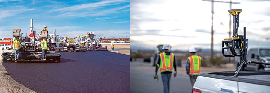
GNSS links the three steps in this example paving system. The mobile scanning system creates a 3D model that the grinding and paving equipment systems use. (Image: Topcon)

GNSS links the three steps in this example paving system. The mobile scanning system creates a 3D model that the grinding and paving equipment systems use. (Image: Topcon)

Even construction projects that involve separate pieces of heavy equipment can be tightly coupled, with GNSS as the “glue.” One example is Topcon’s SmoothRide paving system. The separate active steps of grinding and paving are working from a 3D model developed in a first step: precise mobile scanning. Each step constrains (horizontally) with GNSS, and vertically to the corresponding position in the model. In this example, the premium is on the quality of the scan.

For the first step, an RD-M1 scanner, usually attached to a pickup truck, can scan at highway speeds. The positioning component is an integrated HiPer SR GNSS receiver and inertial measurement unit (IMU). The GNSS observations, IMU data, and velocity from a wheel encoder are post-processed (PPK) together, to provide a high-definition 3D model with very tight relative integrity.

“A great lateral benefit of scanning in this manner is that it can be done quickly and also gives you a model of the area surrounding the road,” said Mark Larranaga, director, Intelligent Paving Business Development. “You get the terrain for drainage design, guardrails, signs, road furniture — everything you might need for good roadway design.”

For base data for the post-processing, Larranaga said a GNSS base typically will be set up on the site, though if a permanent base from a network such as TopNet is nearby, that can be used.

“The model is then created in MAGNET Collage software,” Larranaga said. “That produces the surface file. Once we get that created, we take it into a software called MAGNET Resurfacing. It is used to design for cross slope correction, or a smoothness factor, as well as material management  — the software will do all this automatically. The software empowers the customer to create a file for the machine that will maximize the potential of the end results, based on the project parameters. Thus, allowing the contractor to evaluate and learn about potential pitfalls and maximizing incentives.”

The next step, using roadway surface grinding equipment, employs a two-antenna GNSS system (for position and heading). A sonic sensor is keyed to the corresponding elevations in the 3D model and informs the depth for which the grinder is set. The third step, paving, is quite similar: GNSS and a sonic sensor constrained by the precise 3D model. There are some implementations that add thermal cameras and look behind a paving machine to see whether certain target specifications are met in real time.

Read more of this cover story, “Guide, Assist, Automate: Why GNSS remains a key element for most applications.”

Publicerad den Lämna en kommentar

Guide, Assist, Automate: Why GNSS remains a key element for most applications

Image: CHC Navigation

Image: CHC Navigation

Industry experts noted in our November 2022 issue that heavy equipment autonomy may be a distant future. However, the steady innovation in machine-control technology to get there is yielding substantial value. To drill deeper into those technologies, we interviewed additional industry experts with a focus on the key role of GNSS in such systems.

1D, 2D and 3D

There is currently a sharp growth in the adoption of 3D systems, according to Jordan Van Wie, product specialist with SANY America, a prominent manufacturer of construction equipment. “The fact is that many jobs are requiring this. They’re more efficient in their bidding process. They know exactly where they need to cut and where to fill — this means being more productive in less time.”

SANY America is based in Peachtree City, Georgia, where many of its construction equipment systems are manufactured, including the SY225C, a popular medium excavator.

The process of automating to the levels the operators desire is a matter of which sensors are added and how they sense the active geometry of the equipment in use.

For an excavator, SANY installs four sensors, then measures the machine, said Mukesh Selvaraj, product manager, medium and large excavators, SANY America.

“We know the distance between the bucket pin and the stick pin, up through the boom, and the angles on the sensors. We can compute in the system and report where the tip of the bucket is in relation to the body, and construct a 3D model in real time. This reporting can be as fast as 200 Hz.”

Among the machine-control systems implemented on SANY construction equipment are those from Hexagon | Leica Geosystems. Leica produces precision guidance and control sensors and systems for construction, agriculture and mining that are integrated onto various heavy equipment brands.

While 3D is becoming more popular, systems need to be scalable. Hexagon | Leica Geosystems has variants for different levels of guidance and automation, said Kert Parker, U.S. channel development manager for the company.

“For instance, if you start with our PowerDigger Lite, it has a control box, a display, a boom sensor, an angle sensor for the stick (which includes a laser catcher) and a 360° bucket sensor. This lets you know where the bucket tip is in relation to the model — call it a 1D system.” The cost of such a system might only be 5% or 10% of the cost of the machine on which it is installed — a modest investment for the productivity gains it can deliver.

To upgrade and run automatics, users could add a machine control panel and docking station with just 2D software. “That will give you a semi-automatic solution even on 2D. Then you can upgrade and add the GNSS receiver and antenna — or antennas — and 3D software to make it 3D, semi-automatic,” Parker said.

Two-thirds of the price of the base system is for the sensors on the boom, stick, bucket, the pitch and roll sensor, and the wires that communicate throughout the system, Parker explained.

“So, it’s completely scalable. You can start with a low-cost system upgrade to do GNSS fully and semi-automatic. We can automate any pilot-controlled machine, then we set the pressure. And when we sense the stick pressure, if the system is going automatic, then we automate the boom and the bucket.”

Third ‘D’ Options

“When you’re using something to give the machine a northing, an easting and a height at all times — that is when it becomes full 3D,” Parker said.

3D systems can be configured with a single GNSS receiver, with dual GNSS receivers, or off of a robotic total station. “The only difference between single and dual is that, with single, every time you move the machine you have to do a calibration swing, about 90° to get your heading again.”

“You can dig curves and complex designs working in 2D,” Van Wie said. “But every time you move the machine, you have to re-bench to a known reference, either by pinching with a bucket’s teeth, or hit the stick sensor that has an incorporated laser catcher. When you move the machine, you catch the laser beam again, and you use that for your known reference to dig back from the 3D model.”

Excavators are a high-growth class of heavy equipment for machine-control adoption, with many excavators ready for system integration. Shown here, Leica iCON iXe3 systems on a Kobelco SK210 (left) and Hitachi 300-02 (right). (Image: Hexagon | Leica Geosystems)

Excavators are a high-growth class of heavy equipment for machine-control adoption, with many excavators ready for system integration. Shown here, Leica iCON iXe3 systems on a Kobelco SK210 (left) and Hitachi 300-02 (right). (Image: Hexagon | Leica Geosystems)

For certain operations — such as excavating in a straight line or moving materials to the side —higher levels of automation may not be needed, so some users appreciate the option of starting with a cheaper system.

“For the small operator, of course, but even for a large operator, it’s a big investment to go full 3D,” Van Wie said. “They don’t want to go full 3D right away, or not on all equipment at once. They start off with just the basics and get familiar with it. Then when they want to upgrade, they have some of the stuff that they’re going to need for their machine already on it.”

System Examples

eSurvey GNSS manufactures GNSS-based equipment, software and systems for surveying, mapping, agriculture, UAV and construction. Better known in other global markets than in North America, the company has seen a steady rise in the market for construction automation  — outpacing other sectors utilizing heavy equipment automation such as agriculture and mining combined. For construction, in many parts of the world excavators are the prime focus for automation.

Figure 1. A common configuration of sensors for excavators: GNSS receiver, dual antennas, control tablet and tilt sensors on the body, boom, stick and bucket.(Image: eSurvey GNSS)

Figure 1. A common configuration of sensors for excavators: GNSS receiver, dual antennas, control tablet and tilt sensors on the body, boom, stick and bucket.(Image: eSurvey GNSS)

Their eME10 system for excavators includes a dual-antenna GNSS receiver, three single-axis tilt sensors, one dual-axis tilt sensor, a tablet and software (Figure 1). “The eME10 does not support a rotating bucket at this time,” said Edward Zhang, product manager for machine control technology. “We support standard excavators, excavators that reach into the water (for instance on dredging barges), and with different bucket tools such as quartering hammers and milling tools.”

Another popular system for compactors is the eMC10, with a single-antenna GNSS receiver, tablet and software, and optional temperature and vibration sensors.

Managing Positioning

Both the excavator and hydro survey boT have dual GNSS antennas for position and orientation, ensuring fidelity between the 3D model and operation of the excavator for dredging. (Image: Gavin Schrock)

Both the excavator and hydro survey boT have dual GNSS antennas for position and orientation, ensuring fidelity between the 3D model and operation of the excavator for dredging. (Image: Gavin Schrock)

High-precision GNSS, as implemented for architecture, engineering and construction (AEC) applications, can yield centimeter-grade results. However, as many AEC professionals and practitioners know, achieving repeatable and consistent results requires an experienced and skilled GNSS operator. Is the operator examining the results for statistical consistency? How have the observations been constrained to the desired reference framework? Have sources of error such as multipath and space weather been considered?

However, Nick Fifarek, general manager at SITECH Pacific LLC, a construction technology provider, said that equipment operators only need to learn the user interface.

“They are mostly concerned with how the grade is shown in the model, and what actions are required to meet the grade. They should not need to be concerned with the working of the GNSS receiver.”

A larger firm with multiple systems will usually have a technician or surveyor on board, Fifarek explained. This expert would have the experience needed to set up a GNSS site base, ensure corrections are received, and troubleshoot causes of anomalies and poor results.

To be efficient, an operator should not have to deal with a complex set-up.

“It should be more like Google maps in your car,” Fifarek said. “They do not need to know how the model was created, and how the GNSS delivers positions to the interface. All the sensors should work seamlessly, like tilt sensor and IMUs [inertial measurement units] and how they work together with the GNSS to put positions on the blade or bucket. Once this is all working well and the model is applied, they should just be able to take directions.”

Nevertheless, sometimes this expert will need coaching, or a small firm may not have an expert at hand.

“We may need to teach them about some fundamentals, such as signal-to-noise ratio, PDOP [positional dilution of precision], and other quality indicators — especially when setting up the site base station,” Fifarek said.

Additionally, he pointed out, the control must be set up — this is mostly done by engineering or surveying firms along with site calibrations — and operators need to know how to check it.

Multipath Issues. Fifarek has not experienced problems with short masts for GNSS antennas, saying that the height of the cab is sufficient. Modern multi-constellation receivers, have improved multipath mitigation, and are able to work in sites with limited sky view or obstructions. Equipment such as excavators and dozers typically have dual-antenna GNSS systems, or two receivers and antennas. This provides not only position, but orientation and heading. These are usually installed on the body or cab, although some systems have a GNSS antenna on each end of the blade. Some systems use a method that only fixes one of the antennas/receivers, and then performs a fixed baseline solution for orientation.

The Chain of Components

Much like autonomy in vehicles, machine control implementation can be defined as various levels.

Level 1: GNSS-assisted guidance. The most basic level of implementation provides the equipment’s location and heading. It acts the same way as a navigation device or phone in your car. The technology has been around for decades for precision agriculture and construction.
Level 2: Implement Control. Control of the blade or bucket.
Level 3: Assist. Implement control plus a level of automation where the operator moves the control stick to initiate an action the machine completes by moving the blade or bucket to meet the design model geometry. This can include steering for various types of equipment.
Level 4: Autonomy. More on that later.

The power of tilt-compensated GNSS+IMU smart antennas may be the key to reducing the number and complexity of synchronizing a “chain of sensors.” In this example, a Trimble R780 smart antenna has been added to the stick of an excavator. (Image: Trimble)

The power of tilt-compensated GNSS+IMU smart antennas may be the key to reducing the number and complexity of synchronizing a “chain of sensors.” In this example, a Trimble R780 smart antenna has been added to the stick of an excavator. (Image: Trimble)

For levels 2 through 4, continuously updating a position on the blade or bucket requires a chain of sensors to work in tightly controlled harmony. An excavator could be equipped with one or two GNSS receivers and antennas and a tilt sensor on the body, explained Geoffrey Kirk, product manager, autonomy and assist for Trimble. The GNSS will provide the position and orientation of the body, or rotating section of the body, on an excavator, and the tilt sensor reads how level it is. Another option is positioning with a total station and prism on the body, such as when GNSS is not available. “Either way, you need to know where you are in 3D space to be able to work on any 3D model,” Kirk said. “Today there are usually about 30 satellites in view. We can do so much more now compared to the days when we had fewer satellites, things that would have been impractical,” Kirk continued.

Sensors on the boom, stick and bucket can be likened to an upper arm (boom), forearm (stick) and hand (bucket), with rotating buckets acting like a wrist.

“We put a six-degrees-of-freedom IMU at each of these locations,” Kirk said. This is a chain of highly dependent geometry extended out to the bucket. However, Kirk said there may be a better way.

Reducing the Links

In recent years, a new technology has been implemented for GNSS smart antennas (rovers), like those that surveyors and grade checkers use, which tightly couples IMUs and movement of the GNSS antenna for calibration-free tilt compensation. Examples include the Trimble R12i (for surveying) and R780 (for construction), Leica GS19 T, and many more — few high-precision rovers made today lack tilt compensation. The observed acceleration and direction of the antenna adds orientation to the tilt angle (from the onboard tilt sensors), so the position of the tip of the survey rod can be computed precisely and in real time.

At the Bauma construction trade fair held in November 2022 in Munich, Germany, Trimble gave participants a peek at something new: putting a tilt-compensating GNSS smart antenna out on the stick of an excavator.

“With current systems, every time you hit one of those joints on an excavator, you need to understand what it is doing, calculating angles along the way,” Kirk said. “By mounting a tilt-compensated GNSS receiver on the stick, this becomes a lot easier to do.” Such innovations dovetail well with another trend in construction equipment: a move from purely hydraulic steering to drive-by-wire. This trend makes for more simplified and often less costly processes for adding implement control and automatics, but may also be key in implementing autonomy.

The Path Toward Automation

“One of the big changes in the industry is understanding what tasks operators are trying to do, so that we can help them do those tasks,” said Kirk. “We want to help people be more productive. We know autonomy is a thing. We’re actively working on autonomy; it’s going to be a while. In the interim, we want to make sure that we are providing value to the manual operators for the tasks that we can’t do autonomously.”

Key foundational components of what would go into autonomous systems are already in place.

“With automatics, you already have implement control, and in some implementations, you even have steering,” Kirk said. “What is missing in terms of the mechanics is speed control — that may be the easy part.” Adding the crucial situational awareness, other sensors for feedback, and the brains for automation is what might take a lot of time to work out.

“Autonomy for cars is where you are trying to avoid hitting things,” said Kirk. “For construction, we are in the business of hitting piles of dirt and spreading them around.” For a car, the sensors see something, recognize it, know how far away it is, and can issue such commands as “stop” or “slow down” — which is not so simple for construction.

Three key technologies you’ll see being used for situational awareness are radars, cameras and lidar, mostly used in combination. “Radars have some really nice behaviors,” explained Kirk, but cautioned that they cannot tell what they are doing.

A demonstration implementation of an autonomous excavator. (Image: Trimble)

A demonstration implementation of an autonomous excavator.(Image: Trimble)

For instance, adaptive cruise control in cars, which is nearly always done with radar, works very well and reliably. Most such radars are now solid state and safety certified. Unfortunately, he points out, while radar is very good at alerting drivers that there is something in front of them, it is not very good at telling them what it is.

“That’s why developers put in cameras, so that you can see whether what’s in front of you is a person, another vehicle, or something else. That’s why you have those combinations of sensors.”

One of the reasons it will take longer to automate construction, Kirk explained, is that operators need to know much more about the nature of other objects in the construction environment than cars do on the road. The operators need to know not only what people, equipment and materials are around them, but also whether there is something or someone standing in front or on top of the pile of dirt.

“For situational awareness, you need to be able to do real-time mapping,” Kirk said. “Lidar and cameras, such as stereographic cameras, can be used as classifiers. Lidar can have limitations, such as when driving directly into the sun.”

“The smarts for autonomy are knowing what the task is and how to perform that task,” Kirk said. “However, from the standpoint of a machine’s sensor and setup, we’re not controlling speed, though we do on agricultural machines. So, machines are matched really well for autonomy — you can make them do whatever you want today.”

Examples of autonomous conduction systems were demonstrated in the off-site “sandbox” exhibit of Trimble Dimensions+ held in November 2002 in Las Vegas. There was an autonomous excavator, a compactor and a remote-control dozer.

Yet these were operating in a controlled environment. Kirk said that for safety reasons, early adoptions of autonomy might be confined to sites that are not along roads and highways.

Read more of this cover story, “Why GNSS is the glue for construction.” 

Publicerad den Lämna en kommentar

Pilot project analyzes climate change for Caribbean nations 

Image: TommL/E+/Getty Images

Image: TommL/E+/Getty Images

NV5 Geospatial has forged a contract with the Caribbean Community Climate Change Center (CCCCC) to conduct aerial lidar and orthoimagery surveys across the Caribbean. The pilot project will provide advanced geospatial data to help the island nations understand natural and man-induced climate changes, develop programs to support resilience and sustainable development, and establish a foundation for future work.

NV5 Geospatial will conduct topographic and topobathymetric lidar surveys, as well as orthoimagery, via a fixed-wing aircraft. Data collected will help CCCCC address the impact of climate variability and identify potentially hazardous impacts.

The project will cover 10 sites spread across more than 3,000 km. The sites include areas in Suriname, Guyana, Tobago, Barbados, St. Vincent and the Grenadines, Saint Lucia, Antigua and Barbuda, St. Kitts and Nevis, Turks & Caicos and Belize.

Other logistical considerations include the combination of microclimates inherent around tropical islands, highly variable weather conditions, cloud formations and jungles, some of which are in high relief areas or covering the entire area.

Publicerad den Lämna en kommentar

Inertial Labs releases multi-application IMU

Inertial Labs has released its IMU-FI-200C, a compact, self-contained strapdown, advanced tactical-grade inertial measurement unit (IMU) device. The IMU-FI-200C measures linear accelerations and angular rates with its three-axis, tactical-grade, closed loop, fiber-optic gyroscopes and three-axis, high-precision MEMS accelerometers in motionless and high dynamic applications.

The IMU-FI-200C is fully calibrated, temperature compensated and aligned to an orthogonal coordinate system. It contains more than 0.5 deg/hr gyroscopes and less than 2 mg bias repeatability over operational range accelerometers with low noise and high reliability.

Continuous built-in test, configurable communications protocols, electromagnetic interference protection, and flexible input power requirements make the IMU-FI-200C suitable for a wide range of integrated system applications.

Image: Inertial Labs

Image: Inertial Labs

Publicerad den Lämna en kommentar

AUVSI launches Green UAS

AUVSI_NewLogo2023.png

AUVSI_NewLogo2023.png

AUVSI has launched Green UAS, a program to expand the amount of commercial UAS that have been verified to meet high levels of cybersecurity and National Defense Authorization Act supply chain requirements.

Green UAS meets the Blue UAS certification program of the Defense Innovation Unit. It is designed for users who do not immediately require Department of Defense authority to operate.

Green UAS also offers a streamlined pathway to the Blue UAS 2.0 cleared list.

Green UAS is suitable for users who rely on commercial, off-the-shelf UAVs to conduct diverse operations. These users include federal government agencies, local law enforcement, first responders and state departments of transportation.

Green UAS is also suitable for industrial enterprise users such as energy and utility companies, telecoms, manufacturers, food and agriculture, and logistics and mapping/surveying companies.

Publicerad den Lämna en kommentar

Orolia’s GNSS simulator to break high-capacity barrier

Image: Orolia

Image: Orolia

Orolia’s Skydel, its GNSS simulation software, can now generate more than 500 simulated satellite signals. This platform is suitable for GNSS users, experts and manufacturers, as well as users needing a low-Earth-orbit-capable simulation system.

Skydel contains a feature that includes multi-constellation and multi-frequency signal generation, remote control from user-defined scripts, and integrated interference generation.

“With more and more customers simulating multipath and jamming scenarios, and the need for more signals in more applications — even beyond traditional simulators — the need for high capacity has never been greater,” said Pierre-Marie Le Veel, Orolia’s simulation product director. “The Skydel engine opens the possibility for users to escalate to more than 1,000 signals and not be limited by hardware design.”

In addition to generating a high channel and satellite count, Skydel can also produce navigation warfare signals without any additional hardware.