Publicerad den Lämna en kommentar

ESA opens applications for Navigation Training Course

Photo:

Image: European Space Agency (ESA)

The European Space Agency (ESA) Academy is requesting university students to apply for the pilot edition of the Navigation Training Course. The course will take place June 26-30 at ESA Academy’s Training and Learning Facility in ESEC-Galaxia, Belgium.

With a specific focus on Galileo, the ESA Academy course aims to provide university students with an introduction to satellite navigation. Designed by ESA experts that developed the Galileo space and ground segment, this training course will offer students fundamental knowledge of Galileo’s architecture, tools, services and functionalities.

The training course will include lectures and hands-on exercises with a tour of Galileo in-orbit test facilities in ESEC, which provides an essential part of the current Galileo ground segment.

Upon completion of the training course, students will be evaluated and will receive a certificate of participation and course transcript, allowing them to request ECTS credits from their respective universities.

For more information and application requirements, visit the ESA website.

Publicerad den Lämna en kommentar

Atmos appoints Topcon as official distributor in US

Image: Atmos

Image: Atmos

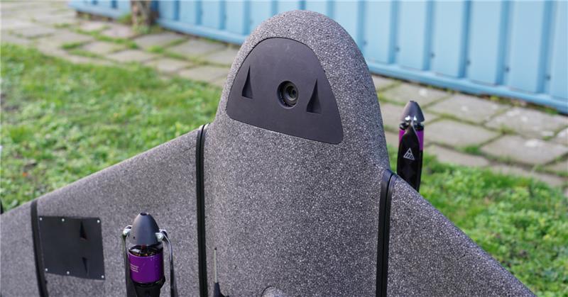
Atmos — a Dutch UAV manufacturer that develops vertical take-off and landing (VTOL) fixed-wing UAVs for mapping and surveying applications — expanded its global reseller network by signing an agreement with Topcon Solutions. Topcon will be responsible for the distribution of Marlyn Cobalt UAVs in the United States and will provide assistance and maintenance services to local UAV operators.

The Marlyn Cobalt is a VTOL fixed-wing mapping UAV developed by Atmos and enables users to collect accurate geospatial information and turn it into actionable insights.

Atmos has integrated the Sony a7R mark III and IV cameras into the Marlyn Cobalt to increase the coverage and accuracy achieved in a single flight for surveyors. When combined with Zeiss’ 35 mm and 21 mm lenses, UAV surveyors can achieve ground sample distance levels of less than 1 cm. The integration of the two cameras enables Marlyn Cobalt users to map an area of 210 ha with centimeter-level accuracy in a single flight.

Publicerad den Lämna en kommentar

Science of geodesy and surveying: support progress report

On March 20, 2023, I wrote a short announcement about a funding opportunity by the National Geodetic Survey (NGS) to support the science of geodesy.

As mentioned in previous columns, Everett Hinkley wrote about the geodesy crisis in an ION article. Hinkley’s article summarized several action items that could help improve the lack of trained geodesists in the United States. One action was to encourage U.S. government support in the form of grants, professional development of staff, and research collaborations/affiliations. A pilot PhD geodesy educational program with three National Geospatial-Intelligence Agency (NGA) and one NGS employee is in place. He stated that the NGA expects to continue growing this program. Click here for more information on NGA’s academic research program.

NGS’ geospatial modeling grant is another example of this action item. There needs to be more funds added to this task, but it is a start. The program priorities under NGS’ grant program include: research and develop new methodologies for defining and applications for working with the NSRS; develop and evaluate tools, models, and guidelines to access, analyze, and manipulate geodetic data; enhance infrastructure of geodetic control, coastal remote sensing data, survey measurements, and other physical datasets that comprise the NSRS; support education, capacity building, and technology transfer for the future of geodesy; coordinate through partnerships with local, state, and regional users such as state and local governments, universities, and/or the public sector.

The geospatial modeling grant was included in the 2023 Omnibus Appropriations Bill. The agreement provides $8,000,000 for the program and states that all funding shall be distributed externally. Hopefully, the same amount or more will be in FY 24 appropriations. Additional information about NOAA’s appropriations can be found in the 2023 Omnibus Appropriation Bill under the explanatory statement for Commerce, Justice, Science and related agencies. The bill can be found here. To find the language in the bill click here, then search the document for “geospatial.” See the image below for the language in the bill.

Image: Senate.gov website

Image: Senate.gov website

For those that are interested in the appropriation process, the image below provides a list of the senators that work on these agencies’ appropriations. If you are interested in learning more about the appropriation process and the geospatial modeling grants, contact your senator. The more congressional representatives know about the geodesy crisis — which includes the lack of trained geodesist as well as surveyors — the sooner they will support funds to help correct the problem. Click here for a list of senators on the Commerce, Justice, Science and Related Agencies Appropriation Committee.

Advancing geodesy with conferences

Another activity that promotes the advancement of geodesy and surveying are national and international surveying and mapping conferences. Before the American Congress on Surveying and Mapping (ACSM) disbanded, the four-member organization collaborated to convene annual surveying and mapping conferences in the United States. Topics like those presented at a FIG Working Week were presented at these conferences.

Since these ACSM conferences are no longer being held, I encourage users of geospatial data and GNSS technology to attend conferences like FIG Working Week 2023. I have participated in several FIG meetings and learned a lot from presentations as well as holding hallway meetings with experts from the international surveying and mapping community. In the March column, I highlighted that FIG Working Week 2023 is going to be held in Orlando, Florida, on May 28 – June 1. NGS will be presenting a full-day worth of content on NSRS modernization during the conference. I want to highlight some presentations that may be of interest to readers. Register for FIG Working Week 2023 here.

The image below provides a list of NGS presentations with scheduled times. There will be a panel session in the beginning of the day to set the context for the day.

Agenda of NGS DAY at FIG Meeting (Image: FIG website)

Agenda of NGS DAY at FIG Meeting (Image: FIG website)

As in most conferences there are several ways participants can register, one day to the entire conference. This is a great opportunity to have discussions with the leadership of the National Geodetic Survey and individuals working on the development of the new, modernized NSRS.

Image: FIG website

Image: FIG website

There are a lot of presentations on various topics so, I would encourage readers to look through the entire agenda. FIG’s technical work is led by ten commissions. The August 2021 column provided information about the FIG commissions. See the list of commission below:

Commission 1 – Professional Standards and Practice
Commission 2 – Professional Education
Commission 3 – Spatial Information Management
Commission 4 – Hydrography
Commission 5 – Positioning and Measurement
Commission 6 – Engineering Surveys
Commission 7 – Cadastre and Land Management
Commission 8 – Spatial Planning and Development
Commission 9 – Valuation and the Management of Real Estate
Commission 10 – Construction Economics and Management

The full technical program lists the topics by date and time. I highlighted sessions by commission 5 and 6 that I think would be interested to the surveying and mapping community. See the image below.

Image: FIG website

Image: FIG website

Image: FIG website

Image: FIG website

Image: FIG website

Image: FIG website

Image: FIG website

Image: FIG website

Image: FIG website

Image: FIG website

Image: FIG website

Image: FIG website

Image: FIG website

Image: FIG website

Finally, I would like to highlight a NGS product that is now in production mode. That is, OPUS Project 5.1 is now a production product. *NGS did not make an official announcement about this change, but if you access OPUS Project the new version comes up. As described in the March column, OPUS Project 5.1 routine allows the use of RTN vectors and post-processed vectors from vender software.

Clicking the “projects” icon on the OPUS page connects you to the latest version of OPUS Project 5.1. See image below. Please see the March column or NGS’ January webinar to learn more about OPUS Project 5.1.

Image: NGS Website

Image: NGS Website

*Note: As of the writing of this column, March 29, it is still listed on the beta release section of NGS website. If you click on OPUS Project 5.1 in the Beta Release section, it will link to the production version of the routine.  

Publicerad den Lämna en kommentar

Trimble company added to GeoCue network

Image: AllTerra

Image: AllTerra

AllTerra, a Trimble geospatial dealer, has joined the GeoCue distribution network. AllTerra will provide GeoCue’s full line of TrueView 3D imaging sensors, a UAV, lidar and photogrammetry solution. The technology enables fast, automated generation of true 3D colorized point clouds, oblique imagery and orthophotos from a single UAV flight.

AllTerra is also authorized to sell LP360 lidar and photogrammetry 3D point cloud software. LP360, an advanced desktop lidar software package, simplifies extracting information and generating deliverables in a GIS environment.

The company offers Trimble and Spectra Precision solutions in surveying, MGIS, marine, forensics, mobile mapping and infrastructure. Alltera also offers mobile/airborne lidar and photogrammetry solutions from GeoCue and Microdrones.

Publicerad den Lämna en kommentar

Orolia Skydel will support Galileo OSNMA

Image: Orolia

Image: Orolia

Orolia, a Safran Electronics and Defense company, announced its Skydel GNSS simulation engine will support Galileo Open Service Navigation Message Authentication (OSNMA) simulation in the form of two-phased and separate solutions. These solutions will be available to users who have purchased simulation access to the Galileo constellation, which will be available in the next few months.

OSNMA is an emerging authentication service that allows GNSS receivers to verify the authenticity of received data to protect against potential jamming or spoofing attacks that can result in service disruptions, denial incidents and more.

The first solution is well-suited for most receiver integrators that want to test the OSNMA capability of a GNSS receiver with the official test vectors from the European Union Agency for the Space Programme (EUSPA). This solution will support the available official test vectors sample data, which supports the verification of OSNMA functionality implementation.

The second option will provide full flexibility in the configuration of the scenario as well as the OSNMA authentication parameters. It will be suitable for advanced users that test receivers in a wide range of edge and corner cases.

Available later in 2023, this phase will include the following elements in Skydel: authentication of the Galileo E1 OS navigation message, a new Skydel engine supporting OSNMA SIS ICD 1.0, support for the timed efficient stream loss-tolerant authentication protocol, and useful crypto material for running user-programmable simulation test scenarios.

This feature will be ready for future software updates in accordance with the next phases recommended by EUPSA.

Publicerad den Lämna en kommentar

Quanta Micro INS named a finalist for AUVSI XCELLENCE awards

Image: SBG Systems

Image: SBG Systems

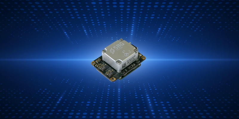
The Quanta Micro inertial navigation system (INS) has been named a finalist for the AUVSI XCELLENCE Awards — “Enabling Components & Peripherals.” The winners will be announced during an awards ceremony at AUVSI XPONENTIAL 2023 at the Colorado Convention Center in Denver.

The AUVSI XCELLENCE Awards honor innovators who demonstrate commitment to advancing technology, leading and promoting safe operations and developing programs that use unmanned systems to improve the human conditions.

Quanta Micro is a GNSS-aided INS designed for space-constrained applications. Quanta Micro leverages a survey-grade inertial measurement unit (IMU) for heading performance in single antenna applications, and temperature calibration from -40° C to +85° C. An optional secondary antenna enables fast heading initialization in low dynamic applications.

“This year, XPONENTIAL is all about designing a shared plan for the future of autonomy,” Brian Wynne, president and CEO of AUVSI, said. “There’s no better place to announce the 2023 XCELLENCE award finalists.”

Publicerad den Lämna en kommentar

BAE Systems laser-guidance kits tested by US counter-UAS office

Image: BAE Systems

Image: BAE Systems

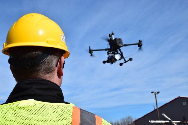
The Joint Counter-Small Unmanned Aircraft Systems office successfully tested BAE Systems’ APKWS laser-guidance kits in a counter-unmanned aircraft systems (C-UAS) mission.

During the Department of Defense-led exercise at Yuma Proving Ground, Arizona, the 70 mm APKWS-guided rockets demonstrated 100% effectiveness when fired against 25-to-50-pound UAVs traveling at more than 100 miles an hour. The APKWS C-UAS solution is platform agnostic, permitting multiple options to accelerate fielding.

APKWS transforms unguided rockets into smart munitions for precision strikes on soft and lightly armored targets. An updated proximity fuse for the standard M151 warhead enables laser-guidance kits to target Class-2 and Class-3 UAVs, which typically weigh less than 55 lbs. The fuse retains the legacy point denotation capability for flexibility of the weapon in the field.

APKWS now enables rockets to engage and destroy UAVs at a fraction of the cost of existing C-UAS systems with unprecedented precision.

The kits are available to all U.S. armed forces, as well as allies via foreign military sales.

Publicerad den Lämna en kommentar

NV5 Geospatial maps North American shorelines and riverine environments

 NV5 Geospatial has mapped more than 26 million acres of North America’s shoreline and riverine environments across more than 200 projects.

The projects have spanned from the Nuyakuk River in Alaska, Lake Tahoe in California, the Rio Grande in Texas, the entire coasts of South and North Carolina, the Achigan River in Quebec, Chesapeake Bay in Maryland and the Florida Keys.

In 2022, the company mapped and acquired topobathymetric lidar data for 14 projects including the Yellowstone River, Wyoming; Hells Canyon, Indiana; Revillagigedo Island, Alaska and Iles de la Madeleine in Quebec.

NV5 Geospatial first mapped these environments in 2012 using high-resolution bathymetric lidar and natural color imagery. The company mapped 34,051 acres of shoreline along the Sandy River, located in northwestern Oregon, to study the ever-changing basin geomorphology.

NV5 has also signed a two-year contract with the National Geodetic Survey of the National Oceanic and Atmospheric Administration to provide topobathymetric lidar, 4-band imagery and mapping of 3,115 sq miles of the Maine shoreline.

“For a decade we have been helping local, state, and federal government agencies as well as commercial and private entities gain the insights they need to solve some of their most challenging nearshore and riverine projects through our mapping technologies including topobathymetric lidar,” Kurt Allen, vice president of NV5 Geospatial, said. “Whether it be mapping the shoreline after a hurricane, updating the national shoreline, assisting water boards with flood planning, or hundreds of other possible use cases, we are constantly improving our technology and scalability to always be at the ready for our customers.”

Publicerad den Lämna en kommentar

Centimeters and picoseconds without satellites or atomic clocks

Image: Locata

Image: Locata

A new European Commission (EC) Technical Report, published after exhaustive and completely independent testing of several candidate A-PNT (Alternative Positioning, Navigation, and Timing) technologies, confirms that Locata has demonstrated positioning and timing performance across every test environment, delivering:

  • cm-level positioning accuracy in all tests, indoor and outdoor, under static and kinematic conditions
  • picosecond-level time transfer using Locata’s proprietary TimeLoc technology, over multiple media types including RF over distances of more than 105 kilometres and over fibreoptic and/or coaxial cables, without requiring satellites or atomic clocks.

The rigorous scientific test campaign was conducted over a period of eight months by experts from the EC’s Joint Research Centre (JRC) in Italy. Its purpose was to establish the foundations for European navigation and timing policy, including the upcoming European radionavigation plan, in the context of growing concerns about the single-point-of-failure that GPS and other Global Navigation Satellite Systems (GNSS) pose.

According to Locata, their validated capabilities promise to open previously unattainable, satellite-free A-PNT performance for autonomous vehicles, logistics, indoor positioning, critical national infrastructure, and aviation, as well as better levels of synchronization to improve mobile phone and digital data networks.

Locata’s products have been deployed commercially for a decade, delivering cm-level positioning (via sales and IP licences) to globally recognized partners, including systems now certified for safety-of-life level operation of autonomous vehicles. Prominent government customers include NASA and the United States Air Force, which runs a large Locata network that covers more than 6,500 sq km for aviation use when GPS is being jammed or spoofed.

This performance evaluation assessment was run under a globally-open tender launched by the EC’s Directorate-General for Defence Industry and Space (DEFIS). The tender sought applications from around the world, from every potential candidate claiming they could provide “an alternative to GNSS-based PNT.” More than 30 companies applied, and this number was then down-selected by an expert panel to the seven technologies that were, in the end, independently evaluated. Locata was the only technology that was granted two contract slots, and the only technology that completed every timing and positioning test, in every indoor and outdoor environment, sought by the EU.

Publicerad den Lämna en kommentar

CHC Navigation releases 3D Grade Control System

Image: CHC Navigation

Image: CHC Navigation

CHC Navigation has released the TG63, a 3D Grade Control System designed for motor graders.

With a tightly coupled dual-GNSS positioning system and inertial sensor, the TG63 provides reliable 3D positioning and heading to ensure accuracy of the grader blade within ±2 cm.

The TG63 is designed to withstand the harsh environment of construction sites and supports multiple applications, including real-time kinematic networked transport of RTCM via internet protocol and ultra-high frequency base stations.

In addition, GradeNav software, operating on a 10.1 in industrial display, supports standard AutoCAD DXF design files to manage multiple grading operations, including surfaces, slopes, TINs and road features.